ViewTube

ViewTube
Sign inSign upSubscriptions
Filters

Upload date

Type

Duration

Sort by

Features

Reset

2,173 results

RS & GIS
ArcGIS Pro Full Beginner's Course (2025 Extended)

Ready to Master ArcGIS Pro? This ArcGIS Pro Tutorial is your Complete GIS Tutorial – 37 lessons in one awesome video!

2:04:33
ArcGIS Pro Full Beginner's Course (2025 Extended)

73,409 views

11 months ago

Geomatics Planet
Extracting OpenStreetMap Data with Overpass Turbo

Discover how to extract OpenStreetMap data using Overpass Turbo and convert it for use in various GIS applications like ArcMap, ...

1:04:41
Extracting OpenStreetMap Data with Overpass Turbo

287 views

5 months ago

NGEOSPATIAL SOLUTION
ArcGIS Pro 2025 Tutorial: Create Your Own Study Area Map in Minutes!

Learn how to quickly create a study area map in ArcGIS Pro 2025 with this easy step-by-step tutorial! Whether you're a ...

20:25
ArcGIS Pro 2025 Tutorial: Create Your Own Study Area Map in Minutes!

58 views

5 months ago

kiki's
tutorial arcmap
27:12
tutorial arcmap

24 views

4 months ago

Azahra zf
Tutorial ArcGIS Fieldtrip 60_Azahra zf

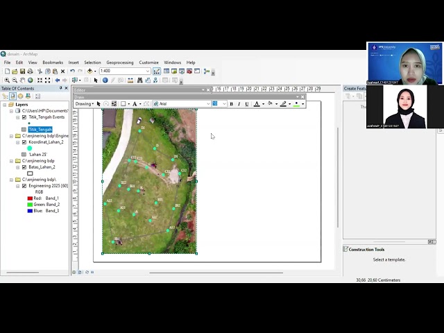
P2_K4_C1401231047_Azahra Zahiya_Tugas ArcGIS.

27:54
Tutorial ArcGIS Fieldtrip 60_Azahra zf

3 views

10 months ago

Tutorials With Nayeem
ArcGIS 10.8 Tutorial || 2. Make a Study Area Map in ArcGIS | Step-by-Step Tutorial

In this video, I'll provide a step-by-step tutorial on how to create a professional study area map for any research paper or project ...

28:37
ArcGIS 10.8 Tutorial || 2. Make a Study Area Map in ArcGIS | Step-by-Step Tutorial

1,419 views

5 months ago

mosaic spatial solutions
Spatial Regression In ArcGIS: A Step-by-Step Guide to OLS and GWR

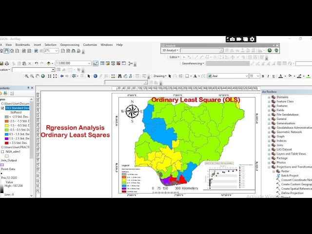
In this tutorial, you will learn how to perform Ordinary Least Squares (OLS) and Geographically Weighted Regression (GWR) in ...

30:10
Spatial Regression In ArcGIS: A Step-by-Step Guide to OLS and GWR

284 views

1 month ago

GeoMicrosphere
Land Use and Land Cover Change Detection in ArcMap | GIS & Remote Sensing

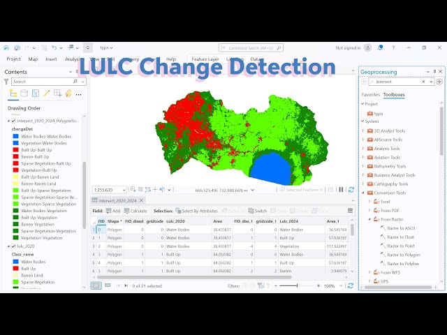
Description: This video demonstrates how to perform Land Use and Land Cover (LULC) Change Detection using ArcMap.

39:21
Land Use and Land Cover Change Detection in ArcMap | GIS & Remote Sensing

651 views

6 months ago

GIS & RS Made Easy
How to Create a Complete Map in ArcGIS Pro | Beginners Tutorial

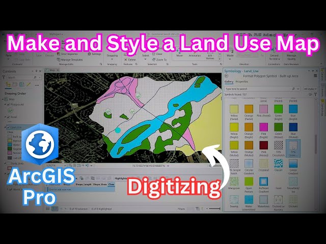
In this ArcGIS Pro tutorial, learn how to digitize features and create a land use map with clear and meaningful symbology.

43:03
How to Create a Complete Map in ArcGIS Pro | Beginners Tutorial

968 views

10 months ago

GeoMicrosphere
Land Use and Land Cover Change Detection in ArcGIS Pro | Step-by-Step Tutorial

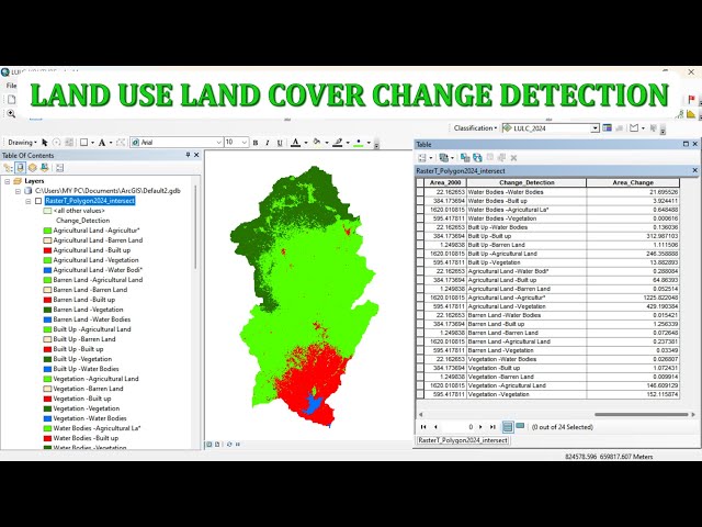
In this tutorial, I walk you through the complete process of Land Use and Land Cover (LULC) Change Detection using ArcGIS Pro.

23:45
Land Use and Land Cover Change Detection in ArcGIS Pro | Step-by-Step Tutorial

1,682 views

3 months ago

Tutorials With Nayeem
ArcGIS 10.8 Tutorial || 6. ArcMap Vector Analysis Tutorial (Buffer, Clip, Intersect,Union and Merge)

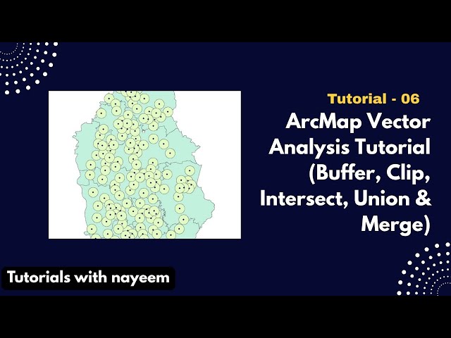
In this essential GIS tutorial using ArcMap 10.8, You will be guided through crucial Vector Analysis methods, covering the ...

22:43
ArcGIS 10.8 Tutorial || 6. ArcMap Vector Analysis Tutorial (Buffer, Clip, Intersect,Union and Merge)

88 views

4 months ago

Reda Badr
1 _ Introduction to ArcGIS Online
51:15
1 _ Introduction to ArcGIS Online

2,668 views

5 months ago

ELITE GEOSPATIAL
Student Training Session: Learn Map Making from Scratch (GIS Tutorial)

1-on-1 Student GIS Training – Learn How to Create a Map from Scratch! In this hands-on session, I guide a student step-by-step ...

1:02:09
Student Training Session: Learn Map Making from Scratch (GIS Tutorial)

80 views

8 months ago

UofILibrary
Introduction to ModelBuilder in ArcGIS Pro (Tech Talk)

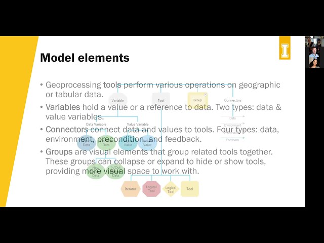
Presenter: Bruce Godfrey Presented: 10/6/2025 Manually running tools repeatedly got you down? Learn to create geoprocessing ...

53:02
Introduction to ModelBuilder in ArcGIS Pro (Tech Talk)

224 views

4 months ago

Master Jond IT-GIS Academy
Mastering ArcMap: Step-by-Step Guide to Creating Stunning Layouts for Maps

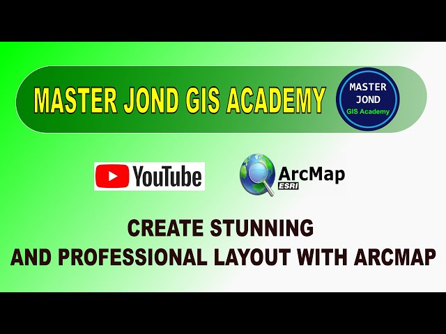
Learn how to create professional and visually appealing map layouts in ArcMap with this comprehensive step-by-step tutorial!

41:06
Mastering ArcMap: Step-by-Step Guide to Creating Stunning Layouts for Maps

19 views

11 months ago

Tutorials With Nayeem
ArcGIS 10.8 Tutorial || 5. Digitizing and Feature Creation in ArcMap 10.8

This video demonstrates the digitization of map elements using ArcGIS ArcMap 10.8. The tutorial guides viewers through the ...

20:58
ArcGIS 10.8 Tutorial || 5. Digitizing and Feature Creation in ArcMap 10.8

78 views

4 months ago

Cadastral Mapping
Digitization Part 1 | GIS Mapping & Cadastral Data Preparation Tutorial

Welcome to Digitization Part 1! In this video, we start the digitization process by focusing on Outer Boundary Cutting using GIS ...

24:07
Digitization Part 1 | GIS Mapping & Cadastral Data Preparation Tutorial

381 views

6 months ago

Space, Remote sensing and GIS
How to Create and Populate a Geodatabase in ArcGIS Pro | Step-by-Step GIS Data Management Tutorial

Welcome to Space Remote Sensing and GIS! Hi everyone! In my latest tutorial, I've shared something fundamental yet often ...

25:28
How to Create and Populate a Geodatabase in ArcGIS Pro | Step-by-Step GIS Data Management Tutorial

1,346 views

10 months ago

Study with Engr. Qasim
ArcGIS Pro Study Area Mapping Tutorial | How to Create a Map Layout Step by Step

arcgispro #mapping #gis #arcgis #studyarea #maplayout #cartography #arcgisprotutorial #geospatial #research Study Area ...

26:47
ArcGIS Pro Study Area Mapping Tutorial | How to Create a Map Layout Step by Step

1,313 views

5 months ago

Sambus Geospatial
Auto Trace Field Boundaries with ArcGIS Field Maps Step-by-Step Guide   Part 1

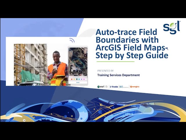
Learn how to auto-trace field boundaries in ArcGIS Field Maps with this step-by-step tutorial (Part 1). Whether you're new to GIS or ...

24:34
Auto Trace Field Boundaries with ArcGIS Field Maps Step-by-Step Guide Part 1

66 views

5 months ago

Apka Era
How to Create Geological Map of Chagai District in ArcGIS Pro | Step by Step GIS Tutorial

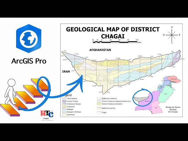
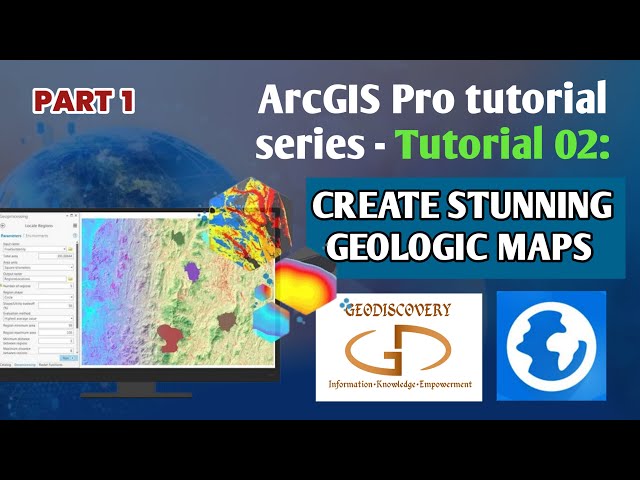
In this ArcGIS Pro tutorial, we'll create the Geological Map of Chagai District step by step — from shapefile loading to lithology ...

31:49
How to Create Geological Map of Chagai District in ArcGIS Pro | Step by Step GIS Tutorial

664 views

4 months ago

Jude Ejepu
Creating Professional Geological Maps with ArcGIS Pro: A Complete Tutorial Part 01

This tutorial demonstrates the complete workflow for creating professional geological maps using ArcGIS Pro. Whether you're a ...

21:50
Creating Professional Geological Maps with ArcGIS Pro: A Complete Tutorial Part 01

1,729 views

11 months ago

NGEOSPATIAL SOLUTION
Hot Spot Analysis in ArcGIS 2026 | Step-by-Step Gi Statistics Tutorial for GIS Professionals*

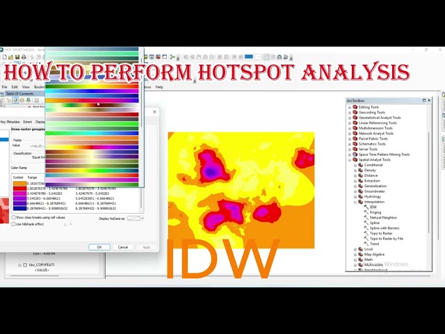
Want to identify statistically significant clusters in your spatial data? In this comprehensive tutorial, you'll learn how to perform Hot ...

23:45
Hot Spot Analysis in ArcGIS 2026 | Step-by-Step Gi Statistics Tutorial for GIS Professionals*

23 views

5 days ago

AMK Channel
ArcGIS Myanmar Tutorial | Dam, River & Forest Map Creation in ArcMap (Points, Lines, Polygons)

This video is an ArcGIS Myanmar tutorial designed for beginners who want to learn GIS step by step. In this ArcMap lesson, we ...

1:16:33
ArcGIS Myanmar Tutorial | Dam, River & Forest Map Creation in ArcMap (Points, Lines, Polygons)

5 views

10 hours ago

Shakya Sinha
Digitization in ArcGIS | Point Line and Polygon | Layout | ArcMap | ArcGIS Tutorial

Digitization in ArcGIS | Point, Line and Polygon | Layout | ArcMap | ArcGIS Tutorial | ESRI | ArcGIS 10.8 📥 Step-by-Step ...

54:32
Digitization in ArcGIS | Point Line and Polygon | Layout | ArcMap | ArcGIS Tutorial

91 views

8 days ago