Upload date
All time
Last hour
Today
This week
This month
This year
Type
All
Video
Channel
Playlist
Movie
Duration
Short (< 4 minutes)
Medium (4-20 minutes)
Long (> 20 minutes)
Sort by
Relevance
Rating
View count
Features
HD
Subtitles/CC
Creative Commons
3D
Live
4K
360°
VR180
HDR
129 results
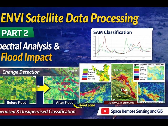
I'm happy to share the latest lecture in my ongoing ENVI satellite data processing series on my YouTube channel “Space Remote ...
88 views
12 days ago
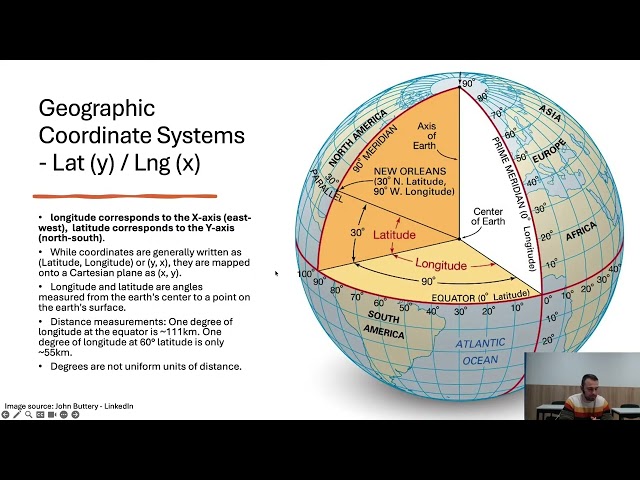
Key properties of geospatial data, including geographic referencing, scale, generalization, and symbolization, are discussed to ...
203 views
1 month ago
Тема: Geospatial Data Engineering at Scale Курс: Geospatial Data Engineering at Scale Трейнър: Дарин Митев Дата: 16 март ...
133 views
9 days ago
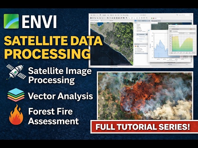
This upcoming video lecture series focuses on satellite data processing using the software ENVI, highlighting essential ...
173 views
2 weeks ago
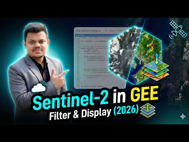
Learn how to filter and display Sentinel-2 satellite imagery in Google Earth Engine (GEE) in this complete 2026 tutorial.
299 views
Streamed 3 weeks ago
Esri's Corporate Director of Software Product Development, Sud Menon, leads us on a journey of development of ArcGIS as an ...
323 views
7 days ago
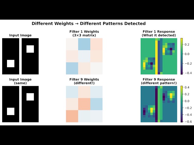
In this free lesson from the Fundamentals of GeoAI course, we cover the core concepts behind GeoAI and neural networks from ...
361 views
13 days ago
Transforming CAD floor plans into GIS data has traditionally been a complex, time-consuming desktop process involving heavy ...
67 views
6 days ago
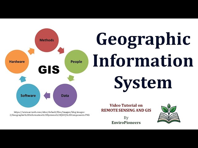
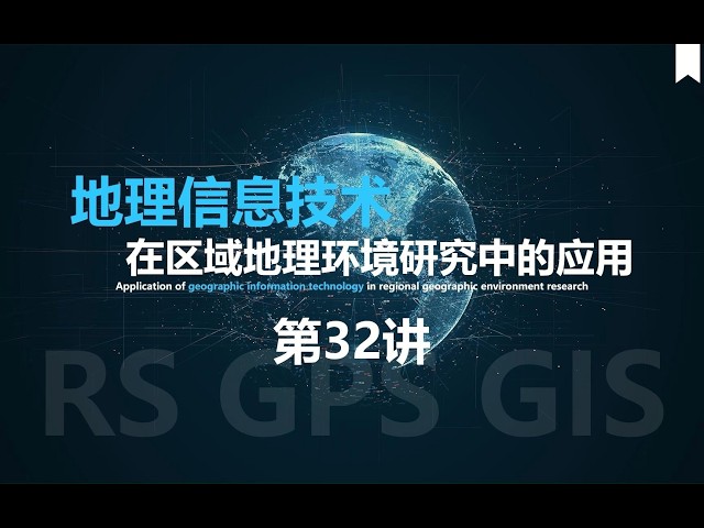
... and utilization of geospatial data. This video covers key GIT components like Remote Sensing, GPS, and GIS, their unique roles ...
0 views
3 weeks ago
... Intelligence in GIS | Workshop Replay Artificial Intelligence is transforming the way we analyze spatial data and make decisions.
244 views
code link: ...
413 views
4 days ago
The library supports large scale satellite data processing, efficient downloading workflows, and clear visualization tools tailored for ...
228 views
In this webinar hosted by DroneNerds, Inspired Flight Technologies, and Sentera, walk through high-accuracy drone mapping ...
103 views
Large language models (LLMs) and foundation models are revolutionizing GeoAI as they need little or no fine-tuning. Join us to ...
426 views
Jay Theodore, CTO - ArcGIS Enterprise & AI, leads this section to highlight the features of the ArcGIS Pro AI Assistant, ArcGIS ...
168 views
1 day ago
NUS CHS Cross-Disciplinary Programme—Geospatial Intelligence | Intelligence from Space and Place, for Real-World Solutions ...
153 views
... which are large AI models pre-trained on diverse geospatial data and adaptable to various tasks across downstream geospatial ...
252 views
Streamed 7 days ago
Whenever we make predictions about the future, we need to consider the uncertainty in those predictions. The more we know ...
4 views
6 hours ago
As organizations race to deploy generative and agentic AI, the biggest challenge they face is not models, it's their data estate.
4,749 views
Welcome to GeoPython with Bapan In this video, I have explained the complete workflow of Drone Image Processing in GIS ...
36 views
5 days ago