ViewTube

ViewTube
Sign inSign upSubscriptions
Filters

Upload date

Type

Duration

Sort by

Features

Reset

5,025 results

Introduction to Data Science
Spatial Data Analysis 4: Map Projections

In this video we talk about how we deal with the fact that the earth is a globe when making maps.

4:54
Spatial Data Analysis 4: Map Projections

364 views

3 years ago

TALE: The Archaeology Lecture E-library
Developing a method for a spatial correspondence analysis

Martin Sterry University of Leicester Multivariate analyses, in particular correspondence analysis, (CA) have become a standard ...

16:23
Developing a method for a spatial correspondence analysis

724 views

10 years ago

Introduction to Data Science
Spatial Data Analysis 2: Shapely

We introduce the python shapely library for manipulating polygons.

7:00
Spatial Data Analysis 2: Shapely

1,197 views

3 years ago

Introduction to Data Science
Spatial Data Analysis 6: Folium

A rapid introduction to the python folium library.

5:25
Spatial Data Analysis 6: Folium

792 views

3 years ago

TALE: The Archaeology Lecture E-library
Spatial data standards matter too

Peter McKeague.

13:27
Spatial data standards matter too

151 views

7 years ago

FOSS4G
FOSS4G 2022 | Morphological Spatial Pattern Analysis: Open Source Release

In this section, we describe the main routines of the MSPA code with reference to the morphological image analysis operations ...

4:10
FOSS4G 2022 | Morphological Spatial Pattern Analysis: Open Source Release

400 views

1 year ago

SpatialPublicHealth
Spatial Epidemiology with Open Source GIS

Spatial Epidemiology with Open Source GIS.

19:45
Spatial Epidemiology with Open Source GIS

6,160 views

13 years ago

Geoinformatics
Geospatial Data Modelling

... The time aspect 10:24 The spatial aspect 14:08 Vector data 15:06 RAster data 15:47 Joining spatial and non spatial data 16:33 ...

19:41
Geospatial Data Modelling

6,079 views

7 years ago

Geography
"Geographical Skills: Using GIS and Spatial Analysis"

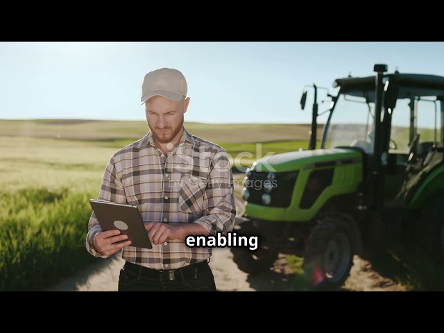
Welcome to "Geographical Skills: Using GIS and Spatial Analysis," your go-to channel for mastering the essential tools of ...

13:12
"Geographical Skills: Using GIS and Spatial Analysis"

13 views

1 year ago

TALE: The Archaeology Lecture E-library
“Festung Brünn”: Remote sensing and spatial analysis of German World War 2 field fortification

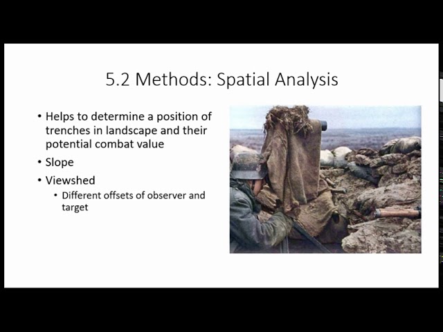
In recent years, several trenches of overall length 400 metres were unearthed on three sites dur-ing rescue excavations at the ...

18:43
“Festung Brünn”: Remote sensing and spatial analysis of German World War 2 field fortification

94 views

5 years ago

Daniel Arribas-Bel
Point Patterns - A Course on Geographic Data Science

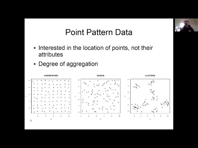
Block H of the Geographic Data Science course - "Points" More materials related to the content in this video are available at: ...

11:10
Point Patterns - A Course on Geographic Data Science

403 views

4 years ago

Lars Juhl Jensen
Single cell and spatial omics: A short introduction to the core concepts of scRNA-seq and more

A short introduction to the core concepts on single-cell omics data and spatial omics data. I will start by introducing how these ...

6:21
Single cell and spatial omics: A short introduction to the core concepts of scRNA-seq and more

12,253 views

3 years ago

EMF Research
SPATIAL ANALYSIS | Chloropleth maps

Creating 3D graphs for Geospatial data in Excel can give YOUR dataset good visualization.

4:51
SPATIAL ANALYSIS | Chloropleth maps

456 views

4 years ago

Daniel Arribas-Bel
"Good old" Spatial Data - A Course on Geographic Data Science

Block C of the Geographic Data Science course - "Spatial Data" More materials related to the content in this video are available at: ...

8:14
"Good old" Spatial Data - A Course on Geographic Data Science

382 views

4 years ago

TALE: The Archaeology Lecture E-library
Exploring spatial autocorrelation in archaeological spaces using R

This property of spatial data, also known as spatial dependency, has proven extremely useful for the analysis of archaeological ...

17:59
Exploring spatial autocorrelation in archaeological spaces using R

514 views

6 years ago

Michael Dietze
Lesson 29a Spatial Data: Point Patterns

Boston University EE509 "Applied Environmental Statistics" Course: This lecture kicks off our unit on spatial statistics, starting with ...

16:55
Lesson 29a Spatial Data: Point Patterns

4,505 views

5 years ago

Daniel Arribas-Bel
Exploratory Spatial Data Analysis (ESDA) - A Course on Geographic Data Science

Block F of the Geographic Data Science course - "ESDA" More materials related to the content in this video are available at: ...

4:27
Exploratory Spatial Data Analysis (ESDA) - A Course on Geographic Data Science

1,364 views

4 years ago

TALE: The Archaeology Lecture E-library
Indigenous Landscapes in the Caribbean: Using network analysis and spatial statistics

What we know today of the Indigenous inhabitants of the Caribbean is the result of a process of cultural interpretation and ...

18:25
Indigenous Landscapes in the Caribbean: Using network analysis and spatial statistics

113 views

5 years ago

Robin Lovelace
R for Spatial Analysis (1 of 3): Introduction to R

This is an introduction to R for beginners interested in its origins and why it is becoming popular for spatial data analysis.

8:44
R for Spatial Analysis (1 of 3): Introduction to R

5,675 views

12 years ago

GIS Coordinated
Using ArcGIS Pro Spatial Analyst to create Slope & Aspect Rasters

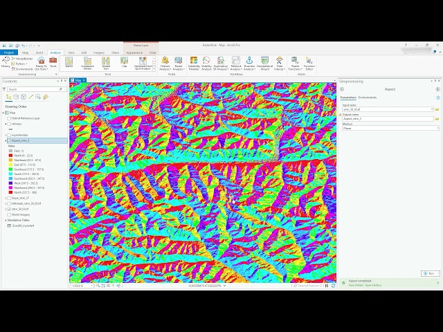
Video #97 In this video (just under 7 mins) I use the Spatial Analyst extension to create a Slope (measurement of steepness) ...

6:42
Using ArcGIS Pro Spatial Analyst to create Slope & Aspect Rasters

11,873 views

4 years ago