Upload date
All time
Last hour
Today
This week
This month
This year
Type
All
Video
Channel
Playlist
Movie
Duration
Short (< 4 minutes)
Medium (4-20 minutes)
Long (> 20 minutes)
Sort by
Relevance
Rating
View count
Features
HD
Subtitles/CC
Creative Commons
3D
Live
4K
360°
VR180
HDR
5,904 results
To navigate adequately in VisionLidar, a mouse with 3 buttons is preferable; left, right buttons and a mouse wheel. To begin, open ...
1,298 views
8 years ago
hello there, in this lesson, we will use geopandas and matplotlib to plot a geographic map from a CSV file with longitude and ...
64,766 views
5 years ago
See how VisionLidar, point cloud software and Deep Learning technologies can help you work smarter. Here at Geo-Plus we've ...
148,551 views
Block H of the Geographic Data Science course - "Points" More materials related to the content in this video are available at: ...
414 views
4 years ago
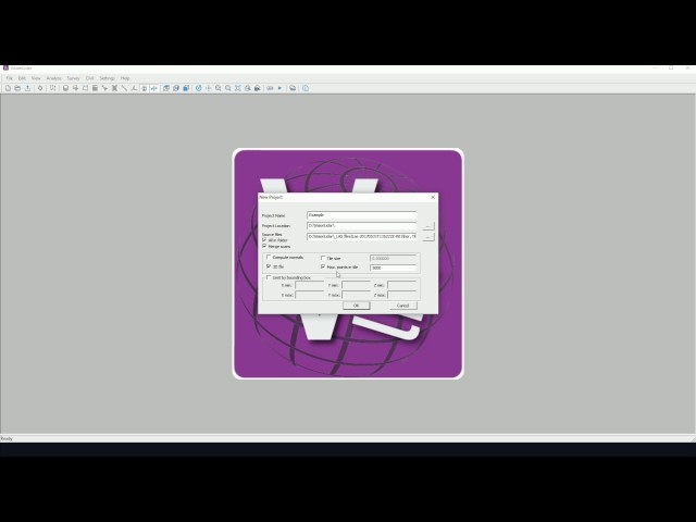
To begin, open up VisionLidar. The start-up screen will appear. To begin working with the software, the user may create a new ...
1,982 views
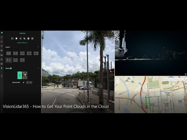
We've got great news! VisionLidar365 is about to make your life easier. Gone are the days of giant file sizes, clumsy point-cloud ...
150,452 views
Scholars GeoPortal is a tool that lets you find, access, and analyze geospatial datasets and maps. This video will show you how to ...
2,849 views
7 years ago
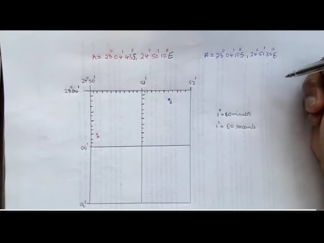
Geography mapwork: How to find a latitude and longitude coordinates Like and share to student geographers. Kindly Subscribe to ...
133,794 views
2 years ago
This video was created as part of an Erasmus + project. It was originally going to be in-person training but due to COVID-19 the ...
15 views
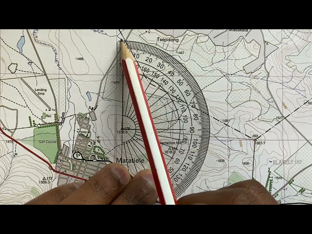
Using a topographic map 1: 50 000 to find a True bearing between two trig beacons and then calculating the magnetic bearing of ...
667,969 views
Master the art of spatial data management in this comprehensive tutorial! We'll start by using the 'Extract Vertices' tool to pull ...
1,127 views
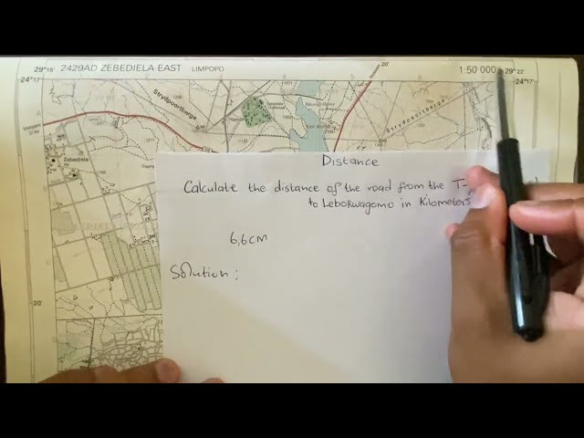
Using a topographic map of Zebediela, Limpopo (1: 50 000) to calculate the distance on a map in Geography mapwork/ map skills ...
221,750 views
3 years ago
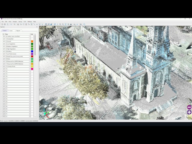
4 types of classification in the Analyze menu Ground Building Vegetation Noise Ground: This detection searches for the lowest ...
7,278 views
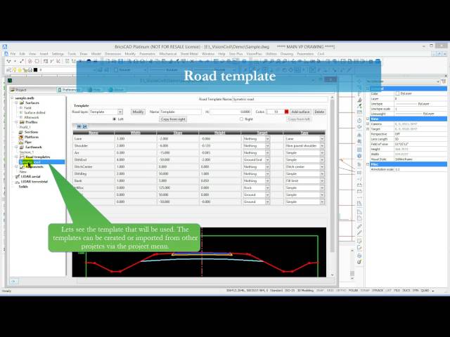
This tutorial shows how to create an alignment with both horizontal and vertical curves, and how to create earthwork along the ...
504 views
11 years ago
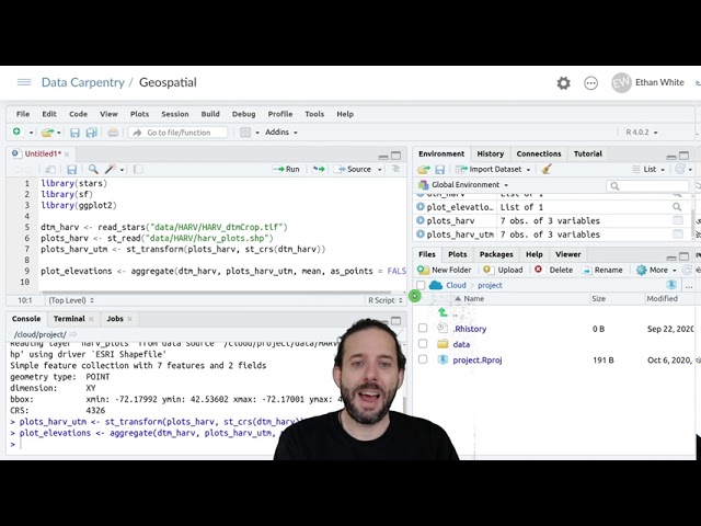
To then get the raster values at the point locations that we have for our plots we use the 'aggregate' function. And aggregate takes ...
12,052 views
In this video I demonstrate how to digitize points, lines and polygons and store them, including their styles, in a GeoPackage using ...
1,931 views
6 years ago
We can see our rectangle and its central point that's all for this tutorial thank you for watching and see you in the next video.
136 views
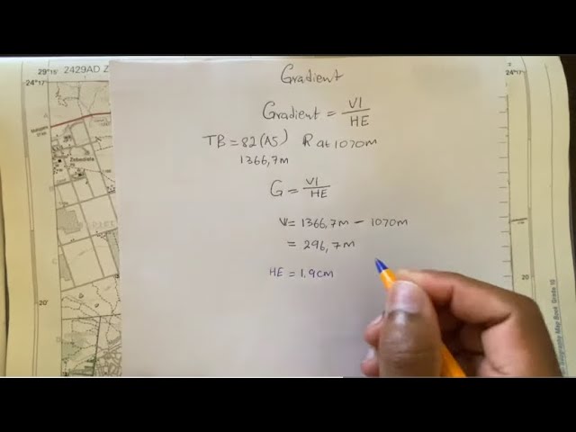
Using a topographic map of Zebedila, Limpopo to calculate Gradient (slope) on a map in Geography mapwork/ map skills.
314,306 views
In this video we use QGIS and Blender GIS to import maps, heightmaps, and OSM data accurately into Blender. QGIS: ...
64,187 views
1 year ago
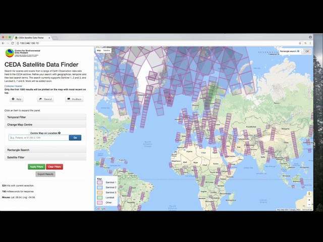
An introductory video demonstrating how to use the CEDA geo-search tool to find satellite data archived in the CEDA archives.
881 views