Upload date
All time
Last hour
Today
This week
This month
This year
Type
All
Video
Channel
Playlist
Movie
Duration
Short (< 4 minutes)
Medium (4-20 minutes)
Long (> 20 minutes)
Sort by
Relevance
Rating
View count
Features
HD
Subtitles/CC
Creative Commons
3D
Live
4K
360°
VR180
HDR
78,954 results
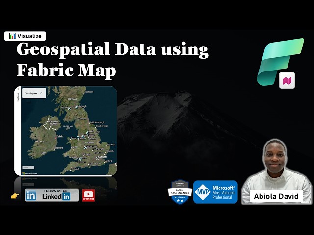
One of the exciting additions to Microsoft Fabric is the Map Item which enables teams to visualize and analyze geospatial data ...
103 views
3 days ago
Get to know geospatial data types (basics) in the form of vector and raster data based on explanations from ...
352 views
3 years ago
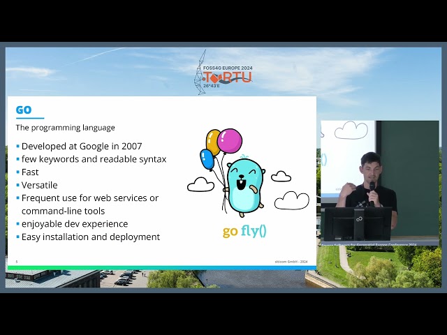
The programming language Go has established itself in various IT areas. This lightning talk offers a brief overview of Go with a ...
100 views
1 year ago
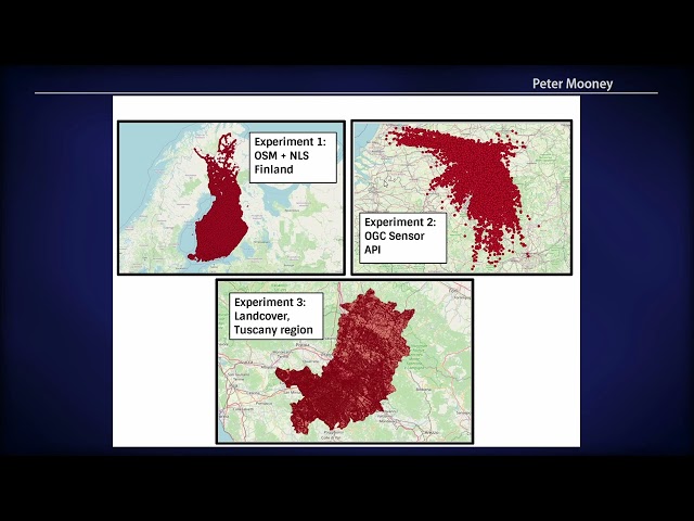
This session was recorded live at State of the Map US 2025 in Boston, Massachusetts. Hosted by OpenStreetMap US, the annual ...
239 views
7 months ago
telluric: interactive manipulation of Geospatial data with Jupyter and Python telluric library is an open source library developed by ...
272 views
7 years ago
Presented by Hidemichi Baba, Hinako Iseki on 19 November 2025 16:30, at FOSS4G 2025 Auckland. Track: Keynote Full ...
34 views
2 months ago
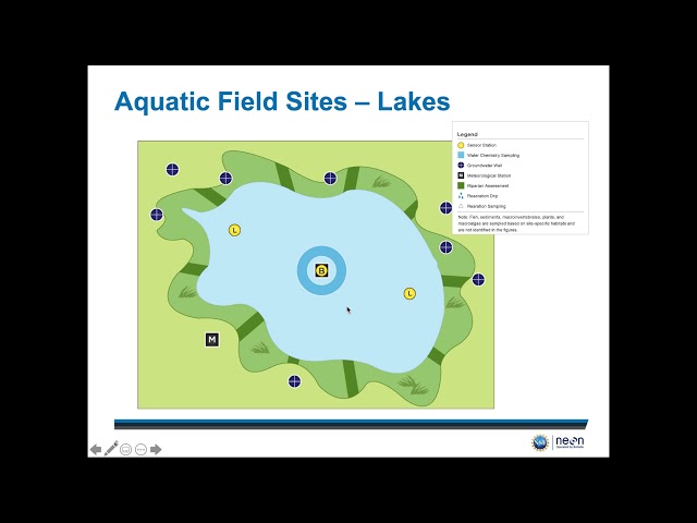
This video provides a detailed overview of how NEON spatial design and where you can access geospatial data. For more ...
381 views
5 years ago
Lecture: Geospatial modeling and GIS-based modeling of landscape processes Lecturer: Helena Mitasova Course: NCSU ...
2,259 views
9 years ago
The Open Geospatial Consortium (OGC) APIs are a new set of standards released in response to existing WxS standards which is ...
180 views
This short talk is about applying the concept of tiles to store geospatial information in a database and use it efficiently.
70 views
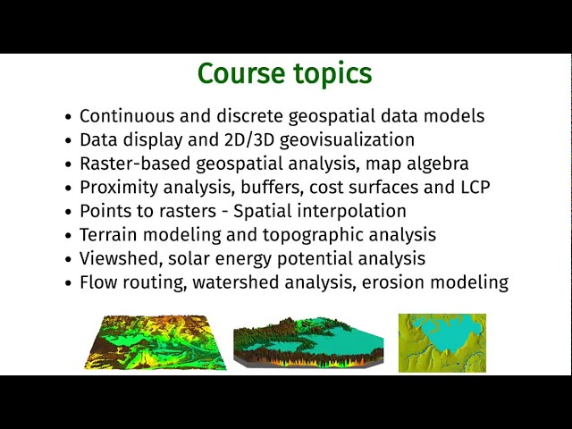
Introduction to and basic information about the Geospatial Modeling and Analysis course (GIS582/MEA582) at North Carolina ...
2,360 views
Have you unlocked the powers of PostgreSQL yet? This talk will show 3 neat features of how to use postgresql in a somewhat ...
157 views
How to create a fast and cost effective serverless geospatial analysis pipeline using AWS (Lambda)
205 views
We advance geospatial data science through providing optimal dev ops for anyone to build geospatial models in a GDAL native ...
63 views
Learn about Penn State's online Intelligence and Geospatial Analysis Option in the Master of Professional Studies in Homeland ...
507 views
4 years ago
A overview of Geospatial Data Modelling including Conceptual models (ontologies) Digital representation models Analysis ...
6,090 views
Data-driven innovation, as outlined by Granell et al. (2022), has seen recent advances in technology driven by the continuous ...
17 views
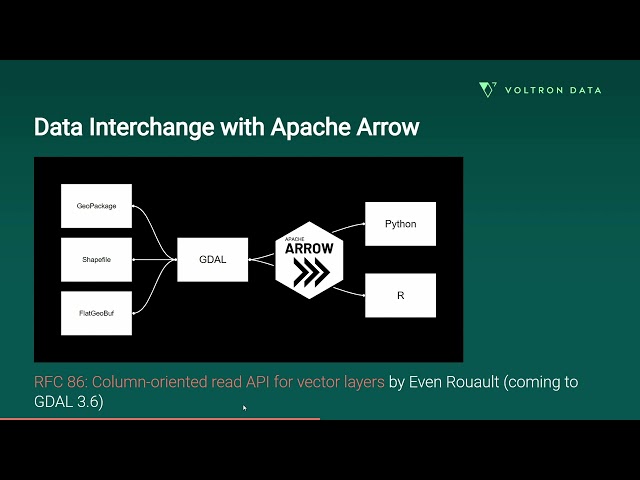
The Apache Arrow (https://arrow.apache.org/) project specifies a standardized language-independent columnar memory format.
60 views
Elasticsearch (https://www.elastic.co/elasticsearch/) is a well-known and mature NoSQL database providing search and analytics ...
194 views
Geographic Value (GeoValue) research demonstrates actions data providers can take to optimize the value of their geospatial ...
64 views
2 years ago
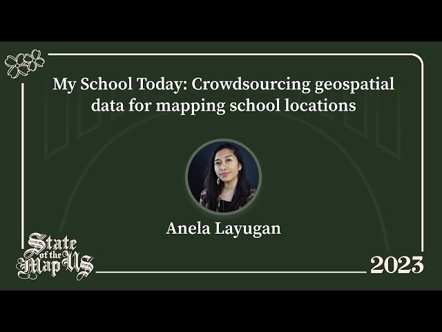
SDSN SDGs Today's initiative, My School Today uses OpenStreetMap map data to share population counts within various travel ...
82 views
Update December 2025 *** The latest version of the addon is working with Bledner 5.0 again you can download it here: ...
1,986,979 views
6 years ago
FOSS4G:UK 2023 Local: https://uk.osgeo.org/foss4guklocal2023/ Slides: ...
39 views
In this video we use QGIS and Blender GIS to import maps, heightmaps, and OSM data accurately into Blender. QGIS: ...
61,742 views
This video highlights the importance of big geospatial data in the digital age and provides an introduction to the NFDI4Earth ...
51 views