Upload date
All time
Last hour
Today
This week
This month
This year
Type
All
Video
Channel
Playlist
Movie
Duration
Short (< 4 minutes)
Medium (4-20 minutes)
Long (> 20 minutes)
Sort by
Relevance
Rating
View count
Features
HD
Subtitles/CC
Creative Commons
3D
Live
4K
360°
VR180
HDR
4,593 results
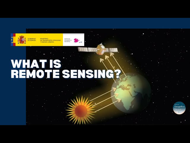
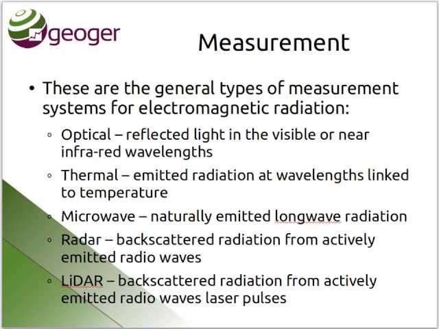
Discover the technology that enables to explore the terrain without being in contact with it. A tour around the current technologies ...
20,727 views
5 years ago
Did you ever wonder how your camera actually takes a picture? It's all about light - it records the light that objects reflect.
179,866 views
10 years ago
This NEON Science video overviews what lidar or light detection and ranging is, how it works and what types of information it can ...
1,000,380 views
11 years ago
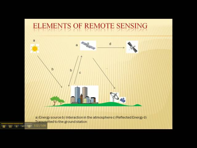
CIRES Fellow and NASA Chief Scientist Waleed Abdalati and CIRES Fellow Steve Nerem explain Remote Sensing and how it is ...
270,988 views
14 years ago
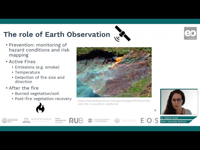
Dr. Valerie Graw introduces you to remote sensing methods used for fire monitoring. 'Land in Focus' Massive Open Online Course ...
845 views
4 years ago
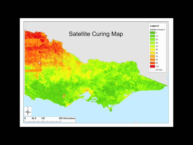
In this video, satellite expert Danielle Martin explains her work in the grassland curing project. We are combining field ...
1,371 views
First lecture in Introductory Remote Sensing class.
7,747 views
A very quick introduction to a few of the terms and concepts that you might come across when talking about Remote Sensing.
156 views
Hi my name is Danielle Martin and I am the satellite remote sensing analyst for the grassland curing project grassland curing ...
505 views
12 years ago
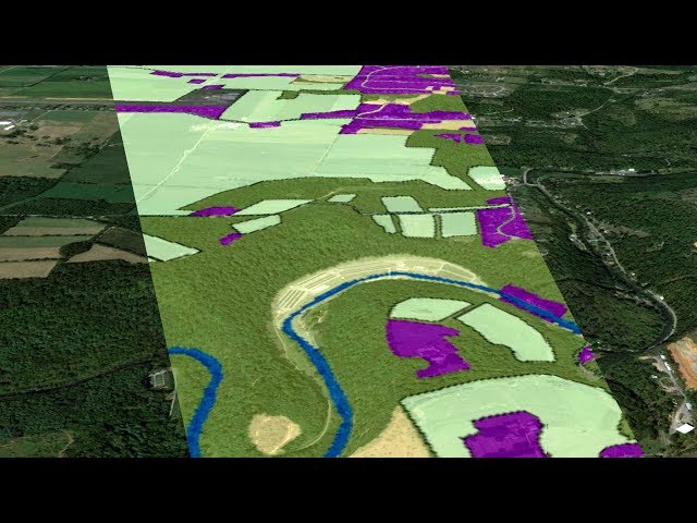
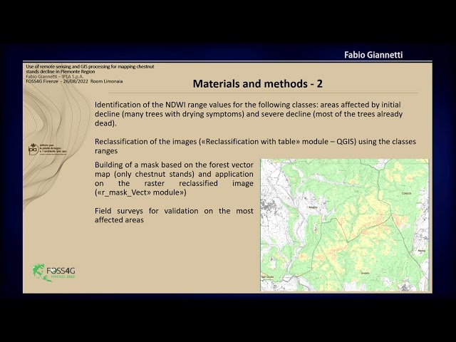
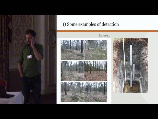
Use of remote sensing and GIS processing for mapping Chestnut stands decline in Piemonte Region Chestnut stands in ...
10 views
1 year ago
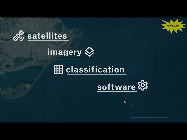
New course this autumn! winter (first) semester of the academic year 2024/2025 Remote Sensing for Sustainable Maritime ...
29 views
We present methods for developing sensor-agnostic deep learning models for remote sensing, highlighting our open-source ...
438 views
This is a short lecture video explaining how remote sensing offers a good alternative in estimating Water Productivity components ...
344 views
3 years ago
This paper, published in Frontiers in Remote Sensing, explores the lack of inclusivity in the field of remote sensing by examining ...
155 views
... opinion uh in the remote sensing Community we emphasize more uh on uh how realistic our uh remote sensing images are and ...
126 views
This video was created for Penn State's GEOG 883, Remote Sensing for the Geospatial Intelligence Professional course ...
4,480 views
Interview with Jadu Dash. Jadu Dash is a Professor of Remote Sensing at the Faculty of Social, Human and Mathematical ...
2,174 views
9 years ago
In Flanders (Belgium) during the last years a large amount of remote sensing data has been acquired and processed, including ...
740 views
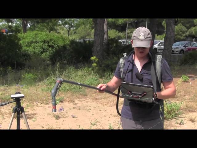
A quick overview of how UCA makes ground-based spectrometry measurements to relate the reflectance properties of vegetation ...
1,531 views
589 views