ViewTube

ViewTube
Sign inSign upSubscriptions
Filters

Upload date

Type

Duration

Sort by

Features

Reset

5,023 results

Introduction to Data Science
Spatial Data Analysis 4: Map Projections

In this video we talk about how we deal with the fact that the earth is a globe when making maps.

4:54
Spatial Data Analysis 4: Map Projections

363 views

3 years ago

TALE: The Archaeology Lecture E-library
Developing a method for a spatial correspondence analysis

Martin Sterry University of Leicester Multivariate analyses, in particular correspondence analysis, (CA) have become a standard ...

16:23
Developing a method for a spatial correspondence analysis

724 views

10 years ago

Introduction to Data Science
Spatial Data Analysis 2: Shapely

We introduce the python shapely library for manipulating polygons.

7:00
Spatial Data Analysis 2: Shapely

1,193 views

3 years ago

TALE: The Archaeology Lecture E-library
Spatial data standards matter too

Peter McKeague.

13:27
Spatial data standards matter too

151 views

7 years ago

Introduction to Data Science
Spatial Data Analysis 6: Folium

A rapid introduction to the python folium library.

5:25
Spatial Data Analysis 6: Folium

792 views

3 years ago

FOSS4G
FOSS4G 2022 | Morphological Spatial Pattern Analysis: Open Source Release

In this section, we describe the main routines of the MSPA code with reference to the morphological image analysis operations ...

4:10
FOSS4G 2022 | Morphological Spatial Pattern Analysis: Open Source Release

399 views

1 year ago

Geography
"Geographical Skills: Using GIS and Spatial Analysis"

Welcome to "Geographical Skills: Using GIS and Spatial Analysis," your go-to channel for mastering the essential tools of ...

13:12
"Geographical Skills: Using GIS and Spatial Analysis"

13 views

1 year ago

TALE: The Archaeology Lecture E-library
“Festung Brünn”: Remote sensing and spatial analysis of German World War 2 field fortification

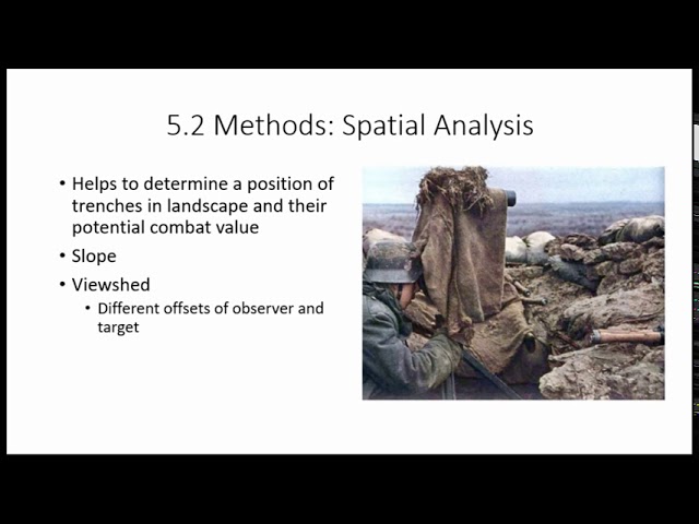
In recent years, several trenches of overall length 400 metres were unearthed on three sites dur-ing rescue excavations at the ...

18:43
“Festung Brünn”: Remote sensing and spatial analysis of German World War 2 field fortification

94 views

5 years ago

SpatialPublicHealth
Spatial Epidemiology with Open Source GIS

Spatial Epidemiology with Open Source GIS.

19:45
Spatial Epidemiology with Open Source GIS

6,160 views

13 years ago

Lars Juhl Jensen
Single cell and spatial omics: A short introduction to the core concepts of scRNA-seq and more

A short introduction to the core concepts on single-cell omics data and spatial omics data. I will start by introducing how these ...

6:21
Single cell and spatial omics: A short introduction to the core concepts of scRNA-seq and more

12,248 views

3 years ago

EMF Research
SPATIAL ANALYSIS | Chloropleth maps

Creating 3D graphs for Geospatial data in Excel can give YOUR dataset good visualization.

4:51
SPATIAL ANALYSIS | Chloropleth maps

456 views

4 years ago

Daniel Arribas-Bel
Point Patterns - A Course on Geographic Data Science

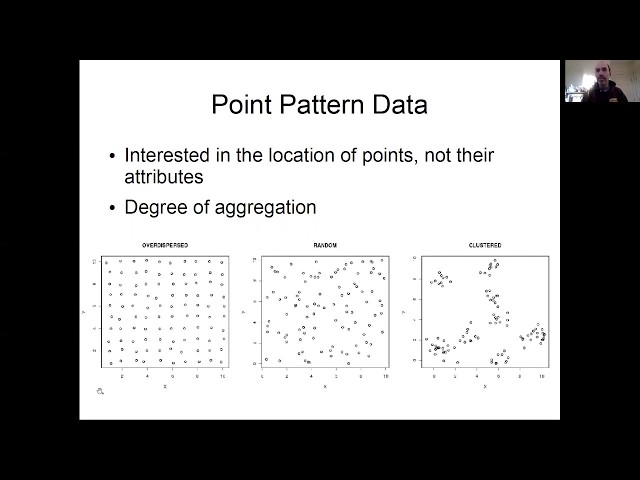
Block H of the Geographic Data Science course - "Points" More materials related to the content in this video are available at: ...

11:10
Point Patterns - A Course on Geographic Data Science

403 views

4 years ago

TALE: The Archaeology Lecture E-library
Exploring spatial autocorrelation in archaeological spaces using R

This property of spatial data, also known as spatial dependency, has proven extremely useful for the analysis of archaeological ...

17:59
Exploring spatial autocorrelation in archaeological spaces using R

514 views

6 years ago

TALE: The Archaeology Lecture E-library
Indigenous Landscapes in the Caribbean: Using network analysis and spatial statistics

What we know today of the Indigenous inhabitants of the Caribbean is the result of a process of cultural interpretation and ...

18:25
Indigenous Landscapes in the Caribbean: Using network analysis and spatial statistics

113 views

5 years ago

Daniel Arribas-Bel
"Good old" Spatial Data - A Course on Geographic Data Science

Block C of the Geographic Data Science course - "Spatial Data" More materials related to the content in this video are available at: ...

8:14
"Good old" Spatial Data - A Course on Geographic Data Science

382 views

4 years ago

Geoinformatics
Geospatial Data Modelling

... The time aspect 10:24 The spatial aspect 14:08 Vector data 15:06 RAster data 15:47 Joining spatial and non spatial data 16:33 ...

19:41
Geospatial Data Modelling

6,079 views

7 years ago

Daniel Arribas-Bel
Exploratory Spatial Data Analysis (ESDA) - A Course on Geographic Data Science

Block F of the Geographic Data Science course - "ESDA" More materials related to the content in this video are available at: ...

4:27
Exploratory Spatial Data Analysis (ESDA) - A Course on Geographic Data Science

1,364 views

4 years ago

Robin Lovelace
R for Spatial Analysis (1 of 3): Introduction to R

This is an introduction to R for beginners interested in its origins and why it is becoming popular for spatial data analysis.

8:44
R for Spatial Analysis (1 of 3): Introduction to R

5,675 views

12 years ago

GIS Coordinated
Using ArcGIS Pro Spatial Analyst to create Slope & Aspect Rasters

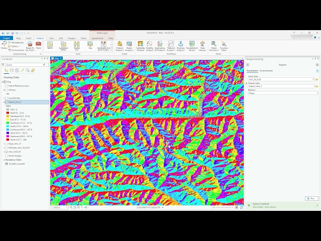
Video #97 In this video (just under 7 mins) I use the Spatial Analyst extension to create a Slope (measurement of steepness) ...

6:42
Using ArcGIS Pro Spatial Analyst to create Slope & Aspect Rasters

11,871 views

4 years ago

Michael Dietze
Lesson 29a Spatial Data: Point Patterns

Boston University EE509 "Applied Environmental Statistics" Course: This lecture kicks off our unit on spatial statistics, starting with ...

16:55
Lesson 29a Spatial Data: Point Patterns

4,504 views

5 years ago

Robin Lovelace
R for Spatial Analysis (2 of 3): Why R for spatial analysis?

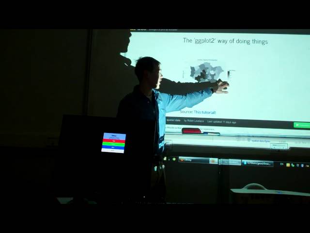
This video provides a very broad brush overview of why R is good for spatial data analysis, its limitations and base and ggplot2 ...

8:14
R for Spatial Analysis (2 of 3): Why R for spatial analysis?

2,186 views

12 years ago

Australian Research Data Commons - ARDC
Standardisation of Spatial Data Quality at OGC and ISO

10.10.19 Data Quality Interest Group Presentation - Dr Ivana Ivanova, Curtin University.

17:35
Standardisation of Spatial Data Quality at OGC and ISO

483 views

6 years ago

Robin Lovelace
R for Spatial Analysis (3 of 3): Getting started with the practical

This video explains how to get started with the tutorial, an Introduction to Visualising Spatial Data in R, which can be found on my ...

15:19
R for Spatial Analysis (3 of 3): Getting started with the practical

1,872 views

12 years ago

weecology
Geospatial Data in R - Introduction to Vector Data

This video is an introduction to vector data and how to work with it in R. Vector data includes all kinds of spatial data that are not ...

15:02
Geospatial Data in R - Introduction to Vector Data

6,442 views

5 years ago

TALE: The Archaeology Lecture E-library
Landscapes of commerce: a spatial approach to local market systems

Spatial analysis offers a way forward. Rather than relying on proxies like urban-manufactured goods to indicate an economic ...

19:32
Landscapes of commerce: a spatial approach to local market systems

103 views

6 years ago