Upload date
All time
Last hour
Today
This week
This month
This year
Type
All
Video
Channel
Playlist
Movie
Duration
Short (< 4 minutes)
Medium (4-20 minutes)
Long (> 20 minutes)
Sort by
Relevance
Rating
View count
Features
HD
Subtitles/CC
Creative Commons
3D
Live
4K
360°
VR180
HDR
428 results
Get insights from Ed Parsons, Geospatial Technologist at google on: Why SDIs are not working like they are meant to be!
1,591 views
11 years ago
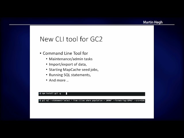
GC2/Vidi: What's new in spatial data infrastructure project The GC2/Vidi platform helps you build a spatial data infrastructure ...
13 views
1 year ago
https://media.ccc.de/v/bucharest-219-a-geo-spatial-big-data-infrastructure-for-asset-management The talk will present case ...
201 views
6 years ago
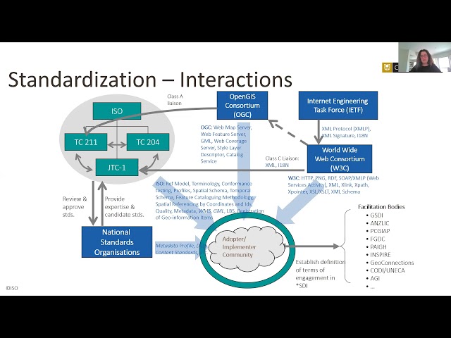
The INSPIRE Directive (2007) mandates European Union countries to share environmentally related datasets so that they can be ...
310 views
9 years ago
I'll offer alternatives to the status quo that will maximize the utility of geospatial data within the OSM - Federal Government ...
64 views
2 years ago
The OSGeo project deegree is open source software for spatial data infrastructures (SDI) and the geospatial web which mainly ...
41 views
The roadmap of directive implementation has reached the last milestone in 21/10/2020 – all spatial data sets had to be provided ...
22 views
Presented by Hidemichi Baba, Hinako Iseki on 19 November 2025 16:30, at FOSS4G 2025 Auckland. Track: Keynote Full ...
32 views
2 months ago
... a multi-purpose web map platform optimized for utilizing modern spatial data infrastructures. Currently incubating to become an ...
50 views
GEOkomm is the German trade association for the geospatial industries. Some companies founded a second association called ...
27 views
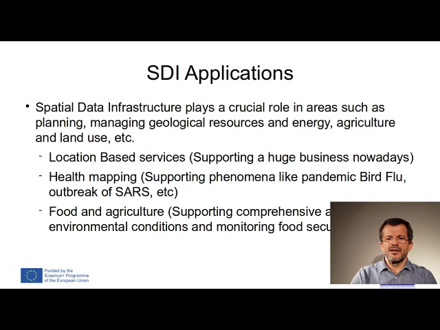
At the core of this research project, lies a Spatial Data Infrastructure (SDI) which assembles disparate datasets that characterise ...
6 views
A lot of data references some kind of location whether it is a place name, street name, address, postcode or some kind of ...
258 views
12 years ago
This video demonstrates how to interpolate groundwater quality data from a borehole point vector data set to rasters.
14,271 views
3 years ago
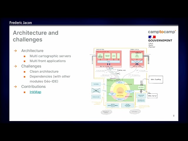
This is an example of the development of a large departmental spatial data infrastructure used by about 150 services in France.
10 views
10.10.19 Data Quality Interest Group Presentation - Dr Ivana Ivanova, Curtin University.
488 views
... were introduced in three modules: Spatial Data Infrastructure, Using GIS and spatial databases and 3D Geological Modelling.
37 views
Eddie Pickle will discuss Boundless' efforts to create new, open source tools that improve geospatial data management workflows ...
266 views
... (https://www.georchestra.org/) (a free, open source, modular and interoperable Spatial Data Infrastructure software born in 2009 ...
43 views
Growing a Global Knowledge Network among Geospatial Specialists. Describes the problems the network is attempting to ...
220 views
14 years ago
EPCA SDI Course.
84 views