Upload date
All time
Last hour
Today
This week
This month
This year
Type
All
Video
Channel
Playlist
Movie
Duration
Short (< 4 minutes)
Medium (4-20 minutes)
Long (> 20 minutes)
Sort by
Relevance
Rating
View count
Features
HD
Subtitles/CC
Creative Commons
3D
Live
4K
360°
VR180
HDR
8,688,200 results
By watching this video you can lern How to set Geolocation in Autocad topogrphy sheet,how can you compare Actual Land ...
113,022 views
10y ago
In this video, you will learn how to add a high-resolution image from Google Earth to AutoCAD, and how to georeference the ...
272,040 views
5y ago
Re-uploaded to fix small errors and improve understandability ** Do you find orbital mechanics too confusing to understand? Well ...
1,013,063 views
3y ago
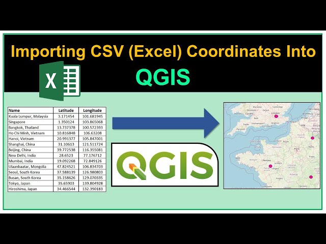
hello there, in this lesson, we will use geopandas and matplotlib to plot a geographic map from a CSV file with longitude and ...
64,776 views
In this video the characteristics of the earth such as its dimensions, shape, hemispheres and movements are summarized.
186,707 views
4y ago
In this video, you will learn how to plot a simple dataset which consists of longitude and latitude coordinates on a map using ...
133,119 views
If you haven't heard of it, GeoGuessr is basically competitive Google Maps. Participants try to guess where they are on the planet ...
5,353,654 views
In this video, you will learn how you can utilize the map making capabilities of Google Earth Pro to create a simple map layout.
151,560 views
Blender tutorial showing how to use Geometry Nodes to create sugar coated candy. Part 2: https://youtu.be/V10GBrmYIDM 0:00 ...
925,851 views
So you've seen those location-tagging numbers on maps and GPS devices before, but do you actually know what they mean?
861,511 views
9y ago
Tableau - Introduction To Maps Lecture By: Mr. Pavan Lalwani, Tutorials Point India Private Limited Get FLAT 10% on latest ...
167,458 views
8y ago
In this video we examine how to use a protractor to calculate the bearing of two points on an OS map. I explain how to use north ...
282,123 views
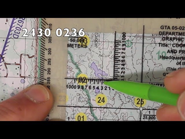
In this video, I'll walk you through how to plot an eight-digit grid coordinate on a topographical map. I'll be using a military map, ...
355,002 views
6y ago
Ready to go beyond tutorials and learn QGIS properly? Explore the *QGIS Masterclass* with structured lessons and practical ...
486,735 views
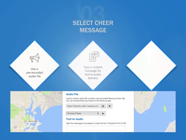
How To: 1. Access the map in your RaceJoy dashboard 2. Choose the location: Use existing marker or add new marker 3. Set up ...
423 views
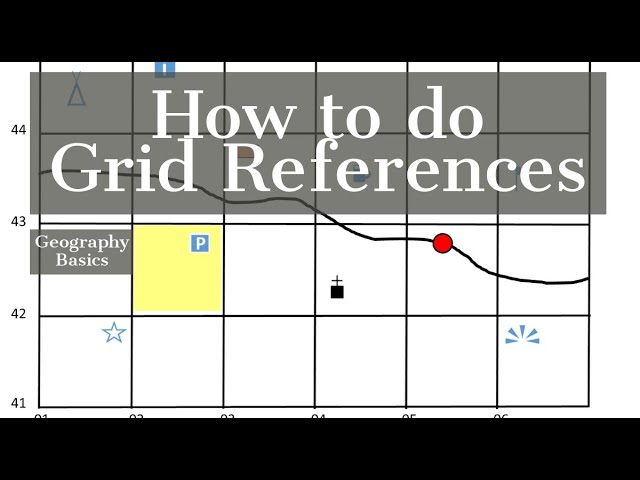
geographybasics #geogbasics #geography In today's video I am going to show you the basics of creating and reading 4 and 6 ...
249,723 views
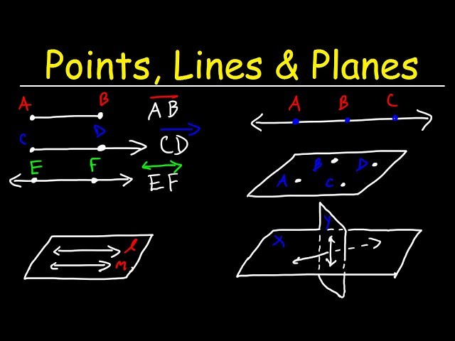
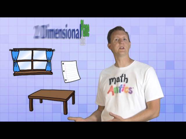
This geometry video tutorial provides a basic introduction into points, lines, segments, rays, and planes. It explains how to identify ...
657,434 views
Learn More at mathantics.com Visit http://www.mathantics.com for more Free math videos and additional subscription based ...
2,577,221 views
12y ago
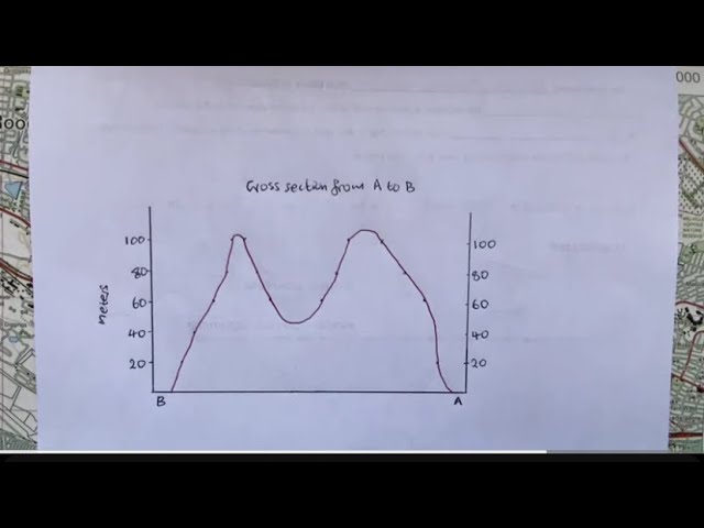
A step by step tutorial on how to draw cross section. You would use contour lines topographic map to perform this. Do not forget to ...
112,585 views
2y ago
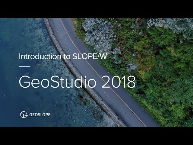
This tutorial guides new users through the basics of creating a simple stability analysis in SLOPE/W.
176,204 views