Upload date
All time
Last hour
Today
This week
This month
This year
Type
All
Video
Channel
Playlist
Movie
Duration
Short (< 4 minutes)
Medium (4-20 minutes)
Long (> 20 minutes)
Sort by
Relevance
Rating
View count
Features
HD
Subtitles/CC
Creative Commons
3D
Live
4K
360°
VR180
HDR
7,091 results
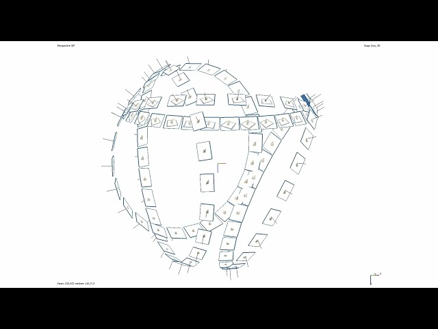
Basic outline of how to acquire data for the purpose of digitising small (geological) samples using Structure from Motion ...
43 views
3 years ago
This tutorial fallows the steps to make a translation and rotation of ground points with some control points. The translation/rotation ...
788 views
11 years ago
VisionLidar 2.0 processes billions of LiDAR points more than 10x faster — and uses 10x less GPU memory — than the legacy ...
128 views
4 days ago
Experience the Precision of VisionLidar! Witness the seamless journey from raw data to automated classification, cluster detection ...
9,772 views
2 years ago
Top Geometry Dash players playing levels on the Demonlist are always clicking so loudly! Why? Join my DISCORD: ...
981,724 views
Join this channel to get access to CRAZY perks for just $0.03 a day! What a deal! Click here: ...
969,564 views
1 year ago
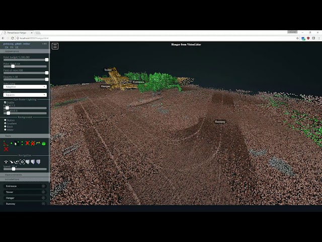
Introducing VisionLidar, the ultimate solution for handling extensive point cloud projects with lightning speed. Explore point clouds ...
616 views
To start using VisionLidar, simply click on this link to get a Free LTD version all ready for you ...
226 views
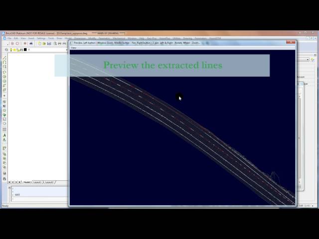
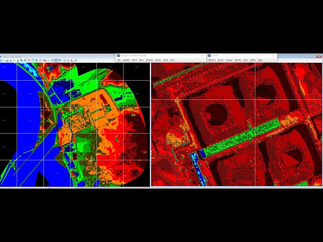
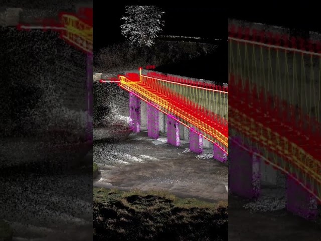
This video offer you a tutorial on how you can extract the centerline of a road from a terrestrial LiDAR file. The LiDAR was mounted ...
351 views
12 years ago
Unit of Scale।Scale unit।scale।Geo Tutorial Point।Geography practical।Linear।Comparative।Diagonal। #Unit of Scale ...
170 views
4 years ago
Unlock the power of VisionLidar the Point Cloud Processing Software with our FREE LTD Version! Learn how to access it in ...
346 views
Little YouTube short explaining every single special block or letter block and what it does in Geometry Dash 2.2! Hope you ...
424,683 views
photogrammetric mapping survey Point cloud, DTM, orthophoto and as-built CAD drawing. Geomatics engineering Classification ...
776 views
Have you ever had to process point clouds with several billion points from aerial, mobile, or terrestrial scans? It can be ...
69 views
Unlock the power of point clouds with VisionLidar! Our point cloud processing software makes it easy to analyze and visualize ...
301 views
VisionLidar is the most complete point cloud software so far. Did you know that we can share a point cloud on the web? Without ...
5,693 views
8 years ago
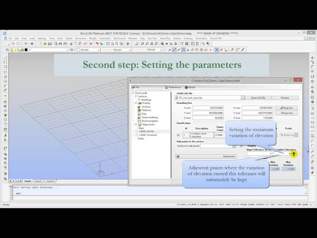
This video offer you a tutorial on how easy it is to create a surface with breaklines with Geo-Plus products. Extracting breaklines ...
461 views
An Azimuthal Equidistant projection, with a changing standard point. Built with GeoCart and FrameByFrame.
16,128 views
14 years ago
VisionLidaris the most advanced Point Cloud software so far. It has new time-saving functions specially designed to detect ...
2,738 views
Unlock the true potential of your CAD and point cloud data to enhance your virtual survey with VisionLidar from Geo-Plus!
811 views