ViewTube

ViewTube
Sign inSign upSubscriptions
Filters

Upload date

Type

Duration

Sort by

Features

Reset

26,187 results

GIS Coordinated
ArcGIS Pro - Move, Rotate & Scale a Polygon

Video #123 In this short (3 minutes!) video, I demonstrate the Move, Rotate and Scale tools. I execute these tools on a polygon ...

2:45
ArcGIS Pro - Move, Rotate & Scale a Polygon

14,680 views

4 years ago

ELITE GEOSPATIAL
Arcgis basics: How to project the Data view on arcmap 10.8

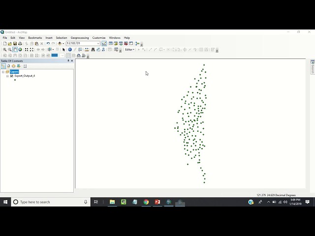
elite geospatial is a spatial company and a training institue its offers wide coverage in the area of gis and remote sensing. this ...

1:04
Arcgis basics: How to project the Data view on arcmap 10.8

204 views

2 years ago

cornell-gis
Extracting rasters from a FileGDB using ArcMap

This is a quick demo of how to get raster layers out of an Esri File Geodatabase (.gdb folder) using ArcMap. This is useful for when ...

3:00
Extracting rasters from a FileGDB using ArcMap

1,289 views

5 years ago

Rajesh Dorkar
ArcMap 10.1tutorial creating a MDB and GDB

Create a MDB and GDB in Arc Desktop. 1) Right-click the file folder in the Catalog tree where you want to create the new personal ...

2:27
ArcMap 10.1tutorial creating a MDB and GDB

4,172 views

9 years ago

GISTutorials
Locating the Raster Calculator and other tools in ArcMap 10

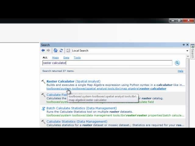
In this tutorial I show you how to easily find any tool using the search feature. I demonstrate by finding the Raster Calculator, which ...

1:07
Locating the Raster Calculator and other tools in ArcMap 10

9,056 views

14 years ago

ELITE GEOSPATIAL
GIS BASICS: how to select and export to a new data layer on arcmap 10 8

GIS BASICS: how to select and export to a new data layer on arcmap 10.8 #autocad #viral #tutorial #arcgistutorial Elite Geospatial ...

2:39
GIS BASICS: how to select and export to a new data layer on arcmap 10 8

91 views

2 years ago

Richard Smith
Automatic and Manual Aspatial Selection of Features in ArcGIS 10.1

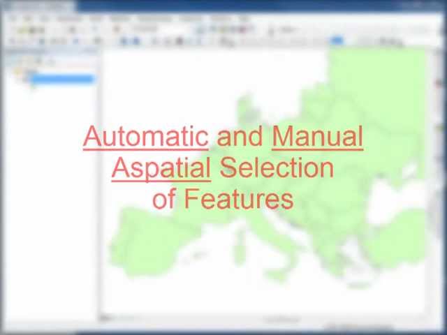
Visual demonstration of automatic and manual aspatial selection of features in ArcGIS 10.1.

1:00
Automatic and Manual Aspatial Selection of Features in ArcGIS 10.1

406 views

13 years ago

GeoThread
ArcGIS Online - data import

This video is about how to import GIS Shapefiles into ESRI ArcGIS Online.

3:56
ArcGIS Online - data import

14,283 views

10 years ago

Roel Van de Paar
GIS: Implementing Pairwise Intersect Tool in ArcMap?

https://amzn.to/4aLHbLD You're literally one click away from a better setup — grab it now! As an Amazon Associate I earn ...

2:28
GIS: Implementing Pairwise Intersect Tool in ArcMap?

87 views

4 years ago

Manikandan Sathiyanarayanan
Rainfall data Interpolation using Kriging in Geostatistics tool -Arcmap

Interpolation can be done using Kriging in geostatistics tool box in arcmap.

2:24
Rainfall data Interpolation using Kriging in Geostatistics tool -Arcmap

2,462 views

7 years ago

Tyler W. Davis
AdvGIS | GIS Workflow Tutorial | Part 3

This video series goes through the process of delineating a watershed in the Napa region of California using Python and ...

3:27
AdvGIS | GIS Workflow Tutorial | Part 3

111 views

4 years ago

Roel Van de Paar
GIS: Merging different classes/clusters in one single raster in ArcGIS Desktop?

https://amzn.to/4aLHbLD You're literally one click away from a better setup — grab it now! As an Amazon Associate I earn ...

1:29
GIS: Merging different classes/clusters in one single raster in ArcGIS Desktop?

172 views

4 years ago

GIS Coordinated
ArcGIS Pro - Distance & Direction Basics

Video #127 This less-than-3 minute video is really just to introduce the Distance & Direction button. A powerful way to quickly ...

2:54
ArcGIS Pro - Distance & Direction Basics

9,484 views

4 years ago

Dutton Institute
Inserting a legend, arrow and scalebar in ARCMAP

This video demonstrates how to insert a legend, arrow and scalebar in ARCMAP. It was created for Penn State's GEOG 469, ...

2:21
Inserting a legend, arrow and scalebar in ARCMAP

7,207 views

9 years ago

Roel Van de Paar
GIS: Creating travel time isochrones using ArcGIS Desktop?

https://amzn.to/4aLHbLD You're literally one click away from a better setup — grab it now! As an Amazon Associate I earn ...

2:03
GIS: Creating travel time isochrones using ArcGIS Desktop?

191 views

4 years ago

Eric Compas
ArcCatalog - Searching data & adding data to ArcMap

Search through metadata in ArcCatalog and drag-and-dropping files to ArcMap.

2:57
ArcCatalog - Searching data & adding data to ArcMap

2,534 views

14 years ago

ELITE GEOSPATIAL
GIS BASICS :HOW TO CLIP(VECTOR) LAYER ON ARCMAP 10.8 #autocad #viral #tutorial #arcgistutorial

GIS BASICS :HOW TO CLIP(VECTOR) LAYER ON ARCMAP 10.8 #autocad #viral #tutorial #arcgistutorial Elite Geospatial is a ...

2:08
GIS BASICS :HOW TO CLIP(VECTOR) LAYER ON ARCMAP 10.8 #autocad #viral #tutorial #arcgistutorial

141 views

2 years ago

Karen Joyce
ArcGIS Zooming and Panning Navigation

... you start up arcmap you probably notice that you've got these these zooming and pounding tools that come up in a toolbar now ...

2:55
ArcGIS Zooming and Panning Navigation

1,526 views

12 years ago

Manikandan Sathiyanarayanan
Rainfall interpolation using Global Polynomial interpolation using Geostatistical tool in Arcmap

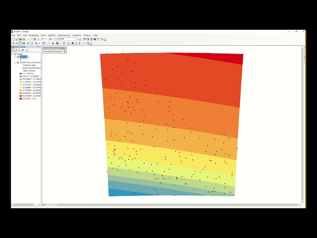
Annual Rainfall interpolation using Global Polynomial interpolation using Geostatistical tool in Arcmap.

2:53
Rainfall interpolation using Global Polynomial interpolation using Geostatistical tool in Arcmap

911 views

7 years ago

Roel Van de Paar
GIS: Resizing shape (polygons) in Arcmap

https://amzn.to/4aLHbLD You're literally one click away from a better setup — grab it now! As an Amazon Associate I earn ...

2:08
GIS: Resizing shape (polygons) in Arcmap

62 views

4 years ago