Upload date
All time
Last hour
Today
This week
This month
This year
Type
All
Video
Channel
Playlist
Movie
Duration
Short (< 4 minutes)
Medium (4-20 minutes)
Long (> 20 minutes)
Sort by
Relevance
Rating
View count
Features
HD
Subtitles/CC
Creative Commons
3D
Live
4K
360°
VR180
HDR
842 results
#GIS is a technology that captures, stores, analyzes, and visualizes #geospatial data, offering insights for decision-making.
479 views
2 years ago
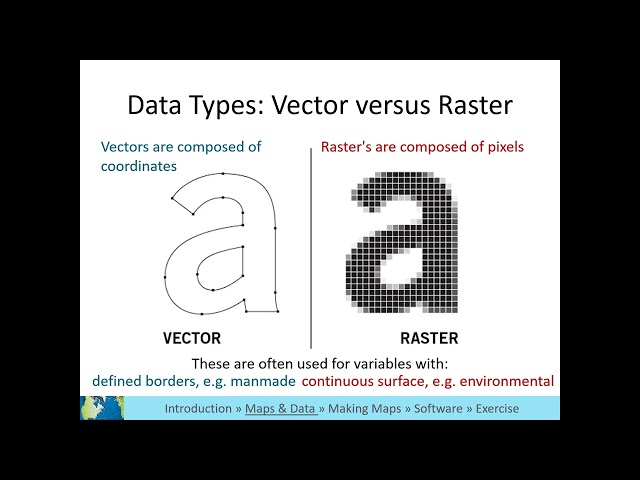
In the subject of Geographic Information Systems (GIS), the vector and raster formats are two ways of representing real-world ...
39,761 views
1 year ago
Learn about Geospatial Analysis with the National Student Data Corps! Why is geospatial data processing important? What are ...
411 views
You can find additional content and tutorials on the Geospatial Institute website (https://www.geospatial.institute). Created by ...
2,124 views
10 years ago
Learn about the different types of data that can be used in a GIS.
1,011 views
4 years ago
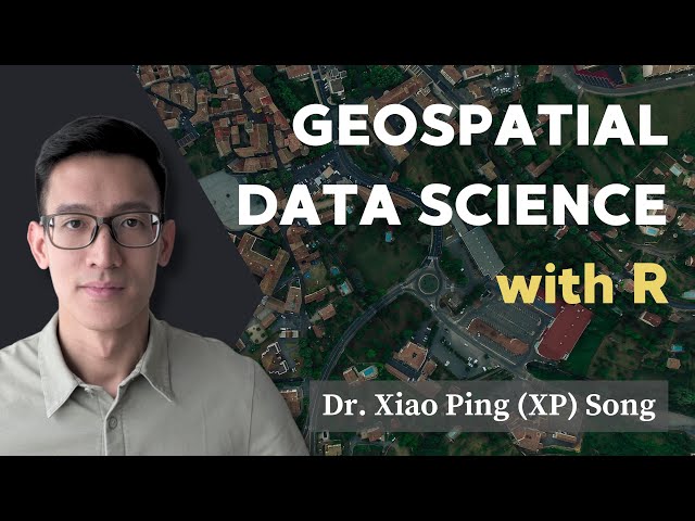
Content preview for Week 1 of the online course 'Geospatial Data Science with R'. Learn the skills to work effectively with spatial ...
1,088 views
A look inside the new GIS & Data Lab in Rotch Library (7-238), where GIS Services and Data Management Services come ...
2,052 views
7 years ago
This video is a demonstration of one of the tutorials found in the book Geospatial Concepts: The Fundamentals of Geospatial ...
2,936 views
1,051 views
Chapters: 00:00 Intro 0:28 Mexico and Mexico City example 0:50 Felt map example using Mexico City GIS data Below are the ...
904 views
Learn more about watsonx.governance → https://ibm.biz/BdPLGc Learn more about Data Quality Tools → https://ibm.biz/BdPjqm ...
77,974 views
3 years ago
1,179 views
With Birdi, all your geospatial data, assessments and reports live in the one workspace, which means you can always find what ...
142 views
Article and sample data: ...
3,014 views
9 years ago
Wherobots is the Spatial Intelligence Cloud, with a data lakehouse engine optimized for processing geospatial data at ...
1,904 views
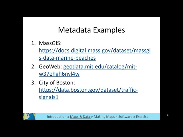
Learn what metadata is and why it is important.
982 views
Embark on an exciting journey into the world of geospatial data science, and open up new possibilities for your research, ...
2,811 views
1,144 views
1,249 views
This is the fourth video in the Introduction to GIS video series and the fourth of the "What is GIS?" videos.
343 views