Upload date
All time
Last hour
Today
This week
This month
This year
Type
All
Video
Channel
Playlist
Movie
Duration
Short (< 4 minutes)
Medium (4-20 minutes)
Long (> 20 minutes)
Sort by
Relevance
Rating
View count
Features
HD
Subtitles/CC
Creative Commons
3D
Live
4K
360°
VR180
HDR
138,614 results
Steps: 1. The Data Frame Properties window is accessible through ArcMap's View menu or by right-clicking the data frame in the ...
64,236 views
4 years ago
Esri instructor Travis Ormsby talks through the process of creating Python scripts in ArcGIS Pro. By using the Copy Python ...
41,726 views
arcgis tutorial for beginners, how to create shapefile in arcgis, how to create shapefile in arcmap, how to make shapefile in arcgis, ...
193,848 views
8 years ago
In GIS, to clip is to overlay a polygon on one or more target features (layers) and extract from the target feature (or features) only ...
97,089 views
5 years ago
Explore the possibilities of mapping in ArcGIS Online. This video shows you how to get started with creating a map in Map Viewer.
98,607 views
3 years ago
... one to create a new shapefile we use the catalog tab within ArcGIS. That pops up here we navigate to the folder where we want ...
1,128 views
7 years ago
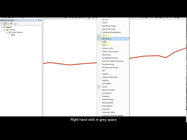
Learn how to split a polyline in ESRI ArcMap, quick guide.
31,644 views
6 years ago
learn to create points in ArcGIS by two different techniques in less than one minute. #Points_arcgis #createPointsInArcGIS.
76,061 views
Recorded with https://screencast-o-matic.com.
439 views
Want to combine multiple shapefiles into one without losing attribute data? This tutorial shows you how to do it quickly and easily ...
24 views
4 months ago
Quick video tutorial on how to use the Clip geoprocessing function in ArcGIS 10.
34,910 views
13 years ago
gis #arcgis #arcgistutorial #tutorialforbeginners How to Create Shapefile in ArcGIS Pro | ArcGIS Pro Tutorial for Beginners ...
18,135 views
1 year ago
This video will show you how to display raster and Vector data on arcgis arcgis allows you to display vector and raster data in ...
5,577 views
12 years ago
Create a Personal Geodatabase in Arcmap 10.5 for exporting and importing data for example shapefile etc A geodatabase is an ...
20,371 views
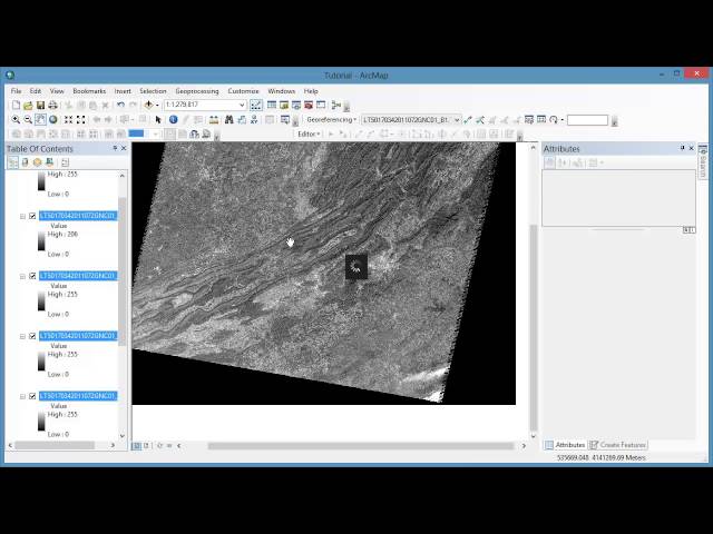
Tutorial 10 in a series of 20 covering remotely sensed data in ArcMap 10.x versions. This tutorial covers displaying Landsat ...
9,096 views
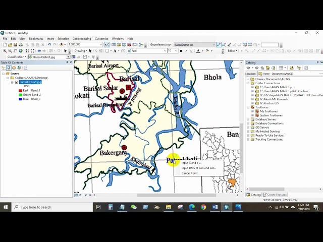
How to Georeference a JPEG/JPG Image or Scanned Map in ArcGIS If you want to learn GIS and Remote sensing in easy way, ...
102,305 views
Learn how to assign a coordinate system in ArcGIS for AutoCAD. Follow us on Social Media! Twitter: https://twitter.com/Esri ...
18,005 views
2 years ago
78 views
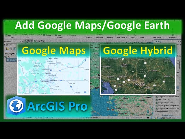
arcgis #googlemaps #arcgispro #googleearth In this step-by-step tutorial, you'll learn how to easily add Google Maps, Google ...
1,581 views
In the subject of Geographic Information Systems (GIS), the vector and raster formats are two ways of representing real-world ...
36,885 views


![How to create a point In ArcGIS [Insert X,Y coordinates]](/api/proxy/image?url=https%3A%2F%2Fi.ytimg.com%2Fvi%2FS4sG1n71bas%2Fsddefault.jpg)