Upload date
All time
Last hour
Today
This week
This month
This year
Type
All
Video
Channel
Playlist
Movie
Duration
Short (< 4 minutes)
Medium (4-20 minutes)
Long (> 20 minutes)
Sort by
Relevance
Rating
View count
Features
HD
Subtitles/CC
Creative Commons
3D
Live
4K
360°
VR180
HDR
3,189,523 results
Here's the full ArcGIS Pro tutorial: https://youtu.be/RTLBgd8MmrY.
34,347 views
10 months ago
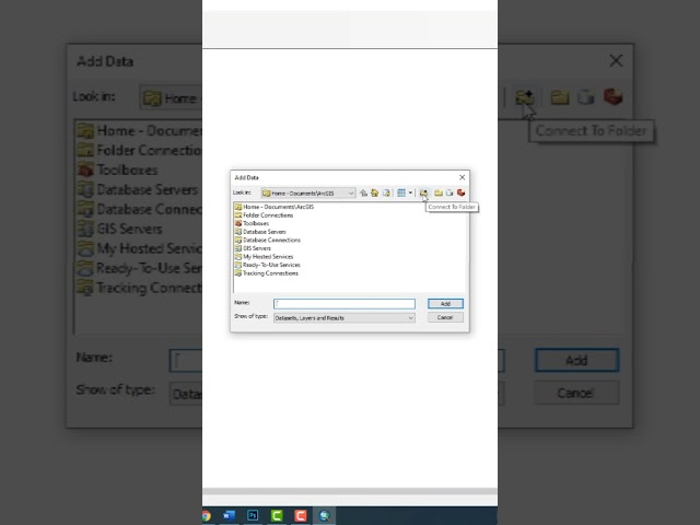
Make an ESRI Shape file using Google Earth and QGIS #tutorial #gis #qgis #googleearth #tutorialyoutube #gistutorial.
175,696 views
2 years ago
In the subject of Geographic Information Systems (GIS), the vector and raster formats are two ways of representing real-world ...
34,521 views
1 year ago
What is GIS? In this beginner-friendly video, I explain what a Geographic Information System (GIS) is, how it works, and why it's ...
2,246 views
9 months ago
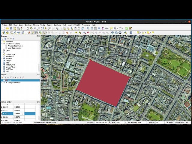
This video shows how to add a new polygon shape file using QGIS as our GIS tool. Polygons are often use to select Areas of ...
136,292 views
4 years ago
This tutorial will show you how to import a DEM image into the ArcGis software. Please subscribe, like, and comment. احصل على ...
37,717 views
3 years ago
This video provides an introduction to a series of video tutorials on how to use GIS to carry out social science research. The skills ...
1,061 views
Esri's Smart Workplace platform enables effective workflows for IT/GIS professionals.
156 views
8 years ago
ArcGIS Field Maps is a mobile app that combines map viewing, data collection, and location tracking into a single app for easier ...
81,672 views
5 years ago
Let us help you with all your tech support needs! Contact us at +1-845-454-2027 or [ netEffx.com ] Tags w/hash: #tech #pc ...
19,551 views
Discover a brief yet informative guide to flood risk mapping using GIS. Learn how Geographic Information Systems can aid in flood ...
11,455 views
In architecture, engineering, and construction, location is everything. Every project begins with a place. To understand that place, ...
2,707 views
1,560 views
In this video I show you how to texture buildings created with the addon Blender GIS. To learn how to use Blender GIS please see ...
161,190 views
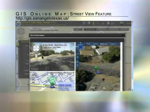
A tutorial on how to use the Street View tool on the new GIS mapping system from the City of San Angelo.
1,218 views
14 years ago
Learn what GIS (Geographic Information Systems) is and how it powers geospatial mapping. Understand how GIS software ...
6,679 views
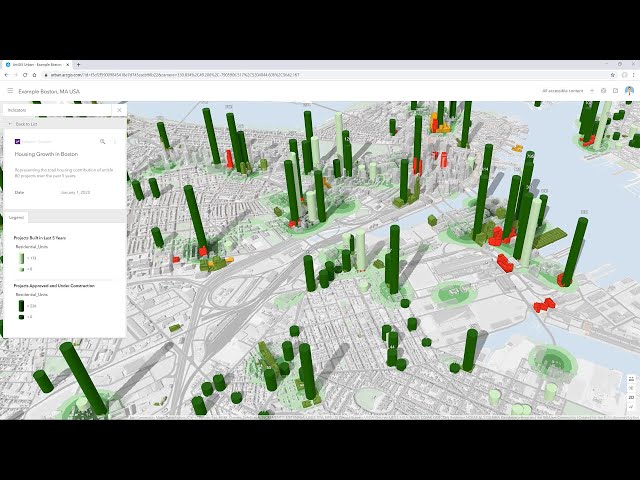
Issues like housing availability, sustainability goals, and economic changes are compelling cities to better plan for the future.
70,446 views
Explore the possibilities of mapping in ArcGIS Online. This video shows you how to get started with creating a map in Map Viewer.
97,463 views
145,894 views
Ready to move beyond desktop GIS? Step into the Spatial Lab: a global community for ambitious geospatial professionals who ...
13,978 views


![What is GIS? | Beginner-Friendly Explanation [2025]](/api/proxy/image?url=https%3A%2F%2Fi.ytimg.com%2Fvi%2FfiIovJSBrVI%2Fsddefault.jpg)