ViewTube

ViewTube
Sign inSign upSubscriptions
Filters

Upload date

Type

Duration

Sort by

Features

Reset

586 results

Geojay GIS Solution
How to calculate the total length of Rivers in a Watershed in ArcGIS

ArcGIS #WatershedAnalysis #RiverLength #GIS #SpatialAnalysis #Hydrology #GeographicInformationSystems In this video, we ...

8:07
How to calculate the total length of Rivers in a Watershed in ArcGIS

53 views

7 days ago

Matt Forrest
Stop Learning New GIS Tools. (Master These 4 Instead)

Forget trying to learn every single tool in the modern GIS stack. It's a trap. The geospatial industry is exploding with new software, ...

12:18
Stop Learning New GIS Tools. (Master These 4 Instead)

1,944 views

7 days ago

Study Hacks-Institute of GIS & Remote Sensing
How to Make Map Layout in GIS || Map Layout in ArcMap || Create Map Layout in GIS

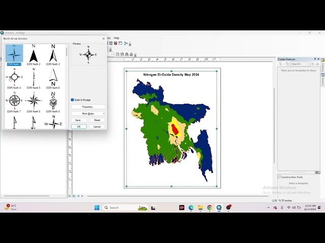
High-CTR YouTube Description (SEO + Engagement Optimized) **How to Make Map Layout in GIS | Map Layout in ArcMap ...

10:38
How to Make Map Layout in GIS || Map Layout in ArcMap || Create Map Layout in GIS

34 views

9 hours ago

Geojay GIS Solution
How to save your Model in ArcGIS Pro

... save model, GIS tutorial, geographic information systems, geospatial analysis, model management, data organization, ArcGIS, ...

2:02
How to save your Model in ArcGIS Pro

0 views

9 hours ago

Full Time GIS
Slope and Aspect Analysis in ArcGIS | DEM Slope Aspect GIS Tutorial

Slope and aspect analysis in ArcGIS using DEM explained step by step. This GIS tutorial covers DEM slope analysis and aspect ...

1:12
Slope and Aspect Analysis in ArcGIS | DEM Slope Aspect GIS Tutorial

3 views

7 days ago

FLO-2D Software
Pier Scour Map Processing FLO 2D

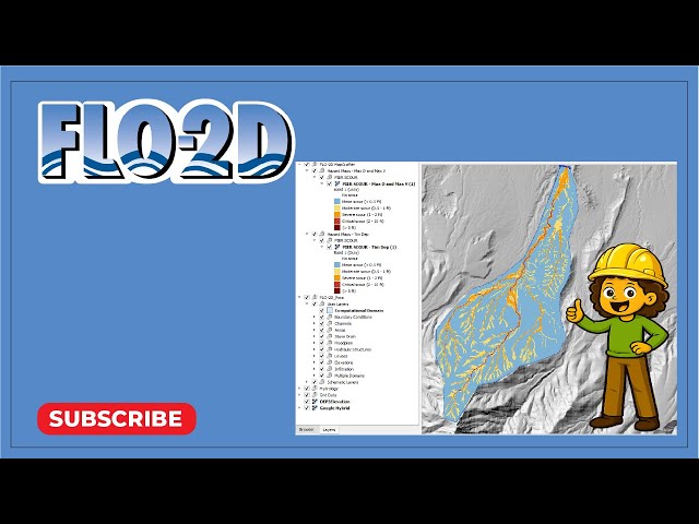
Create pier scour heat maps with a new processor using FLO-2D MapCrafter.

6:26
Pier Scour Map Processing FLO 2D

35 views

7 days ago

Geojay GIS Solution
How to Create Multiple Models in ArcGIS Pro ModelBuilder

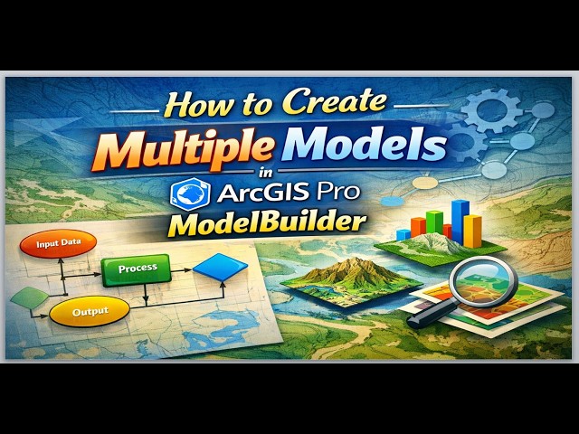
ArcGISPro #ModelBuilder #Geospatial #GIS #DataVisualization #Mapping #Tutorial In this video, we explore the powerful ...

5:43
How to Create Multiple Models in ArcGIS Pro ModelBuilder

0 views

13 hours ago

kentolinlee
Survey GIS Tutorial
1:16
Survey GIS Tutorial

0 views

4 days ago

GeoSkill LAB
Introduction to GIS | Geographic Information System | QGIS | Remote Sensing | Geo skill lab

জিআইএস (GIS) কী এবং এটি কীভাবে কাজ করে? আজকের ভিডিওতে আমরা অত্যন্ত সহজ ...

13:49
Introduction to GIS | Geographic Information System | QGIS | Remote Sensing | Geo skill lab

5 views

6 days ago

GeoCortex AI and Consulting
Professional Map Making in QGIS | Real-World GIS Workflow Explained#qgis #gis #mapdesign#geospatial

How do GIS professionals turn raw spatial data into publish-ready maps? In this video, we walk through a complete QGIS project ...

3:16
Professional Map Making in QGIS | Real-World GIS Workflow Explained#qgis #gis #mapdesign#geospatial

14 views

7 days ago

Felt
Best Mapping Software | Best mapping software reviewed: ArcGIS, Mapbox, Maptiv and Felt compared

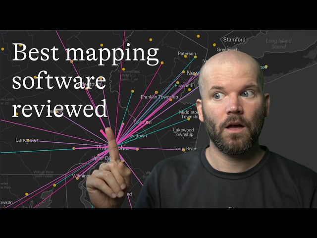
Choosing the best mapping software depends on your needs, budget, and technical requirements. In this review, we compare ...

9:11
Best Mapping Software | Best mapping software reviewed: ArcGIS, Mapbox, Maptiv and Felt compared

213 views

7 days ago

CivilGEO, Inc.
Terrain Modification Using the Stamp Geometry Command in GeoHECRAS | CivilGEO

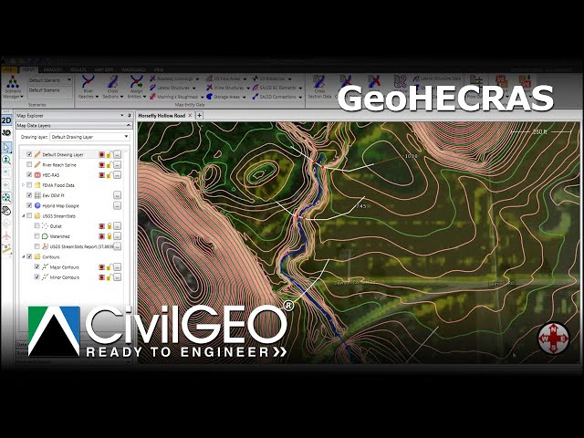
Learn how to use the Stamp Geometry command to modify terrain geometry by burning in a stream channel or constructing a ...

8:10
Terrain Modification Using the Stamp Geometry Command in GeoHECRAS | CivilGEO

7 views

7 days ago

Skynek Mapping
Convert SHP to DWG Using ArcMap | GIS to CAD Tutorial

SHP to DWG Conversion in ArcMap Convert shapefiles (SHP) to AutoCAD DWG format directly in ArcMap—perfect for geospatial ...

5:15
Convert SHP to DWG Using ArcMap | GIS to CAD Tutorial

30 views

7 days ago

GeoSkill Pro
Complete QGIS Tutorial For Beginners (2026) #qgis #qgistutorial

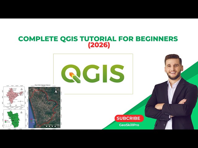
Want to learn QGIS from absolute scratch? This complete beginner-friendly QGIS tutorial will take you step-by-step from zero to ...

1:51:32
Complete QGIS Tutorial For Beginners (2026) #qgis #qgistutorial

31 views

6 days ago

GIS Developer
GIS Web Mapping: The BEST Way To Display GeoJSON Point Data | react leaflet

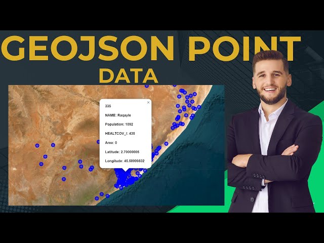
In this tutorial, you'll learn how to display GeoJSON point data on a web map using Leaflet — a core skill for anyone working in ...

42:19
GIS Web Mapping: The BEST Way To Display GeoJSON Point Data | react leaflet

0 views

7 days ago

The Dirty Rock Hounder
Can You Rockhound Here? How to Check with MLAS Before you Dig!

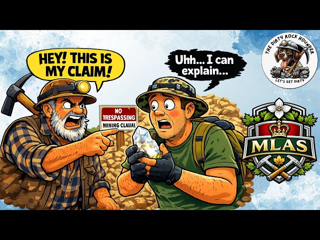
How to Use MLAS to Check Mining Claims (Before You Rockhound!) Before you head out rockhounding, it's critical to know ...

12:43
Can You Rockhound Here? How to Check with MLAS Before you Dig!

41 views

7 days ago

GIS & RS Solution
Google Earth Engine Tutorial 15: Calculate Normalized Difference Water Index (NDWI)

NDWI is widely used for: Mapping surface water bodies, water resources management Monitoring floods and droughts ...

14:38
Google Earth Engine Tutorial 15: Calculate Normalized Difference Water Index (NDWI)

789 views

5 days ago

GeoCortex AI and Consulting
GeoServer Tutorial Part 1 | Introduction to GeoServer & OGC Web Services#geoserver #webgis #ogc #gis

How do GIS professionals publish spatial data as live, interactive maps on the web? In Part 1 of this GeoServer tutorial series, we ...

5:29
GeoServer Tutorial Part 1 | Introduction to GeoServer & OGC Web Services#geoserver #webgis #ogc #gis

15 views

6 days ago

CivilGEO, Inc.
Building Channel Geometry Using LiDAR and Survey Data in GeoHECRAS | CivilGEO

Learn how to process LiDAR data and survey points when channel details are limited or unavailable to create accurate terrain ...

19:22
Building Channel Geometry Using LiDAR and Survey Data in GeoHECRAS | CivilGEO

26 views

7 days ago

GIS & AI,GEOGRAPHY
How to Georeference an Image in ArcMap | Step-by-Step Tutorial I Episode 7  #arcgis

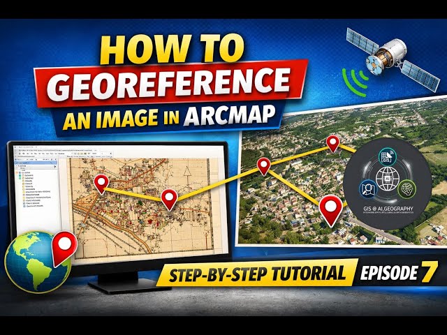
How to Georeference an Image in ArcMap | Step-by-Step Tutorial I Episode 7 In this tutorial, you will learn how to georeference an ...

7:28
How to Georeference an Image in ArcMap | Step-by-Step Tutorial I Episode 7 #arcgis

138 views

7 days ago

Geojay GIS Solution
How to Change Model Name In ArcGIS Pro: Edit Model in ArcGIS

... ArcGIS, GIS Tutorial, Model Builder, Geospatial Analysis, Editing Models, Data Management, Geographic Information Systems, ...

3:08
How to Change Model Name In ArcGIS Pro: Edit Model in ArcGIS

20 views

3 days ago

Aino
Aino tutorials 01:  Introduction to Aino Interface for Absolute Beginners

In this first video of the Aino tutorial series, we walk through the Aino Interactive Map interface step by step, designed especially for ...

1:49
Aino tutorials 01: Introduction to Aino Interface for Absolute Beginners

125 views

7 days ago

Ecospatial_lab
Shapefile Creation in ArcGIS  || Ecospatial Lab || #shapefile #arcgis #gis

In this video, Ecospatial Lab demonstrates a step-by-step guide on Shapefile Creation in ArcGIS. Learn how to create, edit, and ...

46:05
Shapefile Creation in ArcGIS || Ecospatial Lab || #shapefile #arcgis #gis

25 views

6 days ago

Tech and travel
Google earth

lets find out something interesting.

23:38
Google earth

16 views

Streamed 7 days ago

Engr. Muhammad Zaheer, P.E
Clipping Raster and Vector Data in ArcGIS | Step-by-Step GIS Tutorial

In this tutorial, I taught how to clip both raster and vector data using ArcGIS in a clear, step-by-step manner. Clipping is one of the ...

4:00
Clipping Raster and Vector Data in ArcGIS | Step-by-Step GIS Tutorial

53 views

4 days ago