Upload date
All time
Last hour
Today
This week
This month
This year
Type
All
Video
Channel
Playlist
Movie
Duration
Short (< 4 minutes)
Medium (4-20 minutes)
Long (> 20 minutes)
Sort by
Relevance
Rating
View count
Features
HD
Subtitles/CC
Creative Commons
3D
Live
4K
360°
VR180
HDR
3,737 results
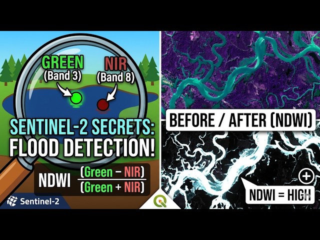
How can a satellite tell where water exists—even during floods? The answer lies in just two bands: Green and NIR. In this video ...
4 views
2 days ago
In the world of high-stakes finance, the most valuable data isn't on a spreadsheet—it's physical. What if you could track global ...
59 views
3 days ago