Upload date
All time
Last hour
Today
This week
This month
This year
Type
All
Video
Channel
Playlist
Movie
Duration
Short (< 4 minutes)
Medium (4-20 minutes)
Long (> 20 minutes)
Sort by
Relevance
Rating
View count
Features
HD
Subtitles/CC
Creative Commons
3D
Live
4K
360°
VR180
HDR
1,137 results
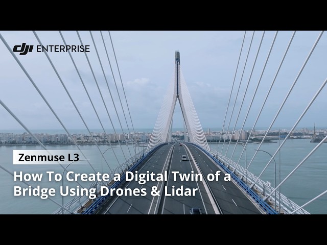
Major infrastructure requires accurate data and continuous monitoring. Working with our authorised partner@atyges, teams used ...
1,255 views
1 day ago
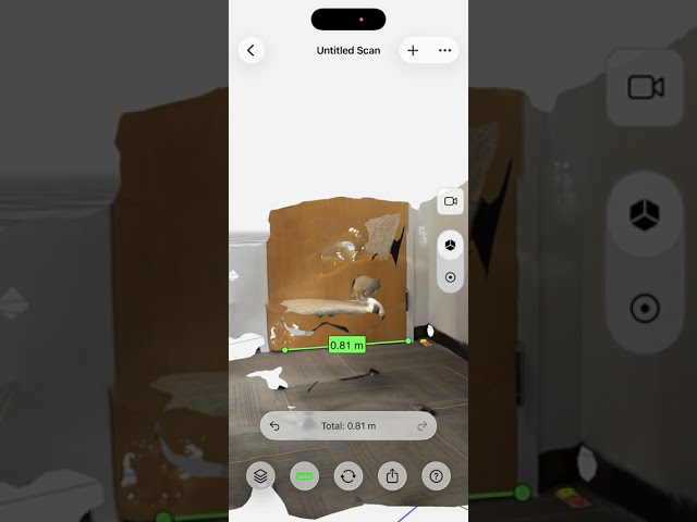
Dive into the world of precision measurement as we guide you through using a lidar 3D scanner. This comprehensive video ...
0 views
3 days ago
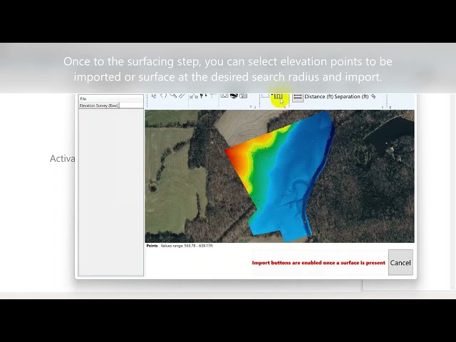
T3RRA Tip: When working with simplified lidar data from drones, a common file type to use is .csv. For more info on drone data in ...
7 days ago
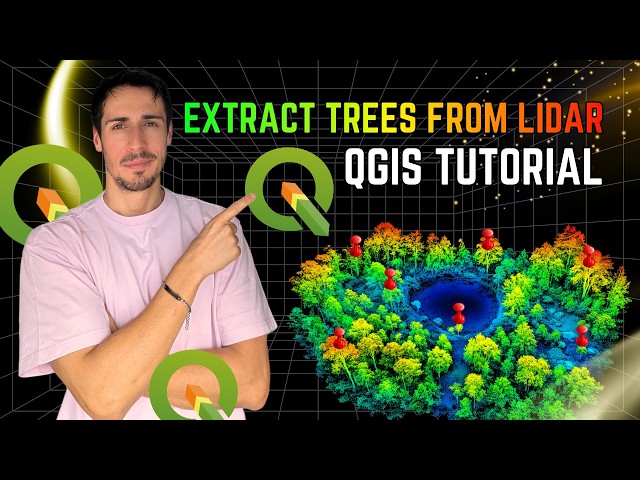
In this video, I demonstrate how to extract trees from LiDAR data using QGIS, replicating a workflow I previously developed in ...
1,569 views
6 days ago
107 views
4 days ago
Overview of the notch project I made for an interactive table, using Hokuyo Lidar Sense. Created with Notch 1.0.182 Original ...
11 views
Modelar Go Through 1. How to scan a targeted object via Modelar-3D LiDAR scanner. 2. How to process a scanned project in the ...
4 views
15 hours ago
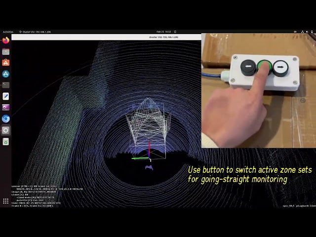
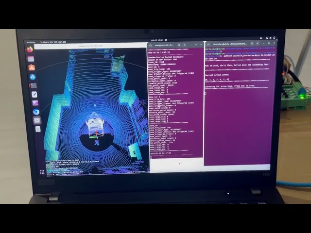
Firmware v3.2.0 of the Ouster LiDAR introduces the Zone Monitoring feature. The Zone Monitoring function provides ...
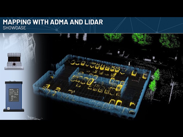
Using ADMA, a GNSS-aided inertial navigation system, in combination with a roof-mounted Lidar sensor, mapping the vehicle ...
28 views
51 views
2017-04-02 56.
41 views
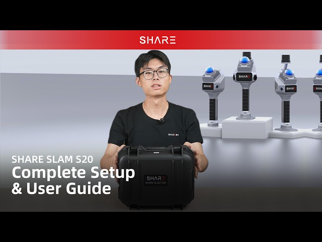
This video provides a complete setup and user guide for the SHARE SLAM S20, covering everything from hardware installation to ...
496 views
Las máquinas y vehículos autónomos confían en el software de localización y mapeo simultáneo (SLAM) para construir un mapa ...
8 views
floorplan #LiDAR #ipad #win Creating an EPC Floor Plan with LiDAR – Live Test Using iPhone & Magicplan Enter here: ...
355 views
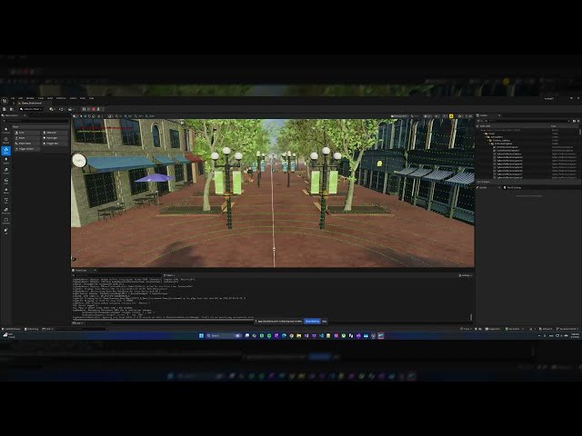
A deep dive into building an industrial-grade, 360-degree LiDAR simulation inside Unreal Engine 5.7 using C++ and Compute ...
25 views
2 days ago
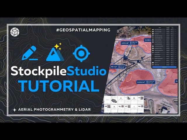
StockpileStudio is PixElement's automated stockpile detection and volume measurement tool for mining, aggregates, and material ...
7 views
43 minutes ago
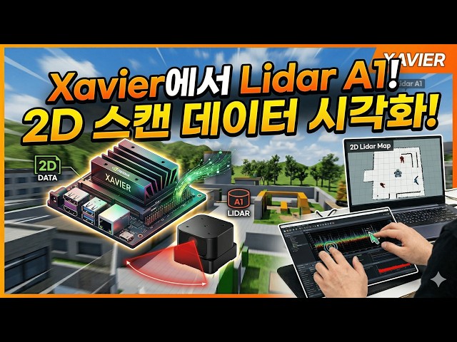
깃 허브 : https://github.com/Kimhyuntae9665/Lidar_senser_room 동아리 방에서 Lidar a1 을 돌려서 네모난 모양 Xavier에서 Lidar ...
2 views
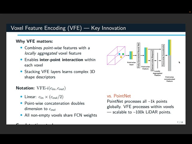
Paper Survey Presentation for CSIE5453 — Embodied Perception and Action Instructor: Prof. Winston Hsu Paper: VoxelNet: ...
Can AI colour grade drone footage, or are you still better off using LUTs and manual grading? AI is everywhere right now, so I ...
418 views