Upload date
All time
Last hour
Today
This week
This month
This year
Type
All
Video
Channel
Playlist
Movie
Duration
Short (< 4 minutes)
Medium (4-20 minutes)
Long (> 20 minutes)
Sort by
Relevance
Rating
View count
Features
HD
Subtitles/CC
Creative Commons
3D
Live
4K
360°
VR180
HDR
6 results
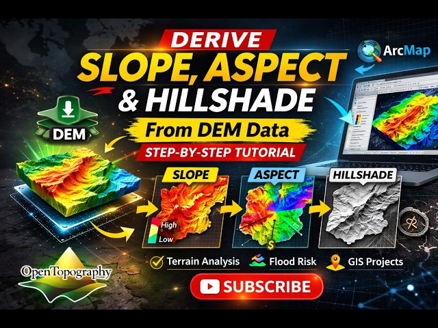
In this practical GIS tutorial, I demonstrate how to derive Slope, Aspect, and Hillshade from Digital Elevation Model (DEM) data ...
0 views
5 hours ago
arcgistutorial #arcmap #arcgispro #arcgistutorial #arcmap #arcgispro #arcgistutorial #arcmap #arcgispro Welcome to ROY GIS ...
19 hours ago
4 views
15 hours ago
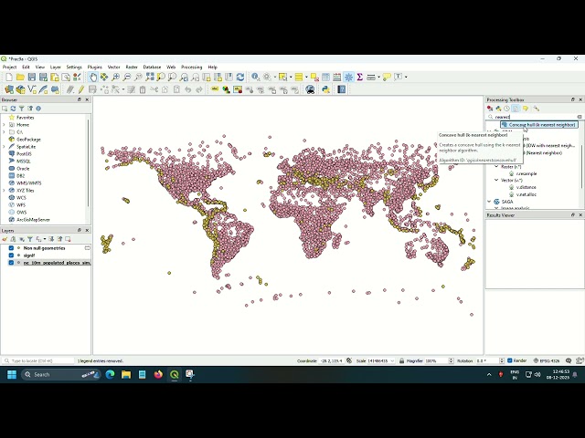
Visit https://riobamwitagis.sevalla.page for any thematic map. In this tutorial, I demonstrate how to georeference a raster in ArcMap ...
14 views
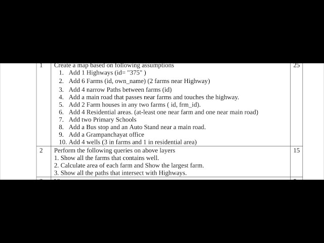
Practical exam question of well and geo reference of taj of GIS practical.
17 hours ago
Practical 9a of fundamentals of GIS.
18 hours ago