Upload date
All time
Last hour
Today
This week
This month
This year
Type
All
Video
Channel
Playlist
Movie
Duration
Short (< 4 minutes)
Medium (4-20 minutes)
Long (> 20 minutes)
Sort by
Relevance
Rating
View count
Features
HD
Subtitles/CC
Creative Commons
3D
Live
4K
360°
VR180
HDR
11,335,609 results
By watching this video you can lern How to set Geolocation in Autocad topogrphy sheet,how can you compare Actual Land ...
113,052 views
10 years ago
If you haven't heard of it, GeoGuessr is basically competitive Google Maps. Participants try to guess where they are on the planet ...
5,354,868 views
3 years ago
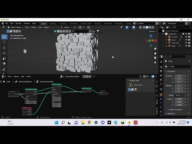
shorts Learn the basics of distribute points on faces using geometry nodes.
9,076 views
Learn how to carry out a complete land survey using just your phone! No expensive tools. No total station. Just your mobile and ...
2,402 views
5 months ago
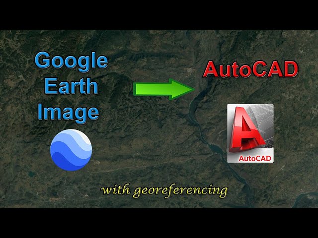
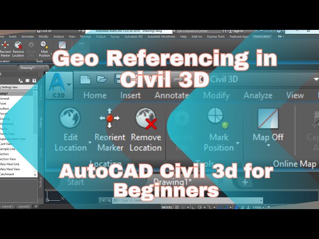
In this video, you will learn how to add a high-resolution image from Google Earth to AutoCAD, and how to georeference the ...
272,155 views
5 years ago
Blender tutorial showing how to use Geometry Nodes to create sugar coated candy. Part 2: https://youtu.be/V10GBrmYIDM 0:00 ...
926,245 views
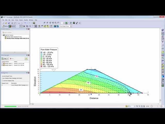
Learn the basics of SEEP/W 2012 with this introductory video.
185,156 views
11 years ago
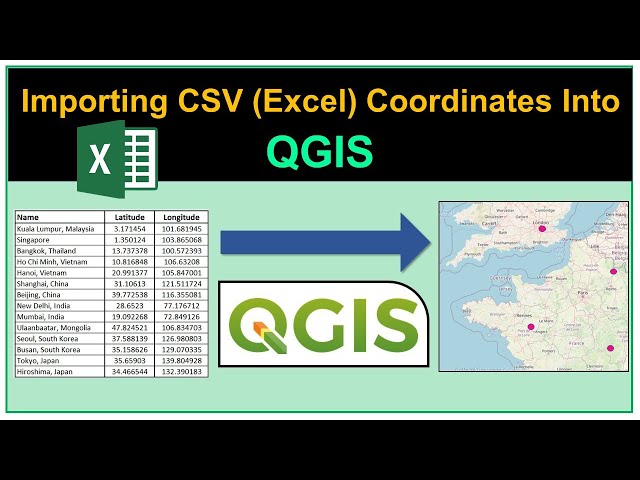
In this video, you will learn how to plot a simple dataset which consists of longitude and latitude coordinates on a map using ...
133,147 views
4 years ago
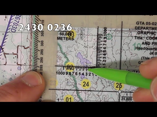
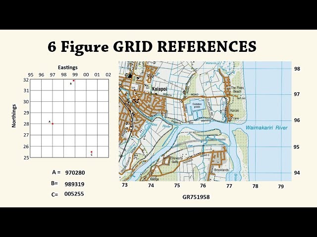
In this video, I'll walk you through how to plot an eight-digit grid coordinate on a topographical map. I'll be using a military map, ...
355,217 views
6 years ago
Learn More at mathantics.com Visit http://www.mathantics.com for more Free math videos and additional subscription based ...
2,577,697 views
12 years ago
Explore practical geospatial and GIS skills with courses and resources from GeoDelta Labs: https://www.geodeltalabs.com ...
1,967,989 views
This tutorial guides new users through the basics of creating a simple stability analysis in SLOPE/W.
176,234 views
8 years ago
Check out products related to Geography, Travel and the Outdoors on Amazon: https://www.amazon.com/shop ...
154,243 views
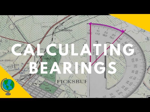
In this video we examine how to use a protractor to calculate the bearing of two points on an OS map. I explain how to use north ...
282,152 views
This calculus 3 video explains how to plot points in a 3D coordinate system. It contains a few examples and practice problems.
902,716 views
7 years ago
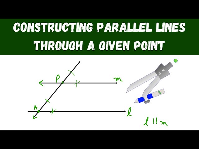
In this video, I show how to use a compass to construct parallel lines through a given point. The techniques used in this video are ...
102,836 views
Welcome to the BIM modeling with AutoCAD and Revit. AutoCAD Tutorials from Beginning to Advanced. Revit Tutorials from ...
1,313 views
1 year ago
Ready to go beyond tutorials and learn QGIS properly? Explore the *QGIS Masterclass* with structured lessons and practical ...
486,976 views
This video takes a look at quick, easy methods for locating coordinates on a map using latitude and longitude. Note: There should ...
145,091 views
In this Blender tutorial I will show you how to Distribute Objects on a landscape, in just specific spots, using weight painting and ...
122,412 views