Upload date
All time
Last hour
Today
This week
This month
This year
Type
All
Video
Channel
Playlist
Movie
Duration
Short (< 4 minutes)
Medium (4-20 minutes)
Long (> 20 minutes)
Sort by
Relevance
Rating
View count
Features
HD
Subtitles/CC
Creative Commons
3D
Live
4K
360°
VR180
HDR
59 results
Topic: Challenges in dealing with observations Jina Jeong (Vrije Universiteit Amsterdam) - Using the International Tree-Ring Data ...
60 views
4 years ago
This GRASS GIS tutorial shows how to load raster and vector data into 3D view and set some of their properties.
3,127 views
14 years ago
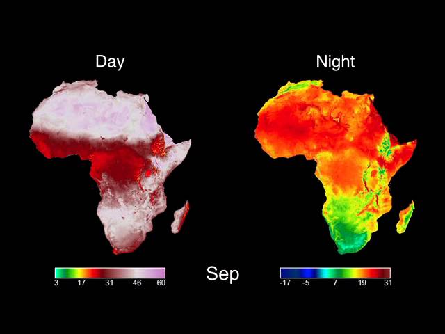
AfSIS Website: http://www.africasoils.net/ AfSIS data sets: ftp://africagrids.net USGS Website: https://lpdaac.usgs.gov/ Original data: ...
2,013 views
13 years ago
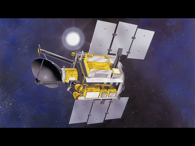
QuikSCAT: QuikSCAT far exceeded these design expectations and continued to operate for over a decade before a bearing ...
94 views
How to cite: Amatulli, G., Garcia Marquez, J., Sethi, T., Kiesel, J., Grigoropoulou, A., Üblacker, M. M., Shen, L. Q., and Domisch, ...
435 views
2 years ago
200 independent rocks falling down a slope, based on DEM data. Surface scattered with obstacles with a stochastic distribution.
179 views
8 years ago
Looking for an advanced point cloud processing and analysis software? Look no further than VisionLidar 2022! In this video, we'll ...
697 views
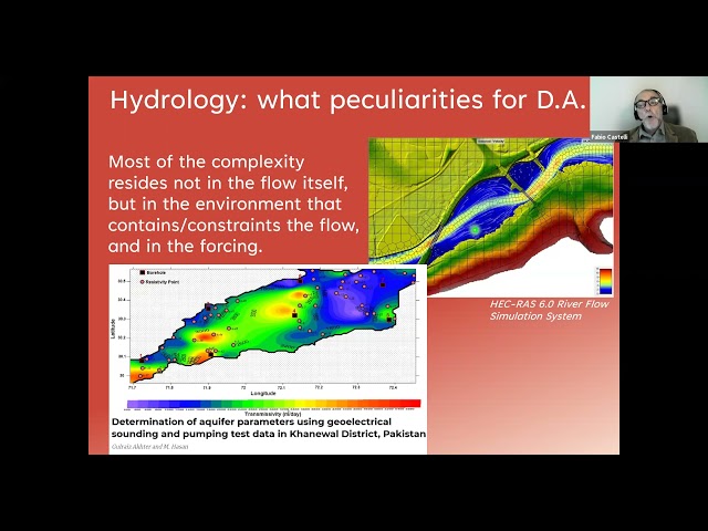
Joint ICTP-IUGG Workshop on Data Assimilation and Inverse Problems in Geophysical Sciences | (smr 3607) Speaker: Fabio ...
347 views
Need precise material estimates? Learn how to calculate surface areas on sloped terrain, vertical facades, or flat foundations.
48 views
7 months ago
Describing the Process of converting a geopolitical conceptual model to a digital representation 00:00 Introduction 01:15 ...
550 views
7 years ago
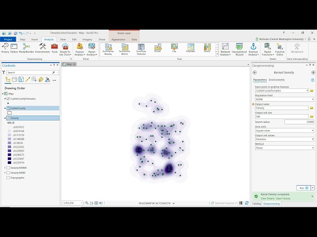
Dr. Nicholas Schuelke demonstrates how to use a kernel density function in ArcGIS Pro to convey a point pattern. Central ...
1,440 views
GIS: How to smooth the DTM? Helpful? Please support me on Patreon: https://www.patreon.com/roelvandepaar With thanks ...
87 views
Keywords ### #Landsat8TIRSdata #landsurfacetemperature #thermalinfrared #monowindowalgorithm #splitwindowalgorithm ...
12 views
1 year ago
Keywords ### #landsurfacetemperature(lst) #landsurfaceemissivity(lse) #performanceevaluation #monowindowalgorithm ...
39 views
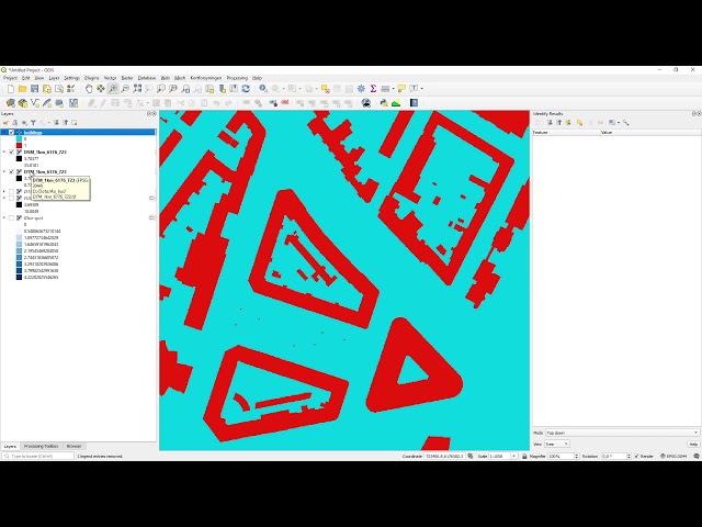
In this short video, I combine DSM and DTM data for urban surface water flow modelling. The video is the third of a series of four ...
1,843 views
5 years ago
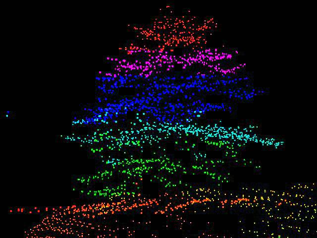
LiDAR point cloud:small trees Displaying data from the Sierra Nevada Adaptive Management Project (SNAMP) UC Berkeley ...
379 views
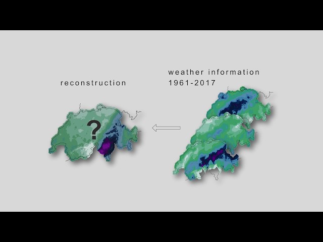
The video is part of an e-learning tool and describes methods to generate local weather reconstructions from global weather ...
1,803 views
6 years ago
Unable to map land surface temperature in QGIS from downloaded tiff I hope you found a solution that worked for you :) The ...
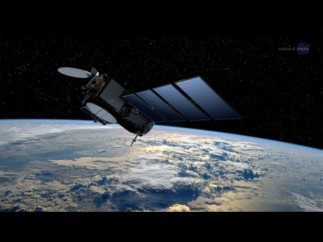
Visit http://science.nasa.gov/ for more. The Jason-3 satellite, launched on January 17, 2016, is allowing scientists to continue a ...
24,039 views
10 years ago
Українська версія трансляції: https://youtu.be/FYEXnI8RpX8 During the Strategic Communication Event 'The usage of Slavutych ...
123 views
Streamed 4 years ago