Upload date
All time
Last hour
Today
This week
This month
This year
Type
All
Video
Channel
Playlist
Movie
Duration
Short (< 4 minutes)
Medium (4-20 minutes)
Long (> 20 minutes)
Sort by
Relevance
Rating
View count
Features
HD
Subtitles/CC
Creative Commons
3D
Live
4K
360°
VR180
HDR
65,486 results
Alex Raichev https://nz.pycon.org/schedule/presentation/172/ I will give a short, example-driven introduction to GeoPandas, ...
5,452 views
8 years ago
Basic outline of how to acquire data for the purpose of digitising small (geological) samples using Structure from Motion ...
43 views
3 years ago
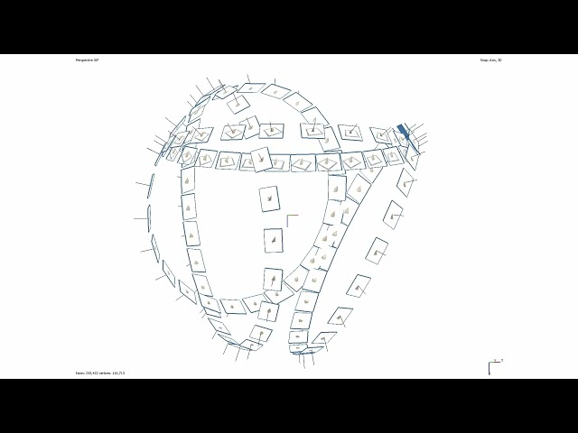
To navigate adequately in VisionLidar, a mouse with 3 buttons is preferable; left, right buttons and a mouse wheel. To begin, open ...
1,298 views
This tutorial fallows the steps to make a translation and rotation of ground points with some control points. The translation/rotation ...
788 views
11 years ago
The Earth Observation Lab (https://eolab.de/) is a facility of Rhine-Waal University of Applied Sciences (http://hsrw.eu/).
1,141 views
5 years ago
hello there, in this lesson, we will use geopandas and matplotlib to plot a geographic map from a CSV file with longitude and ...
64,765 views
Block H of the Geographic Data Science course - "Points" More materials related to the content in this video are available at: ...
414 views
4 years ago
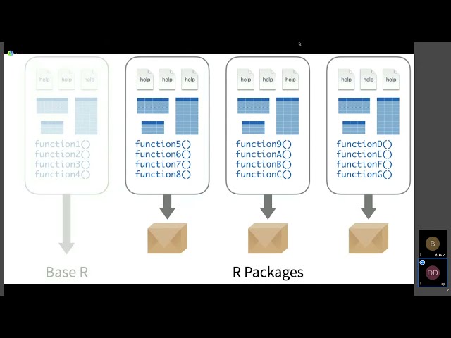
Dewey Dunnington Regardless of which programmiing language is your favourite, the R language for statistical computing is here ...
804 views
Streamed 4 years ago
Scholars GeoPortal is a tool that lets you find, access, and analyze geospatial datasets and maps. This video will show you how to ...
2,849 views
7 years ago
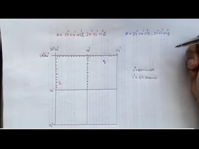
Geography mapwork: How to find a latitude and longitude coordinates Like and share to student geographers. Kindly Subscribe to ...
133,794 views
2 years ago
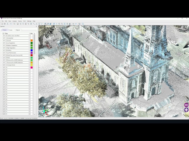
Experience the Precision of VisionLidar! Witness the seamless journey from raw data to automated classification, cluster detection ...
9,643 views
Unit of Scale।Scale unit।scale।Geo Tutorial Point।Geography practical।Linear।Comparative।Diagonal। #Unit of Scale ...
170 views
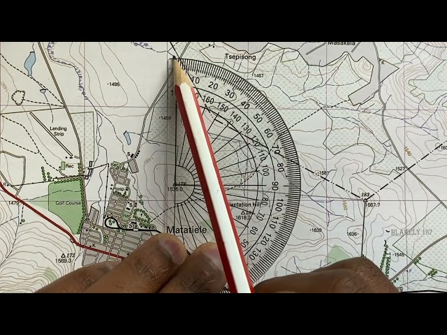
Using a topographic map 1: 50 000 to find a True bearing between two trig beacons and then calculating the magnetic bearing of ...
667,969 views
46,014 views
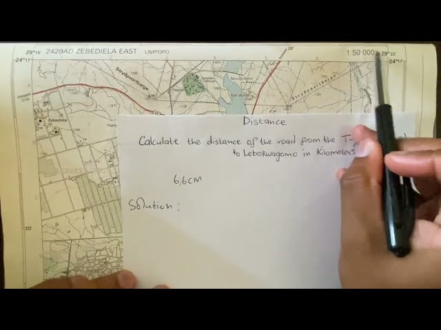
Using a topographic map of Zebediela, Limpopo (1: 50 000) to calculate the distance on a map in Geography mapwork/ map skills ...
221,732 views
Screencast from lesson 3, Automating GIS processes 2019. Course materials are openly available at https://autogis.github.io.
1,700 views
6 years ago
This video was created as part of an Erasmus + project. It was originally going to be in-person training but due to COVID-19 the ...
15 views
Read, create, and modify geospatial shapefiles (vector data) with OSGeo in Python and materials provided at ...
400 views
The presentation aims to provide attendees with enough information to master GeoServer styling documents and most of ...
364 views
We can see our rectangle and its central point that's all for this tutorial thank you for watching and see you in the next video.
136 views