Upload date
All time
Last hour
Today
This week
This month
This year
Type
All
Video
Channel
Playlist
Movie
Duration
Short (< 4 minutes)
Medium (4-20 minutes)
Long (> 20 minutes)
Sort by
Relevance
Rating
View count
Features
HD
Subtitles/CC
Creative Commons
3D
Live
4K
360°
VR180
HDR
842 results
Scholars GeoPortal is a tool that lets you find, access, and analyze geospatial datasets and maps. This video will show you how to ...
2,850 views
7 years ago
Familiarity with big data is necessary for students to be competitive in the geoscience workforce. While the tools evolve over time, ...
14 views
5 months ago
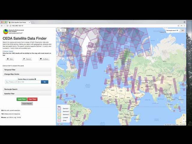
An introductory video demonstrating how to use the CEDA geo-search tool to find satellite data archived in the CEDA archives.
881 views
8 years ago
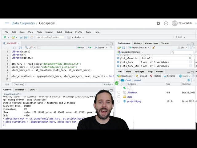
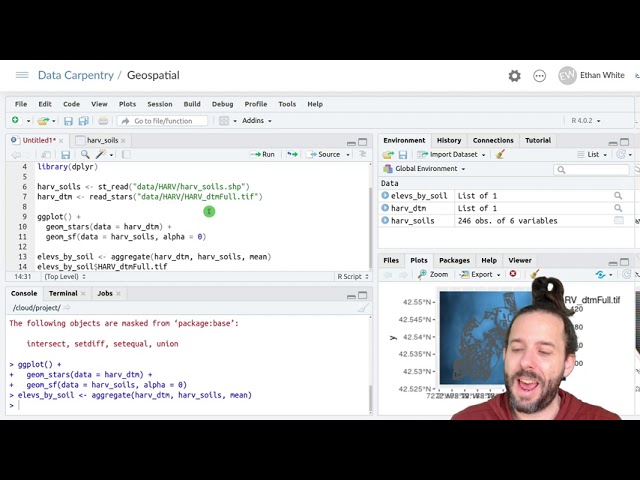
To then get the raster values at the point locations that we have for our plots we use the 'aggregate' function. And aggregate takes ...
12,054 views
5 years ago
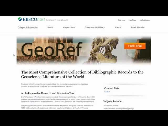
A brief tutorial on how to search GeoRef, a database primarily for the geosciences.
1,275 views
10 years ago
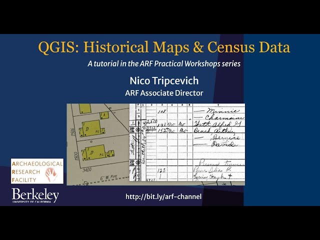
In this tutorial we georeference a 1928 Sanborn historical insurance map and then locate the corresponding 1950 US Census ...
709 views
3 years ago
Lecture 31 : Creating shapefiles from georefrenced maps.
1,397 views
... geology, human and physical geography, environmental sciences, and geomechanics. The content within this online database ...
355 views
... at that and you can see that's another one of these um shape files but one other thing i may point out here on is that you can see ...
574 views
The web developer's guide to cartography Presented by Raluca Nicola, at revo.js 2019 ...
6 years ago
With the Geo-SAM plugin you can use the Segment Anything Model (SAM) by Meta in QGIS. In this video, I'll guide you through ...
14,333 views
1 year ago
This video is a recording of the CESSDA Online Workshop "Using the Geographical Information System QGIS for data analysis", ...
514 views
So this is where we've gotten to up to this point we can load raster data and graph it; we can load vector data and graph it.
7,238 views
Lecture 29 : Extracting point and line features from georeferenced data.
999 views
Data: https://datacarpentry.org/semester-biology/data/neon-geospatial-data.zip Written notes: ...
4,956 views
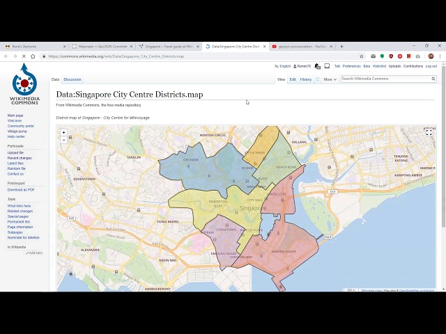
In this video I explain how to use the Mapmask ↔ GeoJSON Converter (https://rene78.github.io/mapmask-geojson-converter/).
282 views
As I mentioned when I was introducing LIDAR, it also collects data on points above the ground and in particular the highest point ...
5,744 views
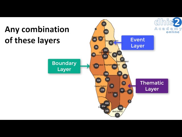
The GIS app allows you to do thematic mapping of areas and points, view facilities based on classifications, and visualize ...
6,510 views
Book your Consultancy Introductory Call ...
205 views
11 months ago
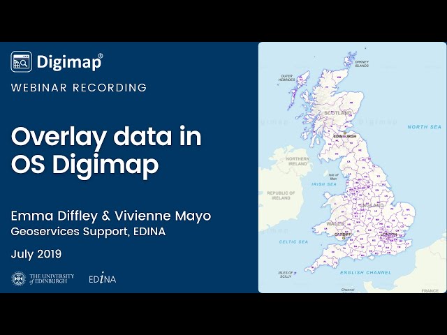
View Points of Interest, postcodes, hillshading and contours on your Ordnance Surevy maps.
1,080 views