ViewTube

ViewTube
Sign inSign upSubscriptions
Filters

Upload date

Type

Duration

Sort by

Features

Reset

5,771 results

GIS Coordinated
QGIS Advanced Digitising

Video no 167 In this QGIS video, I demonstrate the Advanced Digitising Toolbar and the Panel too. - A single polygon is dragged ...

10:10
QGIS Advanced Digitising

7,810 views

2 years ago

Geo-Plus
Here's what VisionLidar is all about, and so much more!  #pointcloud #visionlidar #lidar

Introducing VisionLidar, the ultimate solution for handling extensive point cloud projects with lightning speed. Explore point clouds ...

0:47
Here's what VisionLidar is all about, and so much more! #pointcloud #visionlidar #lidar

92 views

2 years ago

DHIS2
DHIS2 Annual Conference 2020: Maps and beyond - Advanced GIS Techniques

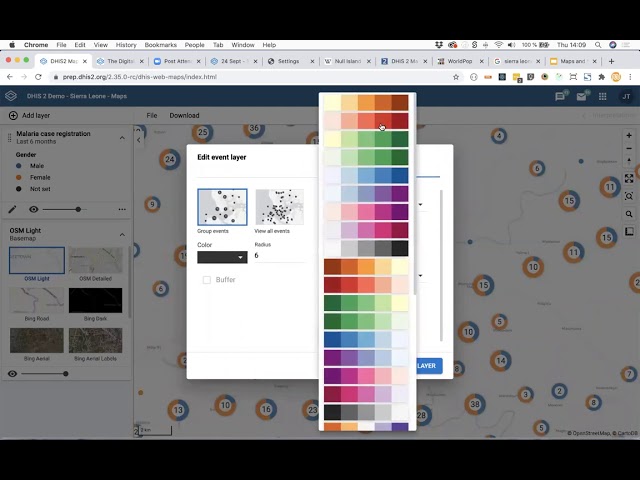
In this video of day 4 of the DHIS2 Annual Conference 2020, Bjørn Sandvik (UiO) shares tips on how to improve your mapping ...

55:05
DHIS2 Annual Conference 2020: Maps and beyond - Advanced GIS Techniques

348 views

5 years ago

ELITE GEOSPATIAL
ArcGIS Basics I  2. GIS Basics I No. 1 I ArcGIS Interface I #howto #gis #mapping #trending  #qgis

ArcGIS Basics II ArcGIS Interface II #howto #gis #mapping #trending #remotesensing #qgis The "ArcGIS Desktop: Tools and ...

16:19
ArcGIS Basics I 2. GIS Basics I No. 1 I ArcGIS Interface I #howto #gis #mapping #trending #qgis

239 views

1 year ago

ELITE GEOSPATIAL
ArcGIS Desktop II beginner to pro II 1.2 Concepts related to spatial analysis #howto #gis #mapping

ArcGIS Desktop II beginner to pro II Concepts related to spatial analysis #howto #gis #mapping The "ArcGIS Desktop II: Tools and ...

15:36
ArcGIS Desktop II beginner to pro II 1.2 Concepts related to spatial analysis #howto #gis #mapping

555 views

1 year ago

FOSS4G SotM Oceania
FOSS4G 2025 | MapSafe QGIS plugin: a complete open-source geoprivacy tool for desktop GIS apps

Presented by Dr Pankajeshwara Sharma on 21 November 2025 14:00, at FOSS4G 2025 Auckland. Track: Desktop GIS & Data ...

23:19
FOSS4G 2025 | MapSafe QGIS plugin: a complete open-source geoprivacy tool for desktop GIS apps

10 views

2 months ago

Hans van der Kwast
Point Cloud Processing with LiDAR Tools of WhiteboxTools in QGIS

From QGIS 3.18 you can load point clouds in QGIS. With LiDAR tools from WhiteboxTools you can add a lot of useful processing ...

20:39
Point Cloud Processing with LiDAR Tools of WhiteboxTools in QGIS

31,456 views

4 years ago

Geo-Plus
From Raw data to so much more using VisionLidar the Point Cloud Processing Software!

Experience the Precision of VisionLidar! Witness the seamless journey from raw data to automated classification, cluster detection ...

0:12
From Raw data to so much more using VisionLidar the Point Cloud Processing Software!

8,805 views

2 years ago

Dutton Institute
Geography 885 Advanced Analytic Methods for the GEOINT Professional

Geospatial Education at Penn State. For more information go to www.pennstategis.com or https://gis.e-education.psu.edu/

2:02
Geography 885 Advanced Analytic Methods for the GEOINT Professional

107 views

7 years ago

ELITE GEOSPATIAL
ArcGIS Desktop I beginner to pro I 5. WORKING WITH SHAPEFILES I No.5I    cchoroplet mapping 1 #howto

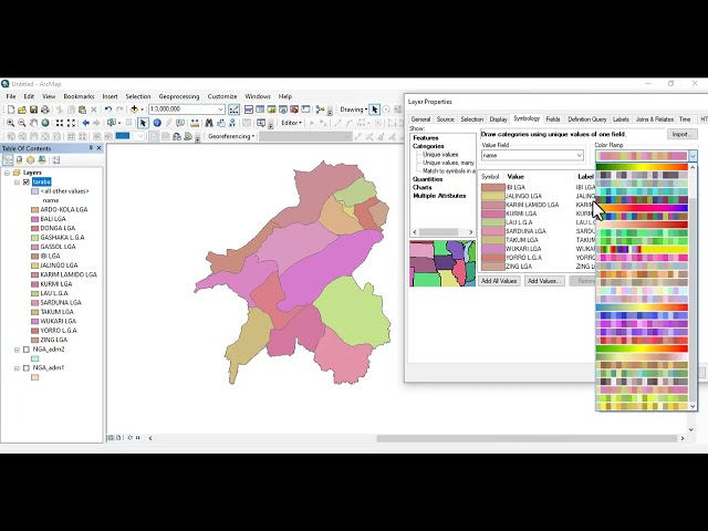
ArcGIS Desktop I beginner to pro I 5. WORKING WITH SHAPEFILES I No.5I cchoroplet mapping 1 #howto The "ArcGIS Desktop ...

5:08
ArcGIS Desktop I beginner to pro I 5. WORKING WITH SHAPEFILES I No.5I cchoroplet mapping 1 #howto

607 views

1 year ago

Roel Van de Paar
GIS: Using Advanced Digitizing tool in QGIS? (2 Solutions!!)

https://amzn.to/4aLHbLD You're literally one click away from a better setup — grab it now! As an Amazon Associate I earn ...

1:40
GIS: Using Advanced Digitizing tool in QGIS? (2 Solutions!!)

82 views

4 years ago

ELITE GEOSPATIAL
ArcGIS Desktop I beginner to pro I 5. WORKING WITH SHAPEFILES I No.2 I field calculator  #howto #gis

ArcGIS Desktop I beginner to pro I 5. WORKING WITH SHAPEFILES I No.1I Using Statistics #howto #gis The "ArcGIS Desktop ...

6:20
ArcGIS Desktop I beginner to pro I 5. WORKING WITH SHAPEFILES I No.2 I field calculator #howto #gis

59 views

1 year ago

Roel Van de Paar
GIS: CAD tools are not enabled for the current map tool (2 Solutions!!)

https://amzn.to/4aLHbLD You're literally one click away from a better setup — grab it now! As an Amazon Associate I earn ...

2:29
GIS: CAD tools are not enabled for the current map tool (2 Solutions!!)

949 views

4 years ago

Esri Developers
ArcGIS Survey123: How to Create an AI Smart Assistant | #EsriDevSummit2024

Leverage your own AI models within your Survey123 forms. Use them to automatically detect objects in photos or to classify ...

1:00:25
ArcGIS Survey123: How to Create an AI Smart Assistant | #EsriDevSummit2024

3,166 views

1 year ago

Roel Van de Paar
GIS: What is the Pick tool in ArcGIS's Spatial Analyst commonly used for? (2 Solutions!!)

https://amzn.to/4aLHbLD You're literally one click away from a better setup — grab it now! As an Amazon Associate I earn ...

1:45
GIS: What is the Pick tool in ArcGIS's Spatial Analyst commonly used for? (2 Solutions!!)

39 views

4 years ago

ELITE GEOSPATIAL
ArcGIS Desktop I beginner to pro I 5. WORKING WITH SHAPEFILES I No.5 I    change color of polygon

ArcGIS Desktop I beginner to pro I 5. WORKING WITH SHAPEFILES I No.5 I change color of polygon The "ArcGIS Desktop : Tools ...

2:15
ArcGIS Desktop I beginner to pro I 5. WORKING WITH SHAPEFILES I No.5 I change color of polygon

52 views

1 year ago

ELITE GEOSPATIAL
ArcGIS Desktop I beginner to pro I 5. WORKING WITH SHAPEFILES I No.1 I statistics #howto #gis

ArcGIS Desktop I beginner to pro I 5. WORKING WITH SHAPEFILES I No.1 I statistics #howto #gis The "ArcGIS Desktop : Tools ...

6:36
ArcGIS Desktop I beginner to pro I 5. WORKING WITH SHAPEFILES I No.1 I statistics #howto #gis

91 views

1 year ago

ELITE GEOSPATIAL
ArcGIS Desktop I beginner to pro I GIS Basics I  No. 5 I  Magnify I #howto   #mapping #gis #trending

ArcGIS Desktop I beginner to pro I GIS Basics I No. 5 I Magnify I #howto #mapping #gis #trending The "ArcGIS Desktop II: Tools ...

3:11
ArcGIS Desktop I beginner to pro I GIS Basics I No. 5 I Magnify I #howto #mapping #gis #trending

116 views

1 year ago

Postgres Conference
PostGIS Advanced Vector Operations

This final session focuses on PostGIS, scratching the surface of a range of the advanced operations PostGIS is capable of.

58:37
PostGIS Advanced Vector Operations

482 views

4 years ago

FOSS4G SotM Oceania
FOSS4G 2025 | Navara map engine: Next-Generation Flexible Map Engine for Advanced GIS Visualization

Presented by Keiya Higuchi on 20 November 2025 11:30, at FOSS4G 2025 Auckland. Track: Tools, Libraries & Visualisation Full ...

20:23
FOSS4G 2025 | Navara map engine: Next-Generation Flexible Map Engine for Advanced GIS Visualization

21 views

2 months ago