Upload date
All time
Last hour
Today
This week
This month
This year
Type
All
Video
Channel
Playlist
Movie
Duration
Short (< 4 minutes)
Medium (4-20 minutes)
Long (> 20 minutes)
Sort by
Relevance
Rating
View count
Features
HD
Subtitles/CC
Creative Commons
3D
Live
4K
360°
VR180
HDR
1,982 results
A short film describing the development of a prototype application for the Oculus Rift DK2 headset, to visualise subsurface ...
8,072 views
10 years ago
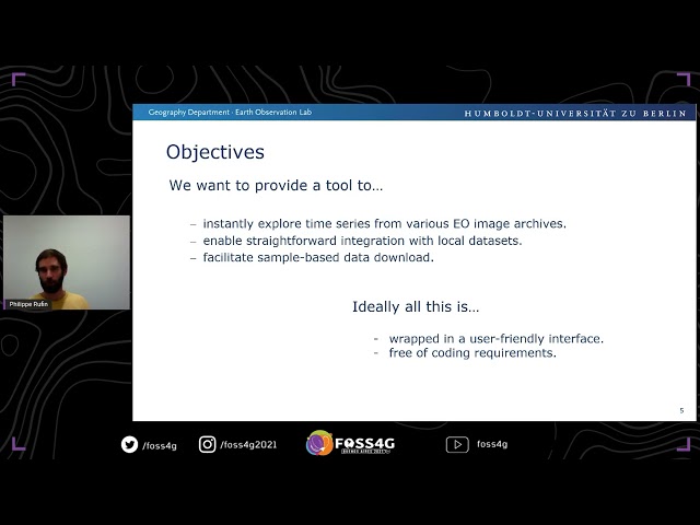
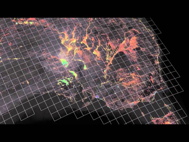
Current Earth Observation applications heavily rely on analyses of dense intra-annual or inter-annual time series. State-of-the-art ...
936 views
4 years ago
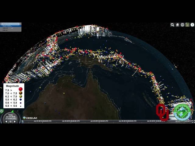
A fly-through in 3D of full earth subsurface earthquakes using CeisumJS. This animation represents 100 years (April 1914 to April ...
2,915 views
9 years ago
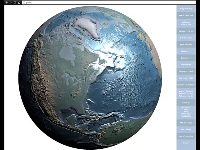
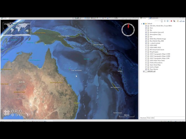
EarthSci is a digital globe, built for visualising 3D geoscience data, both on and under the surface of the Earth. It allows users to ...
740 views
988 views
EarthSci is a powerful tool for the integration and visualisation of three dimensional earth science datasets. This 'virtual ...
2,879 views
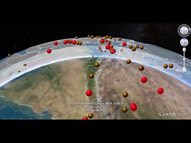
A 3D fly-over of subsurface earthquakes using Google Earth. This animation is supplemental information for this paper ...
829 views
M. Sherlock, M. Hasan, M., F.F. Samavati: Interactive data styling and multifocal visualization for a multigrid web-based Digital ...
39 views
5 years ago
Learn about how DEA Land Cover data is produced, and what it is used for. https://www.dea.ga.gov.au/
1,177 views
1 year ago
The video explains the challenges faced when managing vast quantities of satellite data, for the benefit of humankind, to address ...
2,088 views
568 views
Presented by Sachindra Singh on 21 November 2025 09:30, at FOSS4G 2025 Auckland. Track: Use Cases and Applications Full ...
13 views
2 months ago
426 views
We increase conversions and sales. We create understanding, positive image and impression. BEDRIK studio, makes video ...
160 views
3 years ago
Witness the captivating visualization of digital signals encircling the Earth, brought to life by advanced AI simulation. This dynamic ...
3 views
In this talk, we will present the robust functionalities of Nasa World Wind open source virtual globe that allows interactive 3D ...
162 views
On this image taken by the Juno probe, we can see an animation of cyclones and anticyclones at the north pole of Jupiter.
73 views
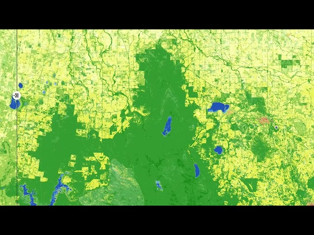
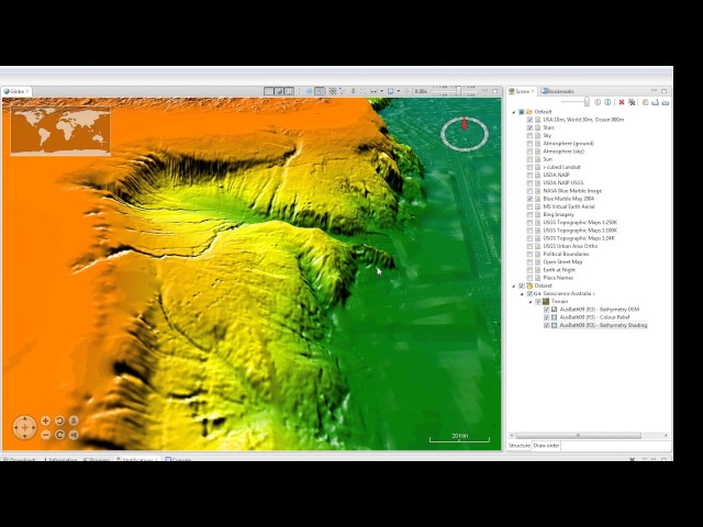
To manage the large volumes of Landsat imagery covering the Australian continent, Geoscience Australia in collaboration with ...
4,019 views
11 years ago
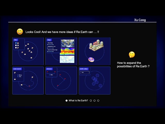
The Re:Earth project grew from the idea of, "What would be possible if anyone, anywhere could access the digital Earth's potential ...
33 views
552 views