Upload date
All time
Last hour
Today
This week
This month
This year
Type
All
Video
Channel
Playlist
Movie
Duration
Short (< 4 minutes)
Medium (4-20 minutes)
Long (> 20 minutes)
Sort by
Relevance
Rating
View count
Features
HD
Subtitles/CC
Creative Commons
3D
Live
4K
360°
VR180
HDR
165,503 results
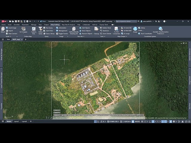
Tutorial how to insert aerial photo with spatial data, such as from orthophoto drone, to AutoCAD Map3D.
175 views
9 months ago
AutoCAD Map 3D enriches your map data, making it more visual and intelligent. With AutoCAD 2022, the Map 3D toolset ships ...
2,979 views
11 months ago