Upload date
All time
Last hour
Today
This week
This month
This year
Type
All
Video
Channel
Playlist
Movie
Duration
Short (< 4 minutes)
Medium (4-20 minutes)
Long (> 20 minutes)
Sort by
Relevance
Rating
View count
Features
HD
Subtitles/CC
Creative Commons
3D
Live
4K
360°
VR180
HDR
1,846 results
This webinar introduces approaches for visualising spatial-transcriptomics data leveraging the SpatialData framework together ...
92 views
4 days ago
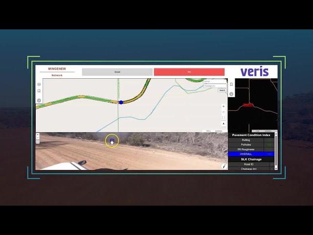
Veris, an Australian spatial data consultancy, set out to give clients more value from their survey and reality‑capture work. When a ...
8 views
5 days ago
Spatial data management as the comprehensive framework for handling geographic information gathered via remote sensing ...
0 views
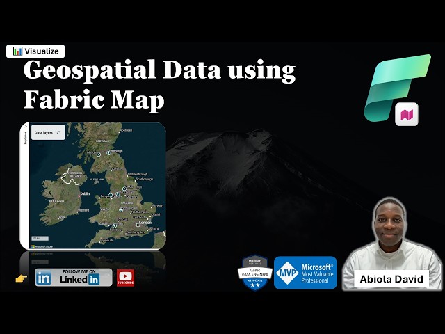
One of the exciting additions to Microsoft Fabric is the Map Item which enables teams to visualize and analyze geospatial data ...
137 views
7 days ago
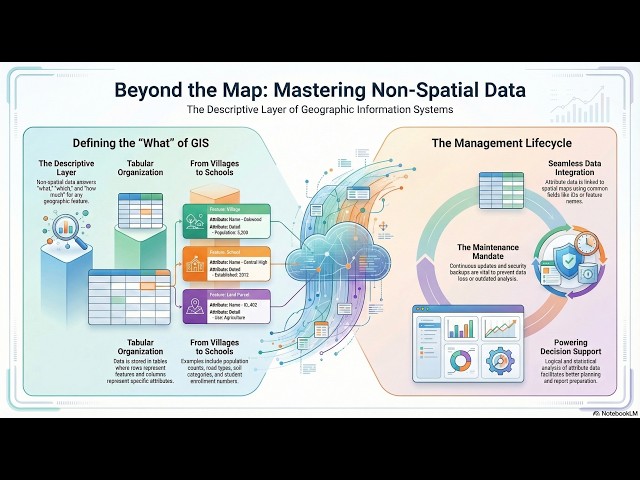
The concept of non-spatial data management, which involves handling the descriptive information linked to geographic features in ...
2 views
Dr N Manikandan.
3 days ago
What you'll learn - Understand the core concepts of GIS and how they relate to crime data. - Work with open-source spatial data ...
8 hours ago
Raven LiDAR Spatial Scanner is a professional 3D scanning solution designed for fast and accurate spatial data capture using ...
637 views
6 days ago
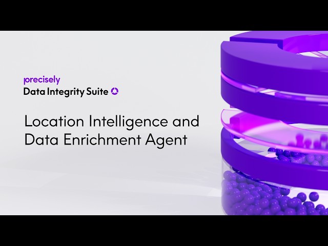
In this demo, see how the Location Intelligence and Data Enrichment Agent enhances datasets with spatial context to unlock ...
... Intelligence in GIS | Workshop Replay Artificial Intelligence is transforming the way we analyze spatial data and make decisions.
184 views
In this AI Research Roundup episode, Alex discusses the paper: 'Holi-Spatial: Evolving Video Streams into Holistic 3D Spatial ...
50 views
Designed for fast and accurate spatial data capture, Raven uses advanced LiDAR technology to scan large environments and ...
535 views
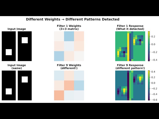
Then we dive into how spatial data becomes tensors, how neural networks process information through weighted connections ...
198 views
Discover how Genie Code acts as an autonomous AI agent to help data scientists build and iterate on machine learning models ...
389 views
5.6 Spatial & Non-Spatial Data | GIS, Raster vs. Vector & Statistics (GATE/DDA) Welcome to Lecture 5.6 of the Perfect Guided ...
... mapping features, and spatial data. Subscribe for more tutorials on Google Earth Pro, operational mapping, and spatial analysis ...
46 views
Your data is fine. Your AI isn't good enough.” That is the bold statement behind TextQL, and it immediately caught my attention ...
30,730 views
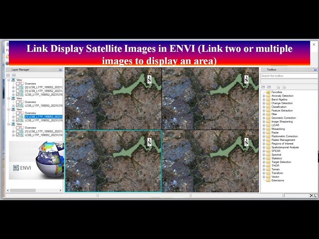
SatelliteImages #ENVI #ImageLinking #RemoteSensing #GIS #DataVisualization #GeospatialAnalysis In this video, we will show ...
40 views
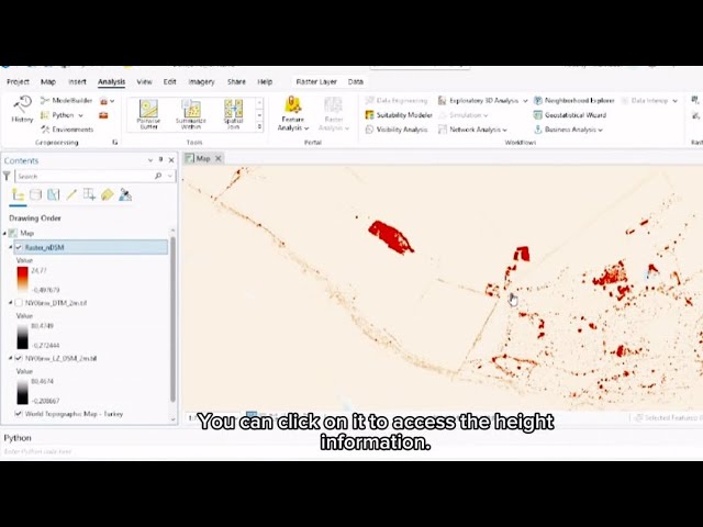
In this video, I demonstrate the fundamental difference between DTM (Digital Terrain Model) and DSM (Digital Surface Model) and ...
18 views
It enables municipalities to visualize, manage, and analyze spatial data for better planning and service delivery. In this video you ...