Upload date
All time
Last hour
Today
This week
This month
This year
Type
All
Video
Channel
Playlist
Movie
Duration
Short (< 4 minutes)
Medium (4-20 minutes)
Long (> 20 minutes)
Sort by
Relevance
Rating
View count
Features
HD
Subtitles/CC
Creative Commons
3D
Live
4K
360°
VR180
HDR
2,265 results
Aerial photos and satellite imagery are two types of remote sensing data with different characteristics, advantages, and limitations.
3,044 views
2 years ago
In this video I will show you real 5 satellites.
7 views
1 year ago
Oral presentation of paper Beluga Whale Detection from Satellite Imagery with Point Labels. Project supported by 4th IEEE GRSS ...
37 views
6 months ago
Visit: https://skywatch.com/skywatch-what-is/ What are the 5 types of satellite images? When working with satellite imagery, you ...
2,649 views
WI series by SkyWatch: What is the most detailed satellite imagery? At this point in time, in the year 2024, the most detailed ...
342 views
26 views
11 months ago
This video explores various research ideas in agriculture that use GIS technology, focusing on how students and researchers can ...
38 views
2 months ago
Discover how field observations and remote sensing tools are helping scientists better understand changes to the climate systems ...
130 views
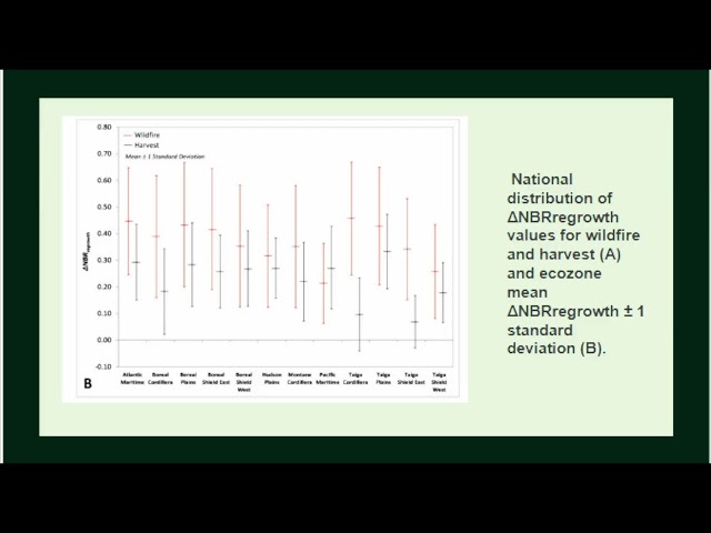
Presenting on 2024 IEEE International Geoscience and Remote Sensing Symposium, Athens, Greece.
54 views
Join us for Part 2 of our in-depth conversation with Dr. Abdul Hameed Marwat, a pioneering forester, biodiversity specialist, and ...
353 views
7 months ago
... panels: 'Staying on Top of the Growing Importance of Remote Sensing for Earth' and 'Data is the Key to Knowledge: Increasing ...
32 views
Find out more about Wavelength 2026 - https://www.rspsoc.org.uk/wavelength-2026.
5 months ago
AWESOME! I'm so thrilled to visit ! The NRSC visit must have been an incredible experience! It's fantastic that you got to ...
278 views
3 months ago
Liz Weidner, University of California San Diego, drives an echoboat at the GEOEO North of Greenland 2024 expedition. Echoboat ...
655 views
February 11th, 2024: AirWorks co-founder Adam Kersnowski presented at GeoWeek 2024 in Denver alongside Rob Sinclair from ...
212 views
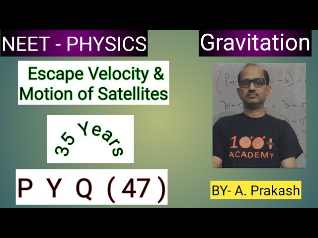
A remote sensing satellite of earth revolves in a circular orbit at a height of 0.25 x 10⁶ m above the surface of earth. If earth's ...
10 views
Simple project that can detect if person is there, or it's gone! Thank you for watching! ✦✦✦ See where else you can find us!
426,361 views
WI series by SkyWatch: What is open data? Open Data refers to data that organizations provide at no charge and often with very ...
452 views
ENHANCED SIGNAL DETECTION OF OFFICIALLY ENCODED PARTICLES VIA FLARE #enhancedsignaldetection ...
9 views
Find out about RSPSoc's Wavelength 2026 conference https://www.rspsoc.org.uk/wavelength-2026.