Upload date
All time
Last hour
Today
This week
This month
This year
Type
All
Video
Channel
Playlist
Movie
Duration
Short (< 4 minutes)
Medium (4-20 minutes)
Long (> 20 minutes)
Sort by
Relevance
Rating
View count
Features
HD
Subtitles/CC
Creative Commons
3D
Live
4K
360°
VR180
HDR
403,062 results
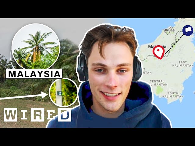
If you haven't heard of it, GeoGuessr is basically competitive Google Maps. Participants try to guess where they are on the planet ...
5,354,160 views
3y ago
Download your 'Longitude and Latitude Teacher Resource Pack' https://clickv.ie/w/Kvdx Discover more videos on ClickView: ...
129,311 views
2y ago
Geocaching is the real-world adventure that's happening right now, all around you. Watch this video to learn more about what ...
1,334,947 views
8y ago
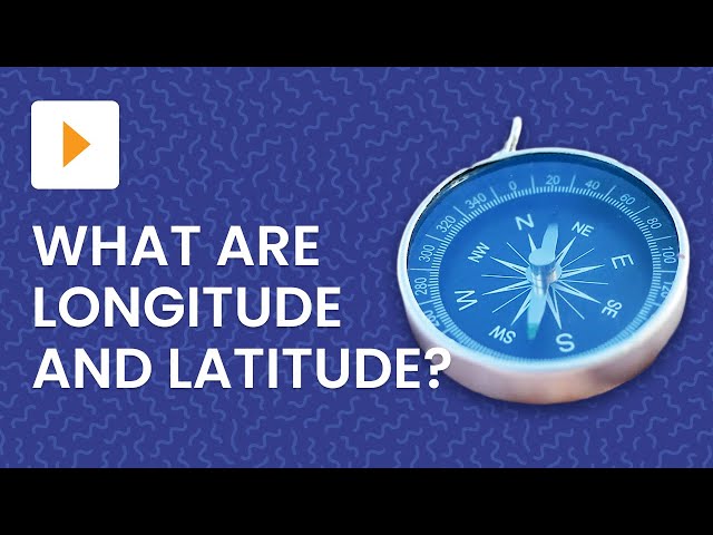
So you've seen those location-tagging numbers on maps and GPS devices before, but do you actually know what they mean?
861,605 views
9y ago
Learn More at mathantics.com Visit http://www.mathantics.com for more Free math videos and additional subscription based ...
2,577,496 views
12y ago
Check out products related to Geography, Travel and the Outdoors on Amazon: https://www.amazon.com/shop ...
1,462,549 views
13y ago
Are you struggling to get creator points in Geometry Dash? Here are some editor tips & tricks to help you out! Follow my socials ...
61,839 views
8mo ago
This tutorial will show you how to import a DEM image into the ArcGis software. Please subscribe, like, and comment. احصل على ...
45,568 views
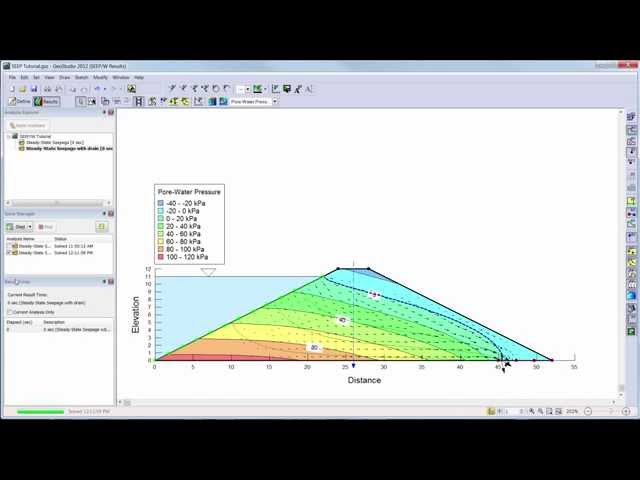
Learn the basics of SEEP/W 2012 with this introductory video.
185,140 views
11y ago
This video introduces the new program GEO5 Point Cloud for point cloud processing and its connection with the GEO5 ...
29,043 views
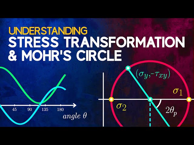
In this video, we're going to take a look at stress transformation and Mohr's circle. Stress transformation is a way of determining the ...
1,441,204 views
6y ago
Lining up imagery data with its real-world location may seem complicated, but Esri instructor Mike Rink shows a method to simplify ...
45,414 views
4y ago
Rivers become curvier and curvier until they bump into themselves. Then, lakes follow the route of least resistance and connect to ...
45,949,006 views
Keeping your Reference Geometry stick in place is crucial for iterating your work. But sometimes a simple Refine or Solve ...
1,698 views
3mo ago
This tutorial guides new users through the basics of creating a simple stability analysis in SLOPE/W.
176,222 views
DJI Mini 4 Pro is our most advanced mini camera drone to date. It integrates powerful imaging capabilities, omnidirectional ...
143,658 views
https://gisgeography.com/georeferencing/ Georeferencing is the process of aligning an image to establish its spatial reference ...
15,493 views
The Caribbean is more than just beautiful beaches! This region consists of over 7000 islands, with 13 independent countries ...
212,296 views
1y ago
154,209 views
10y ago
Every BIM project collaboration starts with ensuring that the project is correctly located. Archicad enables model-based open ...
31,315 views


![Keep your Geo in Place with Lock Points [Boris FX SynthEyes]](/api/proxy/image?url=https%3A%2F%2Fi.ytimg.com%2Fvi%2FEcJd7J-poU4%2Fsddefault.jpg)