Upload date
All time
Last hour
Today
This week
This month
This year
Type
All
Video
Channel
Playlist
Movie
Duration
Short (< 4 minutes)
Medium (4-20 minutes)
Long (> 20 minutes)
Sort by
Relevance
Rating
View count
Features
HD
Subtitles/CC
Creative Commons
3D
Live
4K
360°
VR180
HDR
700,379 results
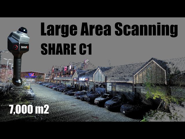
Scanning large, low-feature areas is a challenge for most LiDAR systems—but not for the SHARE C1. Its advanced SLAM ...
4,414 views
4 months ago
This NEON Science video overviews what lidar or light detection and ranging is, how it works and what types of information it can ...
1,000,836 views
11 years ago
This tutorial is aimed at Metal Detectorists in the UK and around the world. The aim is to provide a clearer picture of permissions ...
22,831 views
4 years ago
Learn how to access lidar hillshade maps for free using the USGS's National Map online platform. We show you how to use ...
19,621 views
1 year ago
✅ Step 1: Download the QGIS software: https://qgis.org/download/ ✅ Step 2: Obtain the LiDAR data: https://apps.nationalmap ...
70,916 views
10 months ago
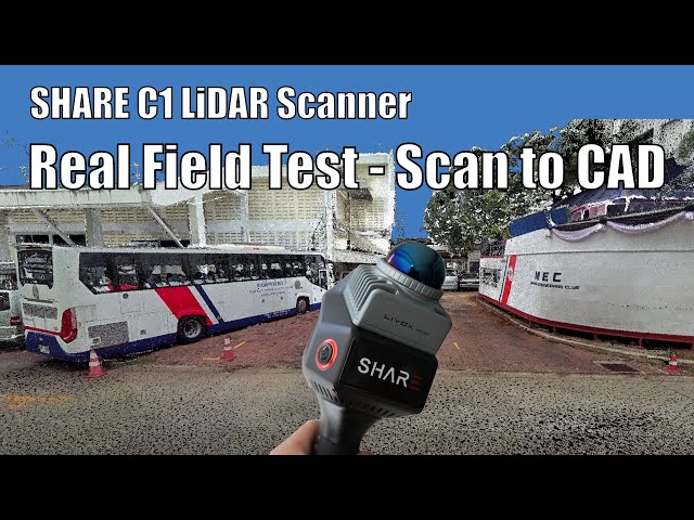
This real client project put the SHARE C1 LiDAR scanner to the test—from 3D scanning and accuracy verification to structural ...
3,450 views
3 months ago
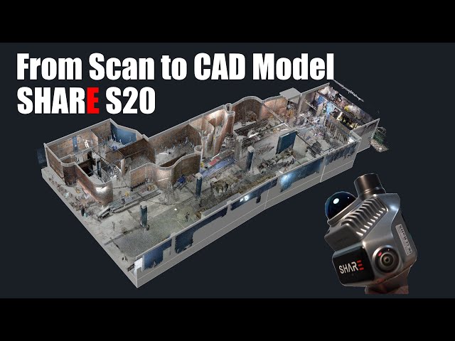
Watch as we take a nightclub from 3D scan to CAD model in preparation for renovation. With low light and plenty of obstructions, ...
2,538 views
1 month ago
How lidar has been used to uncover ancient Mesoamerican complexes. Study: Inomata et al. (2021). Animation from UNAVCO.
2,256 views
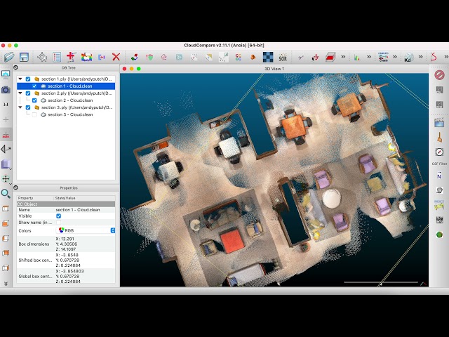
This is an advanced walkthrough on merging SiteScape scans with CloudCompare (http://www.cloudcompare.org/), a free point ...
24,146 views
Complete SHARE C1 LiDAR workflow: scan a job site, align point clouds in CloudCompare, separate layers in ReCAP, and ...
2,217 views
2 months ago
Hello Everybody, and welcome back to the channel. Today we have an informative episode for you hikers and prospectors. Today ...
78,912 views
Announcing SiteScape Multi-Scans - the fastest way to 3D scan areas up to 5000 sqft (500 sqm) on an iOS device without ...
83,584 views
3 years ago
Learn more about LiDAR with ROCK robotic - https://www.rockrobotic.com/ If you are interested in LiDAR then please reach out to ...
253,718 views
5 years ago
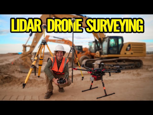
Check Out Drone Mapping Essentials: https://uavcoach.com/online-drone-mapping-course/ ✓ Check Out Our Drone Mapping ...
8,720 views
This National Map training video is an introduction to using the LidarExplorer application to easily access lidar data and derived ...
2,941 views
Today I am excited to share with you the brand new LiDAR mapping (Light Detection and Ranging) brought to you by Detector ...
18,512 views
7 months ago
This is the first video in a 3-part series on using the Slamtec RPLidar A1 to create interactive visuals in TouchDesigner. In this part ...
36,290 views
This tutorial demonstrates how to capture, edit and share a scan with Scaniverse. For more information, visit: ...
42,421 views
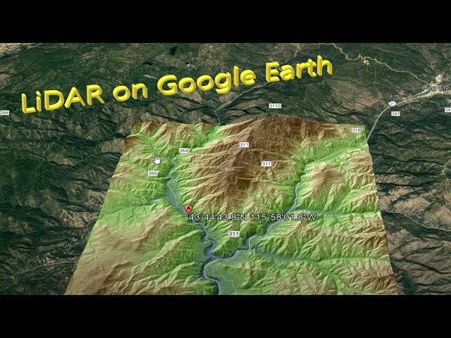
The popular USGS National Map viewer has been updated to operate in 3D! Now you can browse lidar hillshade maps and lots of ...
1,816 views
Demonstration of a 3D scanner using an Arduino and a Garmin LIDAR-Lite 3. More info: http://www.qcontinuum.org/lidar-scanner.
530,167 views
9 years ago