ViewTube

ViewTube
Sign inSign upSubscriptions
Filters

Upload date

Type

Duration

Sort by

Features

Reset

3,670 results

Matt Forrest
I Replaced 6 GIS Tools With One 8-Step Stack

If you've built your career in ArcGIS or traditional GIS tools, you already have the hardest skill: spatial thinking. What you might be ...

12:45
I Replaced 6 GIS Tools With One 8-Step Stack

1,799 views

3 days ago

Geojay GIS Solution
How to Create Random Points for Random Sampling in ArcGIS: Random Sampling || Accuracy Assessment

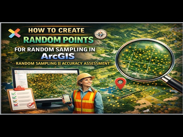
ArcGIS #RandomSampling #GIS #SpatialAnalysis #DataAccuracy #SamplingMethods #GeospatialAnalysis In this tutorial, you'll ...

3:51
How to Create Random Points for Random Sampling in ArcGIS: Random Sampling || Accuracy Assessment

19 views

19 hours ago

SEN SPORTS 221
Ñaari joueurs sénégalais yi gis na leen ca mondiale ba...
16:34
Ñaari joueurs sénégalais yi gis na leen ca mondiale ba...

1,473 views

3 hours ago

GIS & RS Professionals
How to check duplication in attribute table in arcgis

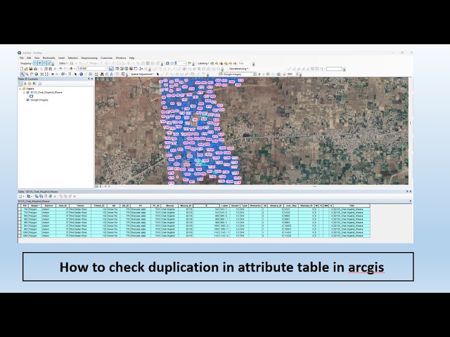
In this detailed tutorial, I will explain how to check and remove duplicate records in the attribute table using ArcGIS, especially in ...

2:42
How to check duplication in attribute table in arcgis

39 views

1 day ago

Geojay GIS Solution
How To Clip Raster In Arcgis Pro review

ClipRaster #ArcGISPro #GIS #RasterAnalysis #MappingTutorial #GeospatialData #SpatialAnalysis Buy me a coffee here: ...

0:22
How To Clip Raster In Arcgis Pro review

0 views

9 hours ago

GIS Solutions, LLC
ArcGIS Pro File Geodatabase Tutorial For Beginners

If you're still using shapefiles in ArcGIS Pro… you might be limiting your GIS projects without realizing it. In this beginner-friendly ...

5:26
ArcGIS Pro File Geodatabase Tutorial For Beginners

39 views

2 days ago

Nasir Farid
Professional GIS & Remote Sensing Projects | Interactive Maps Project | GIS & RS Analyst

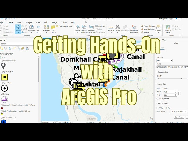
Discover a professional GIS mapping project showcasing advanced spatial digitization, interactive layer management, and ...

1:24
Professional GIS & Remote Sensing Projects | Interactive Maps Project | GIS & RS Analyst

13 views

5 days ago

Esri Developers
ArcGIS and GeoAI: Using Large Language Models and Foundation Models | #EsriDevSummit2025

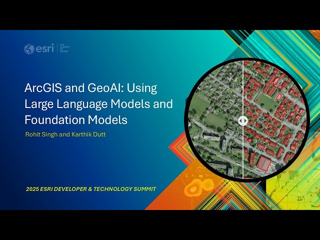
Large language models (LLMs) and foundation models are revolutionizing GeoAI as they need little or no fine-tuning. Join us to ...

56:08
ArcGIS and GeoAI: Using Large Language Models and Foundation Models | #EsriDevSummit2025

178 views

5 days ago

TechInsightCentral
How to Select Features by Location in ArcMap | Step-by-Step GIS Tutorial

Learn how to use the Select By Location tool in ArcMap to select features based on their spatial relationship with other layers.

4:34
How to Select Features by Location in ArcMap | Step-by-Step GIS Tutorial

0 views

4 days ago

Geojay GIS Solution
Generate Contour Map In Arcgis Tutorial overview

ContourMap #ArcGIS #MappingTutorial #GeospatialAnalysis #GIS #SpatialData #TerrainMapping Buy me a coffee here: ...

0:45
Generate Contour Map In Arcgis Tutorial overview

0 views

1 day ago

Geojay GIS Solution
Generate Contour Map In Arcgis Tutorial Review

ContourMap #ArcGIS #MappingTutorial #GeospatialAnalysis #GIS #SpatialData #TerrainMapping Buy me a coffee here: ...

0:36
Generate Contour Map In Arcgis Tutorial Review

0 views

2 minutes ago

Full Time GIS
Watershed vs Basin in ArcGIS | Complete Comparison Step by Step | Hydrology Tools Explained

In this video, we perform a complete ArcGIS hydrology workflow and explain the Watershed vs basin difference using a 30m DEM.

8:19
Watershed vs Basin in ArcGIS | Complete Comparison Step by Step | Hydrology Tools Explained

0 views

4 days ago

Waruguru Okanda (Wakanda)
GEE to ArcGIS Pro (Landsat 5–9) | Harmonized Surface Reflectance & Index Analysis

Project Showcase: GEE to ArcGIS Pro (Landsat 5–9) This video demonstrates an end-to-end remote sensing workflow integrating ...

11:42
GEE to ArcGIS Pro (Landsat 5–9) | Harmonized Surface Reflectance & Index Analysis

17 views

5 days ago

TerraGIS Academy
Beginner GIS Tutorial: Import & Label Nigeria States in ArcGIS Pro

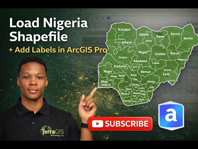
How to Download Nigeria Shapefile from GADM, Load into ArcGIS Pro, Apply Definition Query & Label States In this practical GIS ...

8:12
Beginner GIS Tutorial: Import & Label Nigeria States in ArcGIS Pro

97 views

4 days ago

My Bread Recipe
Minimal Yeast, Light & Airy | Easy Homemade Bread

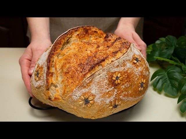
Minimal Yeast, Light & Airy | Easy Homemade Bread This easy homemade bread with oats is made with minimal yeast and simple ...

12:04
Minimal Yeast, Light & Airy | Easy Homemade Bread

2,126 views

4 days ago

Geojay GIS Solution
Drainage Density Mapping In ArcGIS Tutorial

DrainageDensity #ArcGIS #GIS #MappingTutorial #SpatialAnalysis #Hydrology #GeospatialMapping Buy me a coffee here: ...

0:23
Drainage Density Mapping In ArcGIS Tutorial

0 views

1 day ago

Shafiq Mahmud
Getting Hands-On with ArcGIS Pro | Beginner Workflow | My Experience lately

In this video, I've actually shared some of the experiences i went through lately. Yet this video demonstrates the following stuff that ...

26:19
Getting Hands-On with ArcGIS Pro | Beginner Workflow | My Experience lately

44 views

1 day ago

blueraster
Making GIS Accessible Today: ADA Standards, Best Practices, and Implementation

Title II of Americans with Disabilities Act (ADA) has specific requirements about how to ensure that web content and mobile ...

34:13
Making GIS Accessible Today: ADA Standards, Best Practices, and Implementation

0 views

6 days ago

Crooked Contours
Using QuickOSM in QGIS to QUICKLY Download GIS Reference Data for Analysis and Mapping in ArcGIS

Tutorial Video for Professor Crook's GIS classes at Palomar College. This is a quick version of a longer tutorial showing how to ...

2:45
Using QuickOSM in QGIS to QUICKLY Download GIS Reference Data for Analysis and Mapping in ArcGIS

35 views

4 days ago

Final Draft Mapping
Adding Relationships within an ArcGIS Online Feature Service with the ArcGIS API for Python

Full Course https://www.youtube.com/playlist?list=PLWlgkWEhTvz0oqrq6PP6ZbkMqCLXXMNsT Learn how to *add ...

10:21
Adding Relationships within an ArcGIS Online Feature Service with the ArcGIS API for Python

38 views

4 days ago