ViewTube

ViewTube
Sign inSign upSubscriptions
Filters

Upload date

Type

Duration

Sort by

Features

Reset

87 results

GIS Tutorial for Beginners
How to start editing in shapefile

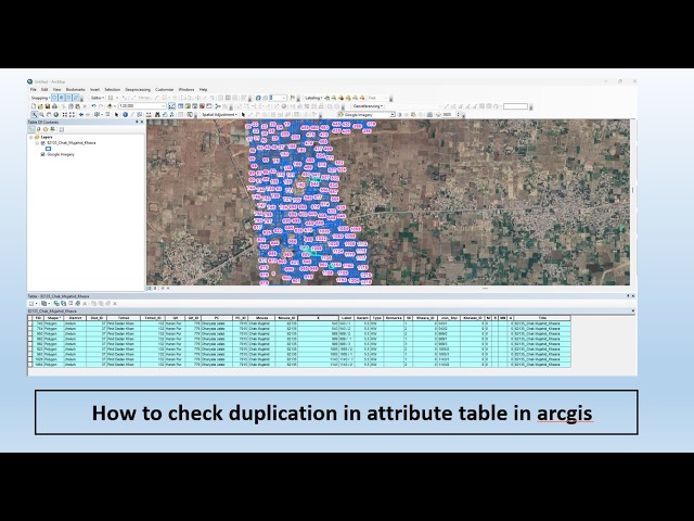
arcgis #arcgistutorial #gis #gistutorial #tutorial.

0:45
How to start editing in shapefile

10 views

4 days ago

GIS Tutorial for Beginners
How to connect with a folder in ArcMap

arcgis #gis #arcgistutorial #gistutorial #tutorial.

0:18
How to connect with a folder in ArcMap

17 views

4 days ago

GIS Solutions, LLC
ArcGIS Pro File Geodatabase Tutorial For Beginners

If you're still using shapefiles in ArcGIS Pro… you might be limiting your GIS projects without realizing it. In this beginner-friendly ...

5:26
ArcGIS Pro File Geodatabase Tutorial For Beginners

50 views

3 days ago

GIS Tutorial for Beginners
How to Create Shp

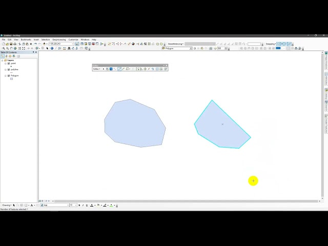
shapefile of point, polyline and polygon #gis #gistutorial #polyline #polygon #point #arcgistutorial #arcgis.

0:58
How to Create Shp

33 views

4 days ago

ABIOTECH SURVEY SOLUTIONS
How To Create A Study Area Map

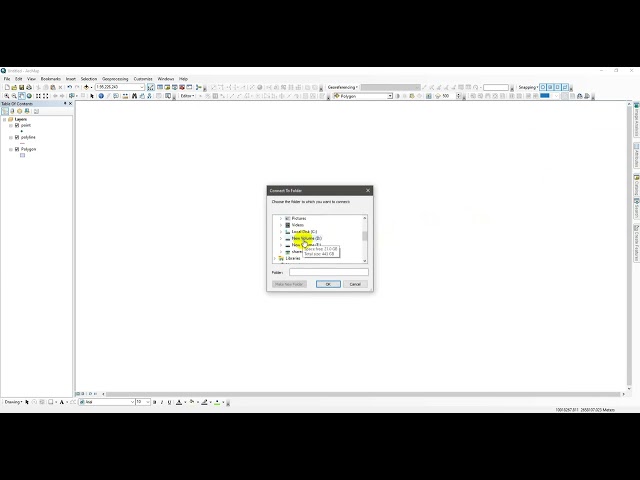
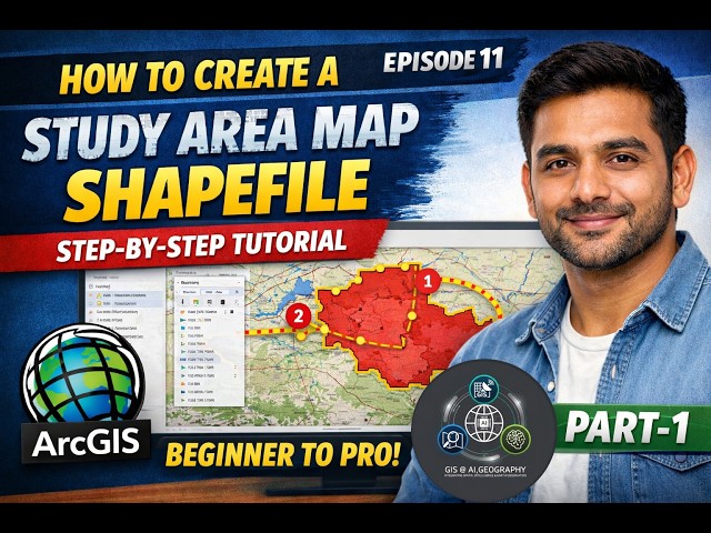
Learn how to create a clear and accurate study area map in ArcMap with this step-by-step tutorial! Whether you're a GIS student, ...

36:44
How To Create A Study Area Map

9 views

3 days ago

Climate and RS & GIS Analysis
Watershed Delineation in ArcGIS using DEM
13:13
Watershed Delineation in ArcGIS using DEM

14 views

3 days ago

GIS & AI,GEOGRAPHY
How to Create a Study Area Map Shapefile I Step-by-Step Tutorial Episode 11 PART 1@GISRS-1 #gis

GISRS-1 How to Create a Study Area Map Shapefile | Step-by-Step Tutorial (Beginner to Pro) | Episode 11 | ArcGIS In this ...

7:43
How to Create a Study Area Map Shapefile I Step-by-Step Tutorial Episode 11 PART 1@GISRS-1 #gis

62 views

4 days ago

NGEOSPATIAL SOLUTION
Hot Spot Analysis in ArcGIS 2026 | Step-by-Step Gi Statistics Tutorial for GIS Professionals*

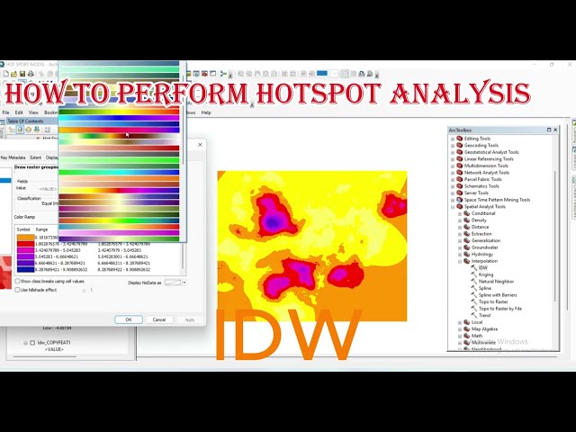
Want to identify statistically significant clusters in your spatial data? In this comprehensive tutorial, you'll learn how to perform Hot ...

23:45
Hot Spot Analysis in ArcGIS 2026 | Step-by-Step Gi Statistics Tutorial for GIS Professionals*

23 views

5 days ago

Crooked Contours
Using QuickOSM in QGIS to QUICKLY Download GIS Reference Data for Analysis and Mapping in ArcGIS

Tutorial Video for Professor Crook's GIS classes at Palomar College. This is a quick version of a longer tutorial showing how to ...

2:45
Using QuickOSM in QGIS to QUICKLY Download GIS Reference Data for Analysis and Mapping in ArcGIS

42 views

5 days ago

TerraGIS Academy
Beginner GIS Tutorial: Import & Label Nigeria States in ArcGIS Pro

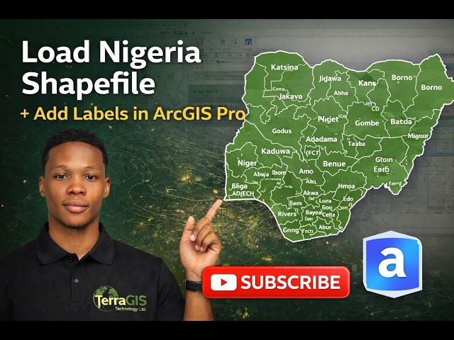
How to Download Nigeria Shapefile from GADM, Load into ArcGIS Pro, Apply Definition Query & Label States In this practical GIS ...

8:12
Beginner GIS Tutorial: Import & Label Nigeria States in ArcGIS Pro

98 views

5 days ago

Sir Kwofae
How to Create a Flood Risk Assessment Map in ArcGIS (Weighted Sum_Overlay Method)

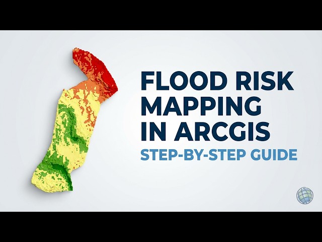
Learn how to create a professional Flood Risk Assessment Map (Flood Susceptibility Map) using ArcGIS. In this tutorial, we will ...

24:20
How to Create a Flood Risk Assessment Map in ArcGIS (Weighted Sum_Overlay Method)

181 views

6 days ago

GIS & RS Professionals
How to check duplication in attribute table in arcgis

Clean data = Accurate Analysis ✓ On this channel GIS & RS Professionals, we focus on practical GIS tutorials including ArcGIS, ...

2:42
How to check duplication in attribute table in arcgis

46 views

2 days ago

GIS Tutorial for Beginners
How To Favorite UTM Zones

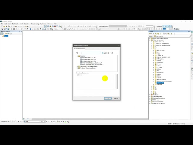
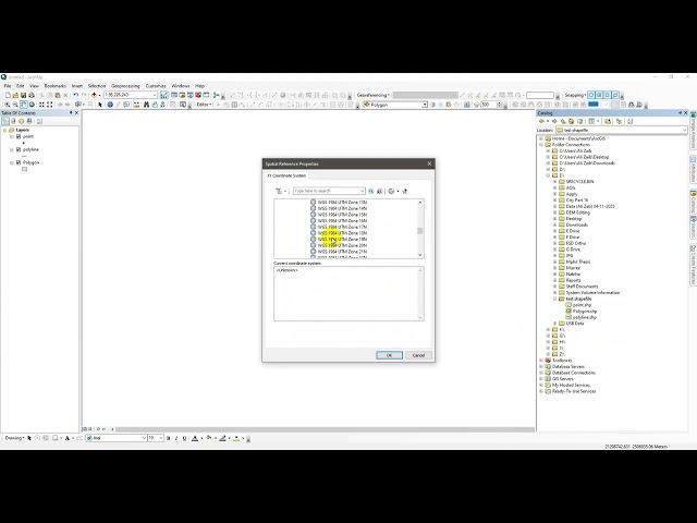
arcgis #gis #arcgistutorial #tutorial #utm #zone.

0:43
How To Favorite UTM Zones

11 views

4 days ago

Geoinformatics Intelligence
Mosaic One Single band Image in ArcGIS #mosaic #arcgistutorial

Thank you. You can ask anything about this tutorial, please feel free to contact me on my WhatsApp number 7529918160.

3:43
Mosaic One Single band Image in ArcGIS #mosaic #arcgistutorial

0 views

6 days ago

TWAHIRWA Eric
How to prepare Location Map in ArcGIS

Let Rising our Skills With ArcGIS Desketop.

26:39
How to prepare Location Map in ArcGIS

14 views

5 days ago

Learn Geography with Shyamal
Georeferencing in ArcGIS Step-by-Step | GIS & Remote Sensing Tutorial | Learn Geography with Shyamal

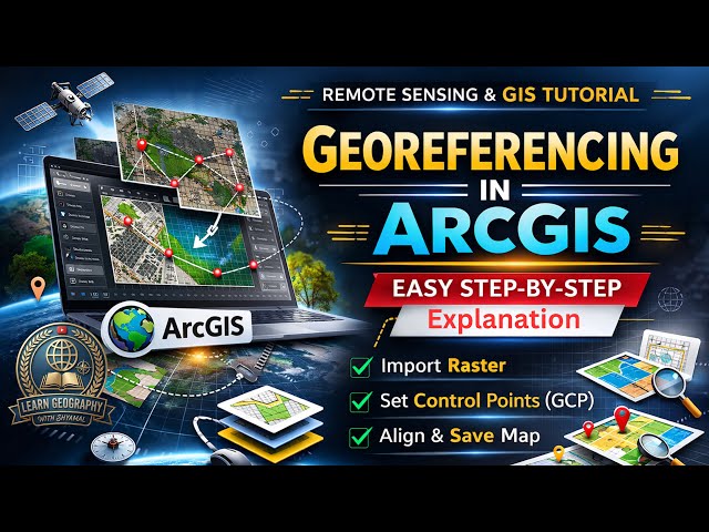
Learn how to perform georeferencing in ArcGIS with this complete step-by-step tutorial in GIS & Remote Sensing. This video ...

9:14
Georeferencing in ArcGIS Step-by-Step | GIS & Remote Sensing Tutorial | Learn Geography with Shyamal

29 views

2 days ago

Geo-RemoteSensing
How to Add KML/KMZ File in ArcGIS | Save KM/KMZ File in Google Earh Pro

How to Add KML/KMZ File in ArcGIS | Save KM/KMZ File in Google Earh Pro Learn how to Import KML/KMZ in ArcGIS step-by-step ...

10:48
How to Add KML/KMZ File in ArcGIS | Save KM/KMZ File in Google Earh Pro

30 views

3 days ago

ABIOTECH SURVEY SOLUTIONS
Download Google Earth Image And Georeference on Arcmap

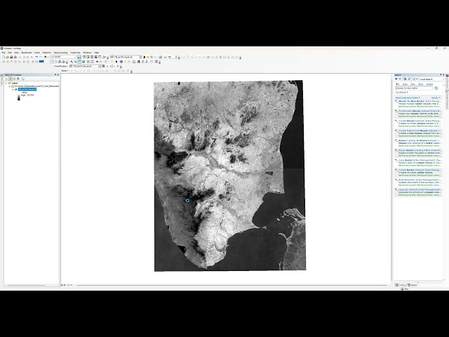
Learn how to download satellite imagery from Google Earth and georeference it in ArcMap for your GIS projects! This step-by-step ...

21:46
Download Google Earth Image And Georeference on Arcmap

0 views

3 days ago

Full Time GIS
Watershed vs Basin in ArcGIS | Complete Comparison Step by Step | Hydrology Tools Explained

In this video, we perform a complete ArcGIS hydrology workflow and explain the Watershed vs basin difference using a 30m DEM.

8:19
Watershed vs Basin in ArcGIS | Complete Comparison Step by Step | Hydrology Tools Explained

0 views

5 days ago

GeoMaps
Advanced Labeling in ArcGIS Pro (Part 3)
8:18
Advanced Labeling in ArcGIS Pro (Part 3)

24 views

3 days ago