Upload date
All time
Last hour
Today
This week
This month
This year
Type
All
Video
Channel
Playlist
Movie
Duration
Short (< 4 minutes)
Medium (4-20 minutes)
Long (> 20 minutes)
Sort by
Relevance
Rating
View count
Features
HD
Subtitles/CC
Creative Commons
3D
Live
4K
360°
VR180
HDR
24 results
eVIIRS #NDVI #USGSEarthExplorer #RemoteSensing #AfricaSatelliteData #DataDownload #GISAnalysis In this comprehensive ...
0 views
8 hours ago
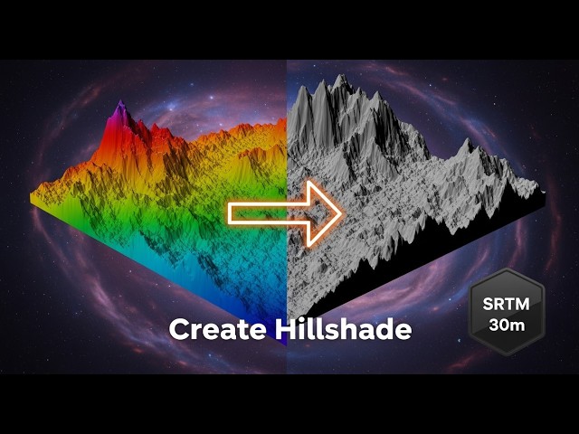
... 30m DEM If you found this helpful, like, share, and subscribe for more GIS tutorials. #ArcGIS #GIS #Hillshade #DEM #SRTM.
3 views
4 hours ago
... GIS Tutorial, Spatial Data, Climate Change, Temperature Data, Environmental Monitoring, Data Interpretation, Satellite Imagery, ...
23 views
12 hours ago