ViewTube

ViewTube
Sign inSign upSubscriptions
Filters

Upload date

Type

Duration

Sort by

Features

Reset

99 results

Native GIS
CNN vs Vision Transformers Geospatial AI Hits an Inflection Point | 2026 GeoAI Shift

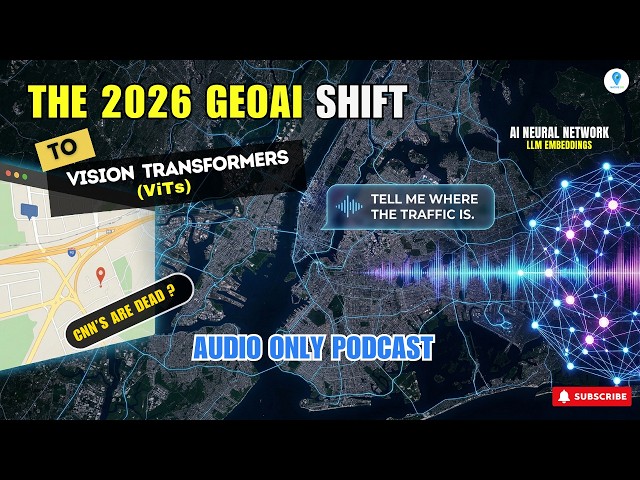
... the staggering computational costs and the critical data governance requirements needed to secure proprietary spatial data.

6:04
CNN vs Vision Transformers Geospatial AI Hits an Inflection Point | 2026 GeoAI Shift

32 views

1 day ago

Geomatics Learning
Reclassification in GIS Explained Simply | All Competitive exams

Reclassification in GIS is a process used to simplify and organize spatial data by assigning new values to existing raster or vector ...

4:17
Reclassification in GIS Explained Simply | All Competitive exams

1 view

1 hour ago

wetransform
Webinar - European Spatial Data Infrastructures: A Time of Change

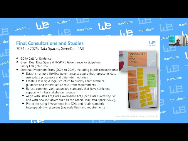
As part of the competitiveness and simplification political priority of the EC, the INSPIRE Directive will be “simplified”, with the ...

58:17
Webinar - European Spatial Data Infrastructures: A Time of Change

70 views

4 days ago

GeoPython with Bapan
From Drone Images to GIS Map | Full Processing Guide (Part 1)  | Drone Image Processing in GIS

Welcome to GeoPython with Bapan In this video, I have explained the complete workflow of Drone Image Processing in GIS ...

20:31
From Drone Images to GIS Map | Full Processing Guide (Part 1) | Drone Image Processing in GIS

42 views

6 days ago

NC State Center for Geospatial Analytics
Geospatial Forum: Doctoral Student Edition 2026

Whenever we make predictions about the future, we need to consider the uncertainty in those predictions. The more we know ...

1:01:01
Geospatial Forum: Doctoral Student Edition 2026

24 views

1 day ago

Geojay GIS Solution
Complete Introduction To Envi Software Tutorial

ENVI #SoftwareTutorial #RemoteSensing #GIS #DataAnalysis #GeospatialSoftware #TechTutorial Buy me a coffee here: ...

0:10
Complete Introduction To Envi Software Tutorial

167 views

23 hours ago

Esri Developers
ArcGIS: A GeoSpatial AI Platform | #EsriDevTech2026

Jay Theodore, CTO - ArcGIS Enterprise & AI, leads this section to highlight the features of the ArcGIS Pro AI Assistant, ArcGIS ...

34:31
ArcGIS: A GeoSpatial AI Platform | #EsriDevTech2026

212 views

2 days ago

Pittsburgh Technology Council
How AI and Lidar Are Turning Maps Into Intelligent Machines

In our Techvibe interview with Woolpert CEO Neil Churman, he explains how AI, lidar, and geospatial data are turning maps into ...

8:32
How AI and Lidar Are Turning Maps Into Intelligent Machines

5 views

5 days ago

Picterra
How Walter Matter Scales EUDR Compliance with GeoAI

How do you verify deforestation risk across global supply chains? In this case study, Walter Matter shares how they are ...

12:09
How Walter Matter Scales EUDR Compliance with GeoAI

42 views

2 days ago

NLR Learning
Powered By reV

This webinar was presented by the National Laboratory of the Rockies' geospatial data scientists Galen Maclaurin and Gabe ...

56:12
Powered By reV

20 views

23 hours ago

Humanitarian OpenStreetMap Team
Project Results Sharing Session Strengthening Geospatial Data  in Mozambique
1:59:23
Project Results Sharing Session Strengthening Geospatial Data in Mozambique

53 views

Streamed 2 days ago

Google Earth Engine with Amirhossein Ahrari
Google Earth Engine Python Tutorial-11: Pointwise Correlation Mapping

code link: ...

45:21
Google Earth Engine Python Tutorial-11: Pointwise Correlation Mapping

433 views

5 days ago

Eazy Geospatialz🌍
How i Download and Install Latest QGIS Software in 2026 || License free QGiS for Windows 10/11

Whether you're a student, researcher, or professional,#qgis is an essential tool for anyone working with geospatial data.

7:45
How i Download and Install Latest QGIS Software in 2026 || License free QGiS for Windows 10/11

148 views

5 days ago

aspacgeosurvey
ASPAC Geo Survey - Road Extraction

Our services include: • LiDAR data processing • Point cloud classification and extraction • 2D & 3D CAD / BIM modeling • Contours ...

0:34
ASPAC Geo Survey - Road Extraction

0 views

5 days ago

Microsoft Fabric
Unifying the Data Estate for the next AI Frontier

As organizations race to deploy generative and agentic AI, the biggest challenge they face is not models, it's their data estate.

1:53:16
Unifying the Data Estate for the next AI Frontier

7,366 views

2 days ago

Mapora
Satellite Image Processing with Landsat 7 | Image Composite & Land Cover Visualization | Mapora

In this video, I show you how to create a Landsat 7 image composite and visualize different land cover types using GIS software.

6:07
Satellite Image Processing with Landsat 7 | Image Composite & Land Cover Visualization | Mapora

134 views

7 days ago

MAPe IT Solutions Pvt Ltd
Photogrammetry Explained – How It Works & Who Benefits

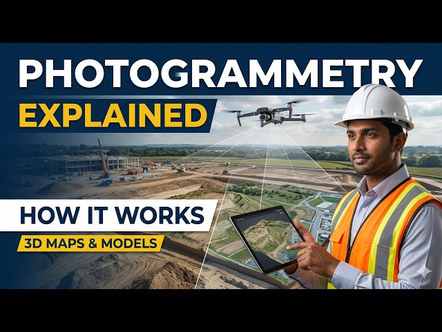
Photogrammetry is a powerful mapping technique that converts aerial images into accurate 2D maps and 3D models.

0:33
Photogrammetry Explained – How It Works & Who Benefits

2 views

5 days ago

Colin Koh
Chapter 4: Where the Twin Thinks

The first five layers of a Digital Twin create a real-time digital mirror. Impressive — but still reactive. Layer 6 is where the twin stops ...

3:19
Chapter 4: Where the Twin Thinks

8 views

5 days ago

LizardTech (a GeoWGS84 Company)
What Is Raster Image?

A raster image in GIS is a grid-based representation of geographic data made up of pixels (or cells) arranged in rows and columns ...

1:58
What Is Raster Image?

5 views

1 day ago

Phoenix Creative Studios
Unlocking the Future: How LiDAR Technology Transforms Autonomous Navigation!

Dive into the fascinating world of LiDAR sensors and discover how they're revolutionizing 3D mapping and autonomous ...

3:03
Unlocking the Future: How LiDAR Technology Transforms Autonomous Navigation!

1 view

4 days ago