Upload date
All time
Last hour
Today
This week
This month
This year
Type
All
Video
Channel
Playlist
Movie
Duration
Short (< 4 minutes)
Medium (4-20 minutes)
Long (> 20 minutes)
Sort by
Relevance
Rating
View count
Features
HD
Subtitles/CC
Creative Commons
3D
Live
4K
360°
VR180
HDR
14,975 results
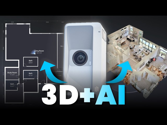
Contact Realsee: https://home.realsee.ai/en/contact-us... About Galois M2: https://home.realsee.ai/en/galois?utm... Official ...
704 views
2 weeks ago
This is result of DLO lidar odometry algorithm https://github.com/vectr-ucla/direct_lidar_odometry dataset ...
17 views
3 weeks ago
Generate floor plans in real-time, complete with doors, walls, windows, and furniture with Measure Square's 3D LiDAR app, Room ...
866 views
4 views
In this video, I break down everything you need to know about LiDAR and the Velodyne VLP-16 specifically, how time-of-flight ...
14,879 views
1 month ago
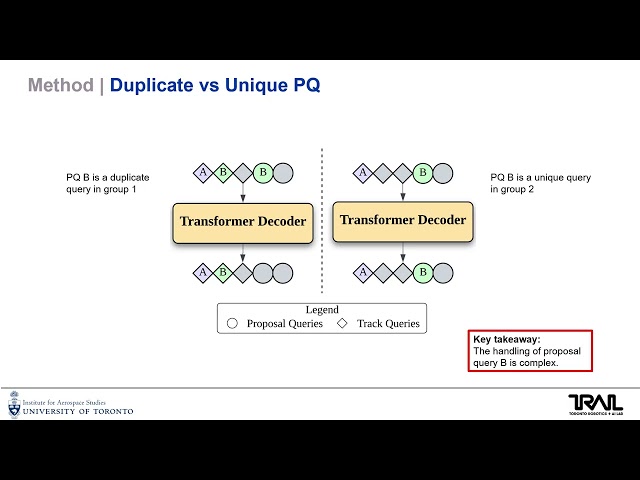
SCATR: Mitigating New Instance Suppression in LiDAR-based Tracking-by-Attention via Second Chance Assignment and Track ...
2 views
9 days ago
Join The Survey School: Want to elevate your survey knowledge and get a FREE 12-month license of Pix4DMatic Pro?
71,970 views
In this video, we will learn how to use a lidar sensor on an iPhone. If you want to know the usage of the lidar sensor or find lidar ...
1,194 views
7 days ago
Discover the latest techniques in utilizing lidar sensors for precise measurements and navigation. This updated video tutorial ...
0 views
In today's episode of The Build Show, builder Bryan Uhler gets his hands on the iGUIDE PLANIX R1 camera. With a built-in 60 ...
20,859 views
Self-Supervised Depth Correction of Lidar Measurements from Map Consistency Loss paper: ...
81 views
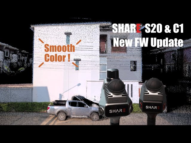
Quick overview of SHARE S20 and C1 firmware update, February 2026. The SHARE S20 LiDAR Scanner captured a hidden ...
1,211 views
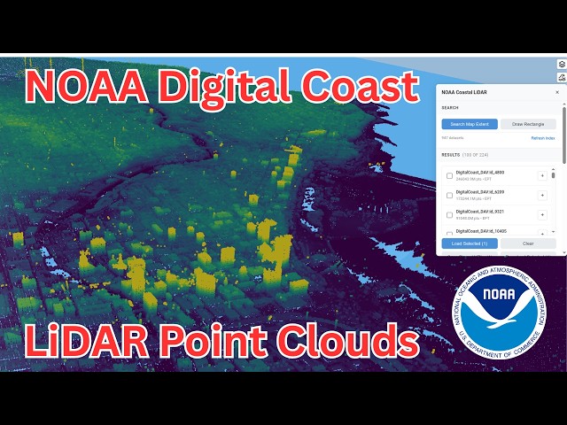
Want to easily explore and visualize LiDAR point clouds from NOAA Digital Coast? In this step-by-step tutorial, you'll learn how to ...
727 views
This is an introduction to the Enviko LiDAR Configuration Tool – LidarSet. The Enviko CET-1230HS LiDAR is specially designed ...
9 views
This video is a demonstration of the Rail Drone system that we have designed for site monitoring, inspection, with real-time video ...
1,611 views
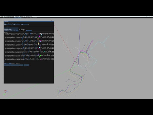
In this movie we qualitatively compare HDMapping-LIO, lidar_odometry_ros_wrapper, RESPLE, GenZ, I2EKF-LO, LIO-EKF, ...
83 views
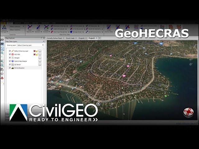
Learn how to work with LiDAR elevation data to build accurate 3D terrain models in GeoHECRAS. This tutorial covers importing ...
480 views
Enviko LiDAR detects vehicle profiles and measures weight, height, and length.
22 views
Lidar isn't a "magic button"—it's a precision tool that requires a plan. In this technical deep dive, Propeller's Ted Crete explores ...
47 views