Upload date
All time
Last hour
Today
This week
This month
This year
Type
All
Video
Channel
Playlist
Movie
Duration
Short (< 4 minutes)
Medium (4-20 minutes)
Long (> 20 minutes)
Sort by
Relevance
Rating
View count
Features
HD
Subtitles/CC
Creative Commons
3D
Live
4K
360°
VR180
HDR
5,121 results
What makes remote sensing such a powerful tool in relation to soil health? An how can new technology in the field empower soil ...
31 views
5 days ago
Remote Sensing of Permafrost Vulnerability and Geohazards 23 February 2026 by Simon Zwieback University of Alaska ...
62 views
HAMIDREZA NOROUZI (CUNY / NY City Tech) ABSTRACT: This talk presents an integrated overview of our remote sensing and ...
17 views
3 days ago
International WEBINAR – MAPIN (Indonesian Society for Remote Sensing) & TECRS (The Environmental Center of Remote ...
276 views
Streamed 3 days ago
Advanced remote sensing technologies are now uncovering lost urban centers, fundamentally altering our established historical ...
0 views
6 days ago
India Space Academy successfully conducted the Winter Workshop on Remote Sensing & GIS Application in Forest Fire on 21st ...
32 views
Discover a professional GIS mapping project showcasing advanced spatial digitization, interactive layer management, and ...
13 views
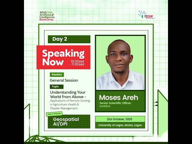
What if you could detect crop failure, track disease risks, and respond to disasters—before they escalate? In this powerful session ...
23 views
4 days ago
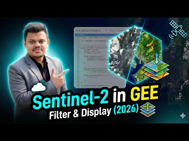
Learn how to filter and display Sentinel-2 satellite imagery in Google Earth Engine (GEE) in this complete 2026 tutorial.
126 views
Streamed 2 days ago
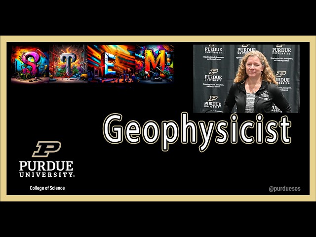
Dr. Andrea Donnellan is a geophysicist who uses remote sensing to study earthquakes. Andrea studies everything BUT the ...
11 views
email to : mattosbw1@gmail.com or mattosbw2@gmail.com If you need solution manuals and/or test banks just send me an email.
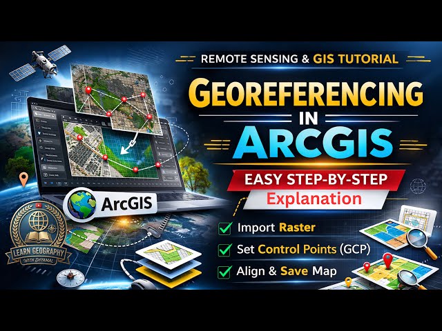
Learn how to perform georeferencing in ArcGIS with this complete step-by-step tutorial in GIS & Remote Sensing. This video ...
25 views
1 day ago
121 views
Streamed 1 day ago
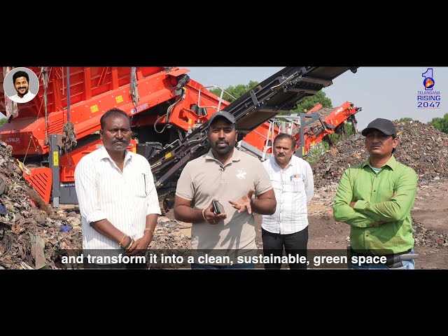
Documentary Film makers in Hyderabad | TG Govt - Cleaner Cities | Scintilla Kreations | https://www.scintilladigi.com | contact us ...
15 views
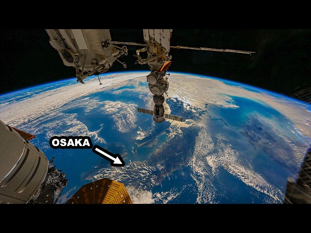
... and Remote Sensing Unit, NASA Johnson Space Center http://eol.jsc.nasa.gov/ from ISS073-E-1309239 to ISS073-E-1311764 ...
9,507 views
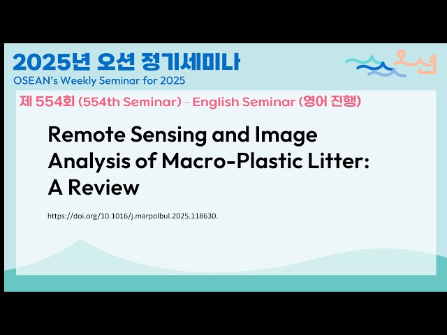
원문/ Reference: Kako, Shin'ichiro, Tomoya Kataoka, Daisuke Matsuoka, et al. 2026. “Remote Sensing and Image Analysis of ...
In this session from FOSS4G NA 2025, Michele Tobias, a data scientist at UC Davis DataLab, presents Remote Sensing for Plants ...
3 views
37 views
Ready to build the confidence to work with real-world datasets, not just classroom examples? Prepared to take on internships, ...
28 views
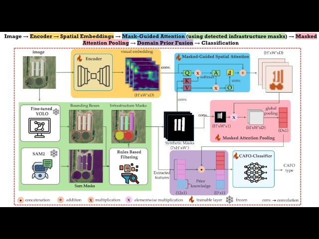
Poster Presentation - WACV 2026.