Upload date
All time
Last hour
Today
This week
This month
This year
Type
All
Video
Channel
Playlist
Movie
Duration
Short (< 4 minutes)
Medium (4-20 minutes)
Long (> 20 minutes)
Sort by
Relevance
Rating
View count
Features
HD
Subtitles/CC
Creative Commons
3D
Live
4K
360°
VR180
HDR
1,040 results
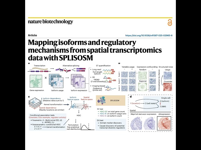
The paper introduces SPLISOSM, a novel computational framework designed to identify spatial isoform variability across diverse ...
0 views
5 days ago
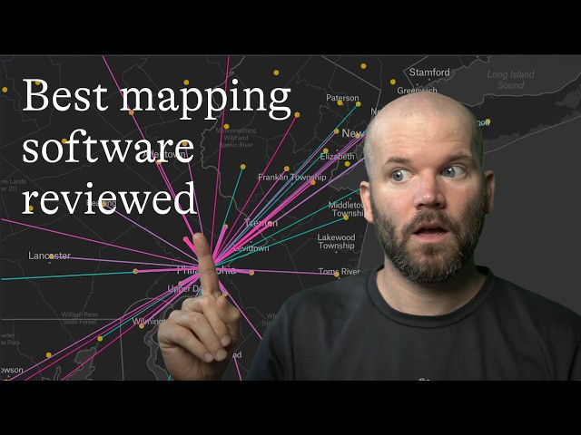
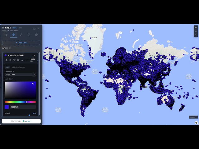
Choosing the best mapping software depends on your needs, budget, and technical requirements. In this review, we compare ...
200 views
6 days ago
Richard Feynman's physics explains why Time Travel is impossible. From the Second Law of Thermodynamics (Entropy) to the ...
57,649 views
1 day ago
The difference between a Geospatial Data Engineer and an Analytics Engineer. - How Spatial Data Scientists differ from ...
392 views
8 hours ago
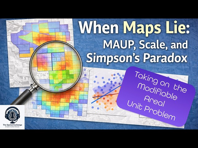
If you work with GIS, spatial data, or maps of any kind, this episode will help you recognize when patterns are being produced by ...
33 views
4 days ago
List of References: - Architecture - Form, Space and Order, Francis DK Ching, 2007 - The Architect's Handbook, Quentin Pickard, ...
115 views
The growing variety and volume of spatial data streams includes a large amount of remotely sensed imagery and ...
25 views
This research article introduces IRIS, a novel computational tool designed to identify distinct tissue regions in spatially resolved ...
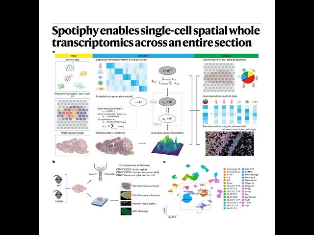
This research introduces Spotiphy, a new computational method designed to analyze spatially resolved transcriptomics data with ...
6 views
Whether you work with GIS, remote sensing, spatial analysis, or environmental data, this video will help you start thinking about ...
2 days ago
Spatial transcriptomics is revolutionizing biological research as a new and emerging field. However, the complexity of method ...
39 views
... AI mapping, AI in GIS, Data Commons, spatial analysis, satellite data analysis, foundation models, embeddings, AI for climate, ...
605 views
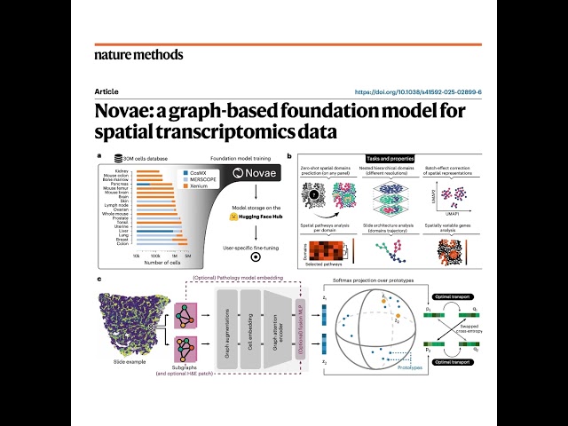
The article introduces Novae, a graph-based foundation model designed to analyze spatial transcriptomics data across diverse ...
4 views
Speed: Vector data at the speed of MVT tiles. ⚡ ✓ Spatial Analysis: Built-in, handy tools for on-the-fly analysis. ✓ AI-Powered: ...
8 views
... Length, Watershed Analysis, GIS, Spatial Analysis, Hydrology, Geographic Information Systems, Data Analysis, Geoprocessing, ...
53 views
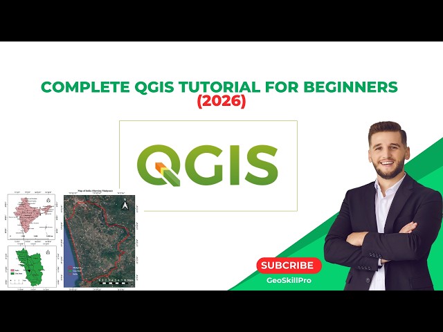
You'll learn how to import and organize vector and raster data, perform spatial analysis, calculate NDVI, apply kernel density ...
12 views
By the end of this tutorial, you'll be confident using QGIS for mapping, spatial analysis, and real-world GIS projects. What you'll ...
30 views
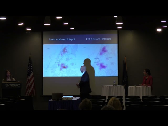
Presenters: Jasmine Hwang, MA, New York City Criminal Justice Agency Nathan Nisenson, BA, New York City Criminal Justice ...
Designed for administrators, supervisors, and field workers, OrbixViewer connects AMLD data uploads, live spatial analysis, task ...
3 views
... video breaks down how spatial data and artificial intelligence are building the next generation of autonomous delivery networks.
29 views