ViewTube

ViewTube
Sign inSign upSubscriptions
Filters

Upload date

Type

Duration

Sort by

Features

Reset

564 results

GIS Solutions, LLC
ArcGIS Pro File Geodatabase Tutorial For Beginners

If you're still using shapefiles in ArcGIS Pro… you might be limiting your GIS projects without realizing it. In this beginner-friendly ...

5:26
ArcGIS Pro File Geodatabase Tutorial For Beginners

72 views

4 days ago

Geo_spatial world.
ArcGIS for Beginners Part 1: Adding Data

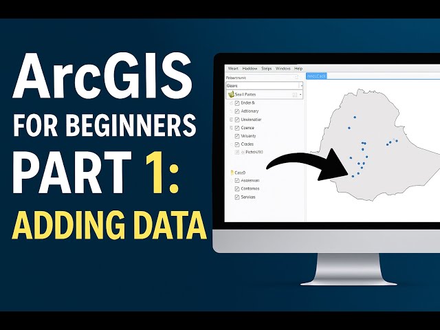
Welcome to Part 1 of the ArcGIS for Beginners series! In this tutorial, you'll learn the essential steps for adding data to ArcGIS ...

5:14
ArcGIS for Beginners Part 1: Adding Data

49 views

3 weeks ago

GIS Tutorial for Beginners
How to connect with a folder in ArcMap

arcgis #gis #arcgistutorial #gistutorial #tutorial.

0:18
How to connect with a folder in ArcMap

19 views

5 days ago

GIS Tutorial for Beginners
How to start editing in shapefile

arcgis #arcgistutorial #gis #gistutorial #tutorial.

0:45
How to start editing in shapefile

10 views

5 days ago

Geojay GIS Solution
Introduction to ModelBuilder in ArcMap: Complete Introduction to ModelBuilder for Beginners

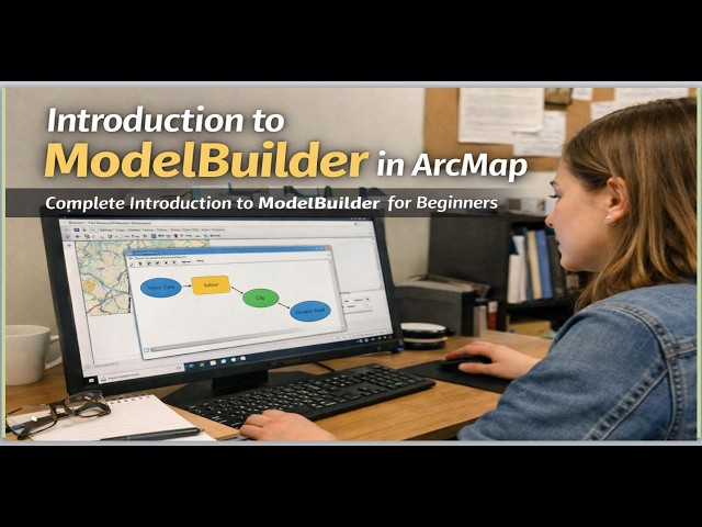
ModelBuilder #ArcMap #GIS #GeospatialAnalysis #BeginnersGuide #DataVisualization #MappingTools In this comprehensive ...

10:21
Introduction to ModelBuilder in ArcMap: Complete Introduction to ModelBuilder for Beginners

36 views

2 weeks ago

Skynek Mapping
How to Create and Export Maps in ArcMap | GIS Tutorial

Create & Export Maps Using ArcMap Design professional maps and export them in high quality from ArcMap—essential for drone ...

3:09
How to Create and Export Maps in ArcMap | GIS Tutorial

47 views

3 weeks ago

AMK Channel
ArcGIS Myanmar Tutorial | Dam, River & Forest Map Creation in ArcMap (Points, Lines, Polygons)

This video is an ArcGIS Myanmar tutorial designed for beginners who want to learn GIS step by step. In this ArcMap lesson, we ...

1:16:33
ArcGIS Myanmar Tutorial | Dam, River & Forest Map Creation in ArcMap (Points, Lines, Polygons)

12 views

1 day ago

Tech Miracurol
How to Add Basemap in ArcGIS | Step-by-Step Tutorial

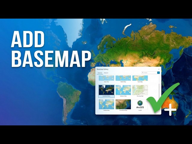
In this tutorial, you will learn how to add a basemap in ArcGIS step-by-step. Basemaps help provide background context such as ...

8:03
How to Add Basemap in ArcGIS | Step-by-Step Tutorial

28 views

3 weeks ago

Rioba Mwita TV
GIS for Beginners 2026 Complete Roadmap🛣️

Visit https://riobamwitagis.sevalla.page for more. In this video, I introduce a structured learning path for GIS, remote sensing, and ...

8:29
GIS for Beginners 2026 Complete Roadmap🛣️

81 views

11 days ago

mosaic spatial solutions
How To Use The Clip Feature in ArcGIS | Geoprocessing Tool Tutorial

In this step-by-step tutorial, you'll learn how to use the Clip tool in ArcGIS through the Geoprocessing toolbox to extract specific ...

3:34
How To Use The Clip Feature in ArcGIS | Geoprocessing Tool Tutorial

69 views

2 weeks ago

The Geo Mapping
ArcGIS Buffer, Fishnet Grid & Point Creation with Interactive Map Layout (Step-by-Step Guide)

Welcome to The Geo Mapping – Learn GIS, Remote Sensing & Mapping Made Easy! Full Description Geographic Information ...

20:04
ArcGIS Buffer, Fishnet Grid & Point Creation with Interactive Map Layout (Step-by-Step Guide)

50 views

3 weeks ago

Tirtha Kshetri
How to Create Points Along Polygon in ArcGIS 10.8 | Step-by-Step for Beginners

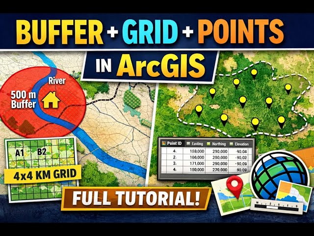
How to Create Points Along Polygon in ArcGIS 10.8 | Step-by-Step for Beginners: In this tutorial, I demonstrate how to create ...

6:32
How to Create Points Along Polygon in ArcGIS 10.8 | Step-by-Step for Beginners

39 views

1 month ago

GIS & AI,GEOGRAPHY
How to Georeference an Image in ArcMap | Step-by-Step Tutorial I Episode 7  #arcgis @GISRS-1

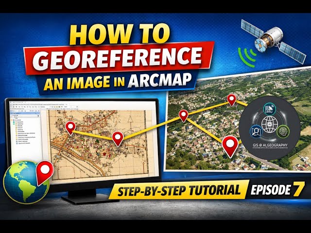
How to Georeference an Image in ArcMap | Step-by-Step Tutorial I Episode 7 In this tutorial, you will learn how to georeference an ...

7:28
How to Georeference an Image in ArcMap | Step-by-Step Tutorial I Episode 7 #arcgis @GISRS-1

168 views

3 weeks ago

Learn Geography with Shyamal
Georeferencing in ArcGIS Step-by-Step | GIS & Remote Sensing Tutorial | Learn Geography with Shyamal

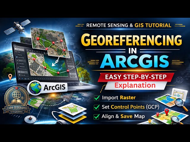
Learn how to perform georeferencing in ArcGIS with this complete step-by-step tutorial in GIS & Remote Sensing. This video ...

9:14
Georeferencing in ArcGIS Step-by-Step | GIS & Remote Sensing Tutorial | Learn Geography with Shyamal

31 views

4 days ago

Full Time GIS
Slope and Aspect Analysis in ArcGIS | DEM Slope Aspect GIS Tutorial

Slope and aspect analysis in ArcGIS using DEM explained step by step. This GIS tutorial covers DEM slope analysis and aspect ...

1:12
Slope and Aspect Analysis in ArcGIS | DEM Slope Aspect GIS Tutorial

4 views

3 weeks ago

GIS Tutorial for Beginners
How to Create Shp

shapefile of point, polyline and polygon #gis #gistutorial #polyline #polygon #point #arcgistutorial #arcgis.

0:58
How to Create Shp

34 views

5 days ago

GIS_withWr_khan
How to Georefrence a map in ArcGis/ArcMap using googlemap as refrence

This video is a practical, step-by-step guide on how to align non-spatial images—like a screenshot from Google Maps—with ...

10:57
How to Georefrence a map in ArcGis/ArcMap using googlemap as refrence

43 views

3 weeks ago

911oklahoma
Introduction to ArcGIS

Introduction to ArcGIS Pro.

5:01:52
Introduction to ArcGIS

11 views

2 weeks ago

ROY GIS ACADEMY
Create Shapefile (Point, Line, Polygon) Step by Step in ArcGIS | Beginner Tutorial | ROY GIS ACADEMY

arcgistutorial #arcmap #arcgispro #arcgistutorial #arcmap #arcgispro #arcgistutorial #arcmap #arcgispro Welcome to ROY GIS ...

21:44
Create Shapefile (Point, Line, Polygon) Step by Step in ArcGIS | Beginner Tutorial | ROY GIS ACADEMY

0 views

22 hours ago

Learn RS & GIS
ArcGIS Tutorial | How to Prepare Aspect Map in ArcGIS Software using DEM | Aspect Map

ArcGIS Tutorial | How to Prepare Aspect Map in ArcGIS Software using DEM | Aspect Map.

1:49
ArcGIS Tutorial | How to Prepare Aspect Map in ArcGIS Software using DEM | Aspect Map

14 views

2 weeks ago