ViewTube

ViewTube
Sign inSign upSubscriptions
Filters

Upload date

Type

Duration

Sort by

Features

Reset

6,697 results

Thleo
207-SpaceSequest: A Unified Spatial Data Analysis Pipeline

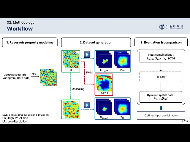
The paper introduces SpaceSequest, a comprehensive and unified computational pipeline designed for the analysis and ...

27:11
207-SpaceSequest: A Unified Spatial Data Analysis Pipeline

0 views

8 days ago

SNU SFTL
Prediction of High-Resolution Dynamic Spatial Data Using U-Net and Diffusive-Time-of-Flight
6:10
Prediction of High-Resolution Dynamic Spatial Data Using U-Net and Diffusive-Time-of-Flight

7 views

4 weeks ago

Felt
What is geospatial mapping? How GIS, spatial data and visualization work together across industries

Geospatial mapping turns geographic data into visual insights that support real-world decisions. In this video, we explain how GIS, ...

5:41
What is geospatial mapping? How GIS, spatial data and visualization work together across industries

288 views

13 days ago

PixelGEO
Built an AI Agent that thinks like a GIS Analyst | Agentic GeoAI | PixelGEO

This is Agentic GIS in action, the future of AI-powered spatial analysis. COURSE LINK:- Agentic AI in GIS: ...

6:32
Built an AI Agent that thinks like a GIS Analyst | Agentic GeoAI | PixelGEO

52 views

3 weeks ago

The Slop Farm
How to Do Spatial Analysis - Full Guide

How to Do Spatial Analysis - Full Guide | Surfshark VPN Deal — Stay private and secure. $1.99/mo + 3 Months Free ...

1:48
How to Do Spatial Analysis - Full Guide

0 views

8 days ago

UCLA Office of Advanced Research Computing (OARC)
Spatial Research and the ESRI Ecosystem at UCLA

... StoryMaps, and other ESRI tools to support mapping, spatial analysis, and data visualization across disciplines for research and ...

1:06:00
Spatial Research and the ESRI Ecosystem at UCLA

72 views

4 weeks ago

Skynek Mapping
How to convert projection WGS to UTM

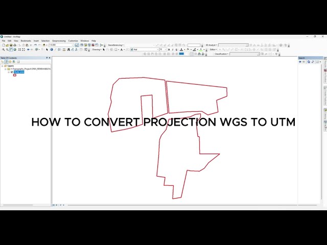
... spatial analysis, and remote sensing. #GIS #WGS84 #UTM #CoordinateConversion #Projection #QGIS #ArcGIS #Geospatial ...

0:52
How to convert projection WGS to UTM

83 views

2 weeks ago

Zbigniew Mikulski
Spatial Analysis and Quantifying Cell-to-Cell Interactions

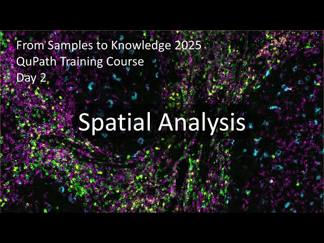
Go beyond the "cell count" and start analyzing the architecture of biology. In this session of the FS2K workshop, we move into ...

1:18:33
Spatial Analysis and Quantifying Cell-to-Cell Interactions

67 views

8 days ago

Oracle Developers
The Future of Geospatial: Advanced Spatial Analyitics in Oracle with CARTOS's Agentic GIS platform

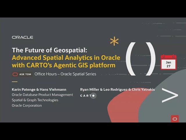
00:04:10 Introducing CARTO as an Oracle partner 00:07:15 An introduction to CARTO´s Agentic GIS Geospatial Analytics ...

1:00:21
The Future of Geospatial: Advanced Spatial Analyitics in Oracle with CARTOS's Agentic GIS platform

187 views

9 days ago

CodeStats Studio
Understand R Code for Spatial Analysis & Machine Learning | Step-by-Step Explanation

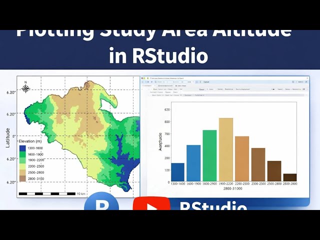
In this video, I explain R code in very simple language for students and beginners. You will understand how soil data, spatial ...

3:34
Understand R Code for Spatial Analysis & Machine Learning | Step-by-Step Explanation

15 views

2 weeks ago

Thleo
132-OmiCLIP & Loki: Foundation Model for Spatial Analysis

This paper introduce a new visual-omics foundation model called OmiCLIP, designed to integrate histopathology images and ...

19:55
132-OmiCLIP & Loki: Foundation Model for Spatial Analysis

1 view

12 days ago

Thleo
127-MintFlow: AI rewrite Spatial Analysis

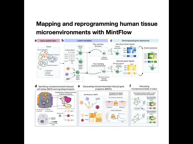
This paper introduces MintFlow, a novel generative AI algorithm designed for mapping and reprogramming human tissue ...

22:16
127-MintFlow: AI rewrite Spatial Analysis

1 view

12 days ago

Mehreen Fida
Hi, I’m Mehreen, a GIS Specialist skilled in digital mapping, spatial analysis, and remote sensing.

Hi, I'm Mehreen, a GIS Specialist skilled in digital mapping, spatial analysis, and remote sensing. I help clients turn geospatial ...

0:16
Hi, I’m Mehreen, a GIS Specialist skilled in digital mapping, spatial analysis, and remote sensing.

4 views

3 weeks ago

Sokora
Downloading and plotting study area Altitude in #rstudio

... studies Environmental and climate analysis Land use and terrain analysis Students and researchers working with spatial data ...

15:29
Downloading and plotting study area Altitude in #rstudio

82 views

8 days ago

Padang & Co
Cloudtim x M Moser - Real-Time Spatial Data Intelligence for Early Design Decisions
2:31
Cloudtim x M Moser - Real-Time Spatial Data Intelligence for Early Design Decisions

16 views

4 weeks ago

arika ligmann-zielinska
The GIS Workflow - Solving Spatial Problems

This video demonstrates a spatial analysis workflow in ArcGIS Pro to identify high-quality drinking water wells in Ingham County, ...

1:04:55
The GIS Workflow - Solving Spatial Problems

31 views

4 weeks ago

Orbital Adventures
The Invisible System Behind Modern Decision-Making

The answer lies in Geographic Information Systems (GIS) and spatial analysis. In this video, we explore how geographic data, ...

1:45
The Invisible System Behind Modern Decision-Making

47 views

2 weeks ago

10x Genomics
Uncovering the hidden biomarkers: A new approach to spatial transcriptomics with Xenium In Situ

... how Xenium In Situ enables their work, and their advice for anyone starting spatial analysis. Featured speakers: - Ruby Huang, ...

2:13
Uncovering the hidden biomarkers: A new approach to spatial transcriptomics with Xenium In Situ

114 views

2 weeks ago

Geographic Knowledge Lab
Semantic Data Enrichment for Maintenance of Foundation Spatial Data

The growing variety and volume of spatial data streams includes a large amount of remotely sensed imagery and ...

2:51
Semantic Data Enrichment for Maintenance of Foundation Spatial Data

25 views

7 days ago

Dr. Riyadh
Topic 1 Advanced Spatial Analysis and Modelling

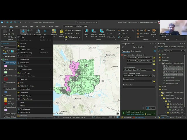
... County California and for my technical demonstration I have chosen my first topic as advanced spatial analysis and modeling so ...

11:40
Topic 1 Advanced Spatial Analysis and Modelling

13 views

2 weeks ago