ViewTube

ViewTube
Sign inSign upSubscriptions
Filters

Upload date

Type

Duration

Sort by

Features

Reset

192 results

Abiola David - Databricks and Microsoft MVP
Visualise Geospatial Data using Microsoft Fabric Map

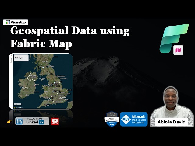
One of the exciting additions to Microsoft Fabric is the Map Item which enables teams to visualize and analyze geospatial data ...

11:53
Visualise Geospatial Data using Microsoft Fabric Map

33 views

2 hours ago

Network Science Institute
Rafael H. M. Pereira on "Spatial data science for just and sustainable cities"

Date: 03/04/2026 Abstract: The presentation outlines a research agenda in urban data science for just and sustainable cities, ...

1:04:35
Rafael H. M. Pereira on "Spatial data science for just and sustainable cities"

5 views

11 hours ago

SpaceEyeNews
China’s J-36 and J-50 Shock the World — Can the F-47 Keep Up?!

China's J-36 and J-50 Shock the World — Can the F-47 Keep Up?!” A new generation of stealth aircraft is taking shape, and it ...

8:59
China’s J-36 and J-50 Shock the World — Can the F-47 Keep Up?!

684 views

5 hours ago

gistipster
AI for Spatial Mapping and Analysis

This document introduces the GeoAI Toolkit for Urban Planners, a comprehensive resource developed by UN-Habitat and ...

5:26
AI for Spatial Mapping and Analysis

0 views

3 hours ago

AI Revolution
New OpenClaw Robot Feels Shockingly Aware (Detonated Skynet)

OpenClaw just demonstrated a system that lets robots build a persistent memory of the real world. Instead of only navigating a ...

14:51
New OpenClaw Robot Feels Shockingly Aware (Detonated Skynet)

8,125 views

3 hours ago

Voxel51
MOSPA: Human Motion Generation Driven by Spatial Audio

Enabling virtual humans to dynamically and realistically respond to diverse auditory stimuli remains a key challenge in character ...

16:13
MOSPA: Human Motion Generation Driven by Spatial Audio

0 views

5 hours ago

Geomatics Engineering Nepal
ArcGIS Pro Basic Tutorial | Add Shapefile, Folder Connection & Understand Spatial vs Attribute Data

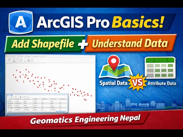
In this ArcGIS Pro beginner tutorial, you will learn the basic steps to start working with spatial data in GIS. In this video, I ...

8:02
ArcGIS Pro Basic Tutorial | Add Shapefile, Folder Connection & Understand Spatial vs Attribute Data

0 views

18 hours ago

Addie LaMarr
The Security Threat Nobody Expected: DNA as Infrastructure

Why most cybersecurity models break when DNA storage enters the chat: this video unpacks DNA storage, DNA encryption, ...

10:10
The Security Threat Nobody Expected: DNA as Infrastructure

2,022 views

9 hours ago

The Good Trouble Show with Matt Ford
"They Won't Allow Nuclear War" — What a Non-Human Entity Told This Air Force Guard

Air Force guard Richard Barth breaks 60 years of silence in this alien abduction testimony from a Minuteman nuclear missile site ...

1:16:50
"They Won't Allow Nuclear War" — What a Non-Human Entity Told This Air Force Guard

3,470 views

7 hours ago

Geomatics Engineer
How to Apply Geographic Transformation in ArcGIS Pro (7-Parameter Datum Transformation)

Without applying the correct transformation, spatial data may appear shifted or misaligned. This tutorial covers: • What a ...

13:05
How to Apply Geographic Transformation in ArcGIS Pro (7-Parameter Datum Transformation)

45 views

23 hours ago

Data Science with Dr Mtambo
Top R Packages for Data Science in 2026 | Must-Know Libraries for Data Scientists

R remains one of the most powerful programming languages for data science, statistics, machine learning, and advanced ...

19:37
Top R Packages for Data Science in 2026 | Must-Know Libraries for Data Scientists

0 views

12 hours ago

Geojay GIS Solution
ArcGIS Layer Transparency Management Tutorial Review for you

... geodata management, visual communication, decision-making tools, spatial data management, best practices, advanced GIS, ...

0:24
ArcGIS Layer Transparency Management Tutorial Review for you

0 views

59 minutes ago

wow
AI is stuck in one dimension; the Transformer architecture is a dead end on the road to AGI | Goo...

Does AI truly understand what it's saying? On the surface, it seems to magically grasp your new commands through "contextual ...

26:57
AI is stuck in one dimension; the Transformer architecture is a dead end on the road to AGI | Goo...

767 views

4 hours ago

Geojay GIS Solution
ArcGIS Layer Transparency Management Tutorial made simple

... geodata management, visual communication, decision-making tools, spatial data management, best practices, advanced GIS, ...

0:38
ArcGIS Layer Transparency Management Tutorial made simple

0 views

1 day ago

VerySpatial
A VerySpatial Podcast - Episode 780

News: Google Maps Granted Access to South Korea's Map Data ESA to launch Celeste LEO-PNT on March 24 A Farewell to ...

47:59
A VerySpatial Podcast - Episode 780

4 views

8 hours ago

PardesLine
Elevate Your 3D Generative AI Workflow: TRELLIS.2 Tutorial

Subscribe for more technical tutorials on Spatial Data Engineering and Advanced 3D Vision. #3DVision #MachineLearning ...

12:35
Elevate Your 3D Generative AI Workflow: TRELLIS.2 Tutorial

0 views

21 hours ago

Geojay GIS Solution
Convert Shapefile To kml or kmz Tutorial in ArcGIS 10 8

... shapefile, KML, KMZ, GIS, mapping tutorial, data conversion, geospatial analysis, geographic information systems, spatial data, ...

0:17
Convert Shapefile To kml or kmz Tutorial in ArcGIS 10 8

0 views

13 hours ago

CWSTAT
IDWSDS 2025 - S125: Harnessing Environmental and Ecological Data: Tools for Navigating Change and ..

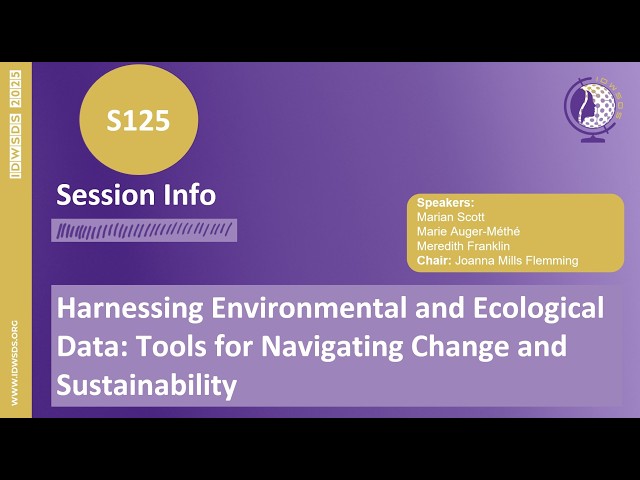
Harnessing Environmental and Ecological Data: Tools for Navigating Change and Sustainability In an era of accelerating ...

1:00:56
IDWSDS 2025 - S125: Harnessing Environmental and Ecological Data: Tools for Navigating Change and ..

0 views

2 hours ago

Practical Remote Sensing for Everyone using GEE
Image Visualization in Google Earth Engine | Greyscale Image

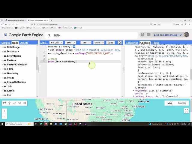
This video demonstrates how to retrieve elevation data from Google Earth Engine and visualize the imagery to identify ...

18:51
Image Visualization in Google Earth Engine | Greyscale Image

2 views

19 hours ago

TutorielGeo - AI GIS Center
Présentation Nouveautés QGIS 4 Norrköping

Cliquez ici pour bénéficier d'offres exclusives #GIS #QGIS #Arcgis #DATA ▭▭▭▭▭▭▭▭ Conseils et Audits ...

1:11:15
Présentation Nouveautés QGIS 4 Norrköping

181 views

Streamed 13 hours ago