Upload date
All time
Last hour
Today
This week
This month
This year
Type
All
Video
Channel
Playlist
Movie
Duration
Short (< 4 minutes)
Medium (4-20 minutes)
Long (> 20 minutes)
Sort by
Relevance
Rating
View count
Features
HD
Subtitles/CC
Creative Commons
3D
Live
4K
360°
VR180
HDR
7,871 results
Mobiltech Replica™ is Large Scale Real-Time Mapping Solution for indoor, outdoor, underground and aerial. Build a digitized ...
100 views
7 years ago
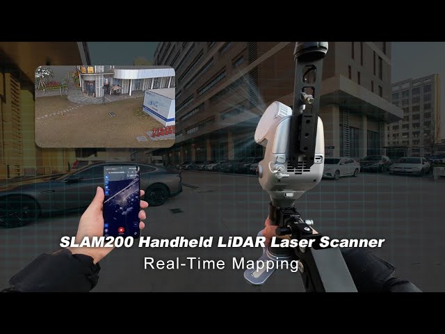
Discover More: https://www.foxtechrobotics.com/slam200-lidar-3D-building-scanning ...
1,954 views
8 months ago
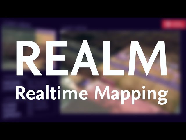
REal-time Aerial Localization and Mapping (REALM) is a ready-to-use open source mapping software for drones.
5,950 views
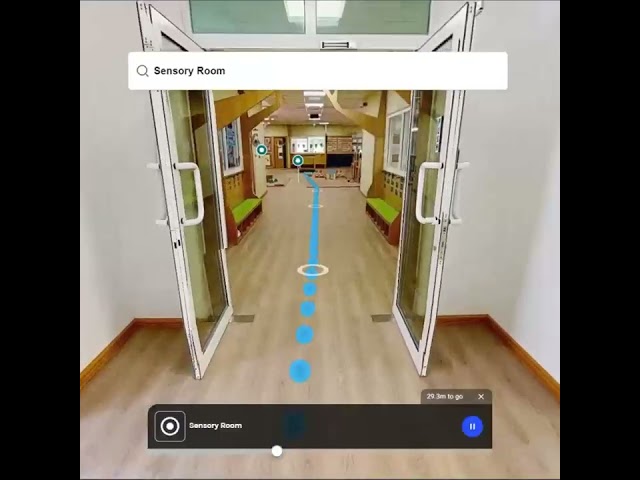
Navigate Indoors with Precision! Lost in a mall, airport, or hospital? Indoor navigation makes it easy with real-time mapping and ...
8,228 views
1 year ago
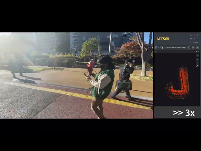
Vitom MK3 scanner for real time mapping www.vitom-tech.com #slam #realtime #3dmapping #lidar.
128 views
2 years ago
111 views
I experimented that a realtime mapping with Realsense T265 by only use Raspberry PI3B(not 3B+). That use Realsense T265 ...
269 views
6 years ago
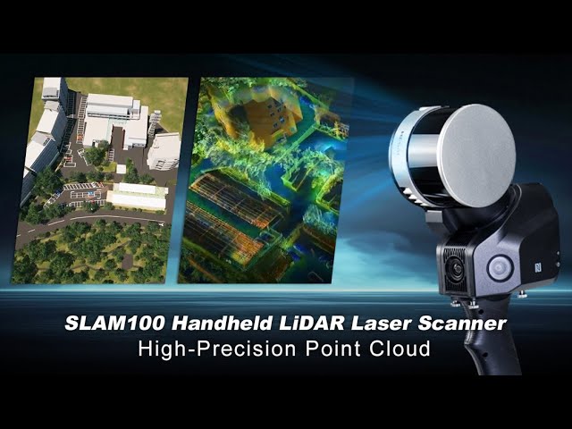
Discover More: https://www.foxtechrobotics.com/SLAM100-Portable-Handheld-Laser-Scanner-System-Survey-for-Building ...
1,721 views
7 months ago
43 views
SLAM2000 #LiDARScanner #3DMapping #FactorySurvey #VolumetricScanning #SLAMTechnology #RealTimeMapping ...
1,984 views
10 months ago
644 views
livox #lidar #slam #robotics #autonomousvehicles #mapping #navigation #3dmapping #realtime #sensorfusion #ros #ros2 #ros ...
1,446 views
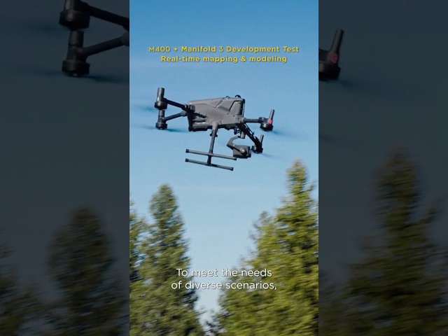
Real-time mapping just got amplified with Matrice 400 and Manifold 3 🗺️ Capture 1 km² in just 10 minutes with live preview, and ...
447,598 views
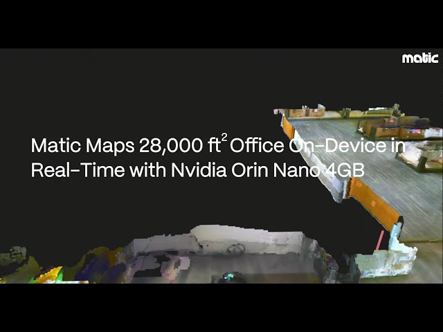
Watch how Matic Robots leverages cutting-edge technology to map our 28000 sq ft office in real-time using Nvidia Orin Nano 4GB ...
633 views
made with ezvid, free download at http://ezvid.com This video is a link from the Real-Time Multi-UAV Mapping with Lo-Cost ...
23 views
9 years ago
Hexagon has revealed a new augmented reality (AR) platform that will use massive 3D datasets to create real-time maps of cities.
31 views
Location: Unlisted rural property (redacted). Duration: 72-hour expedition. Goal: Create the first accurate floor plan of The ...
0 views
3 months ago
We introduce SkiMap++, an extension to the recently proposed SkiMap mapping framework for robot navigation (SkiMap, ...
5,667 views
8 years ago
Discover how Dynatrace's OneAgent automates application discovery and monitoring seamlessly. With SmartScape's real-time ...
161 views
I made this device to perform localization and mapping on the move! Nvidia jetson nano running ROS 2 Humble, using a LiDAR ...
13,401 views
11 months ago


![[Lidar] Livox Mid-360 LiDAR SLAM Test. Real-time Mapping and Navigation](/api/proxy/image?url=https%3A%2F%2Fi.ytimg.com%2Fvi%2Fw6YpZG3AT0g%2Fsddefault.jpg)