Upload date
All time
Last hour
Today
This week
This month
This year
Type
All
Video
Channel
Playlist
Movie
Duration
Short (< 4 minutes)
Medium (4-20 minutes)
Long (> 20 minutes)
Sort by
Relevance
Rating
View count
Features
HD
Subtitles/CC
Creative Commons
3D
Live
4K
360°
VR180
HDR
1,102,275 results
56.3K subscribers
84.5K subscribers
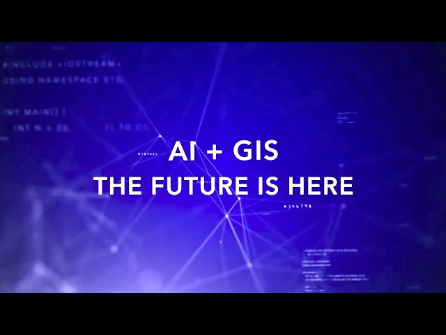
AI combined with location technology is helping organizations around the world realize the promise of building a better future.
15,122 views
11 months ago
ArcGIS Field Maps is a mobile app that combines map viewing, data collection, and location tracking into a single app for easier ...
81,702 views
5 years ago
Recent advancements in language models have opened exciting new possibilities for building generative AI capabilities into the ...
19,697 views
1 year ago
As the world becomes smaller, and what happens somewhere else hits closer and closer to home, geography matters more than ...
38,867 views
3 years ago
Gaussian Splatting is making a large impact on the world of professional mapping and geospatial industries. I travel to Stuttgart, ...
7,858 views
2 months ago
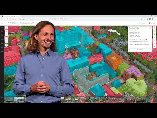
In this video https://mediaspace.esri.com/media/t/1_nt5bvpwj/306500242, Esri experts reveal how they used ArcGIS Reality Studio ...
19,536 views
2 years ago
Navigate the world of ArcGIS, Artificial Intelligence (AI) and Machine Learning (ML), and how ArcGIS supports integration with ...
31,853 views
7 years ago
Find out how to combine data entry forms and maps to add, view and revise data collected in the field. Field Maps is Esri's newest ...
16,609 views
4 years ago
Ready to move beyond desktop GIS? Step into the Spatial Lab: a global community for ambitious geospatial professionals who ...
71,129 views
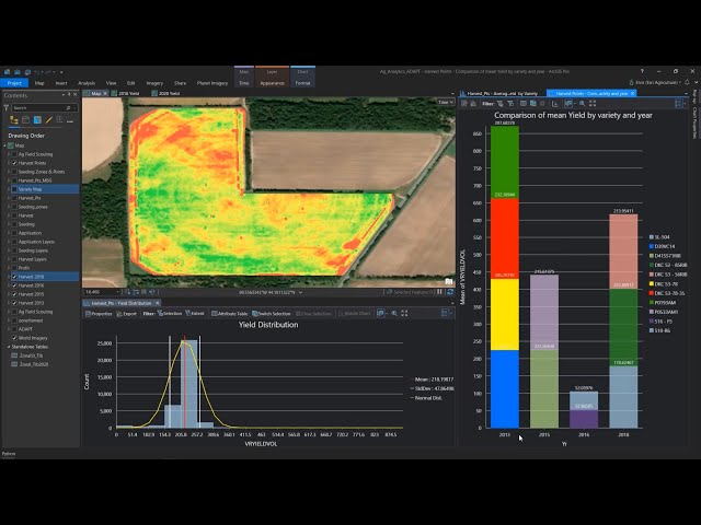
Agriculture webinar focused on analytic capabilities within ArcGIS for agronomic data and introduction of new precision ...
9,677 views
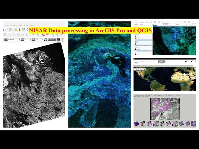
Welcome to my channel Space Remote Sensing and GIS. In this video, I explain how to download NASA–ISRO NISAR SAR data ...
317 views
5 days ago
Deepseek Ai is a cutting-edge technology revolutionizing the world of Geographic Information System. In this video, as beginner ...
5,205 views
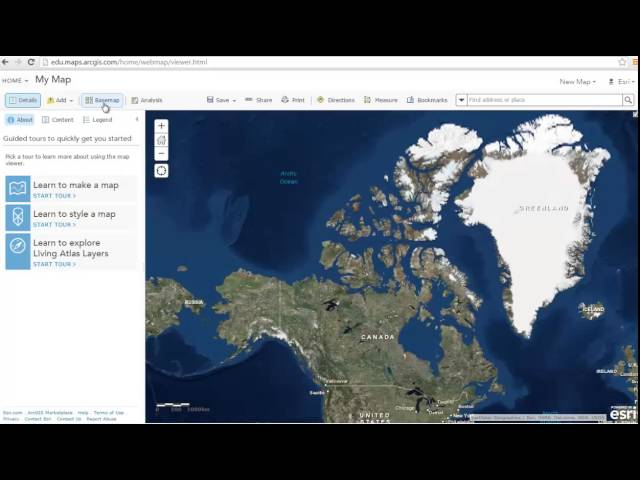
In this video tutorial, you will be introduced to the basics of ArcGIS Online. You will begin by exploring content that's available in ...
175,248 views
10 years ago
How humans understand the world is continually evolving. Today, GIS and geospatial infrastructure are powering this ...
13,593 views
6 years ago
Geospatial Information Systems (GIS) is a unique problem-solving technology with remarkable impact. In this video, visionary ...
139,570 views
ArcGIS Pro has been the center of GIS workflows for decades but how does it hold up in a world moving toward open, cloud-native ...
3,960 views
What is ArcGIS? This video answers that question.
234,242 views
This video highlights the top ten new features in the ArcGIS Pro 3.6 release. To see all the new and improved functionality in this ...
10,346 views
Thanks for watching! Love, John Nelson Check out some other social channels where I share how-to's and updates on random ...
9,611 views
In our ever-evolving world, tackling complex issues like climate change, sustainability, and social and economic inequality ...
13,122 views
ArcGIS Experience Builder empowers you to leverage data, maps, and content, to build web apps and pages with no-low code.
17,802 views
Welcome to our 24/7 live stream directly from the International Space Station (ISS)! Join us as we orbit the Earth, offering ...
194 views
0
In this video, we're going to explore the history of IBM. From its humble beginnings in 1911 to its current status as a global ...
25,002 views
The clock is ticking. So let's make big changes and leverage technology to transform the everyday by combining both the real and ...
20,851,921 views
Join this session for a comprehensive overview of what's new and what's coming in Esri's field operations capabilities.
2,375 views
9 months ago
Streamline your workflow from planning to analysis with Site Scan for ArcGIS. Get started today: ...
170,268 views
ArcGIS Enterprise is your foundational system for data management, mapping and visualization, and analytics. If you are just ...
49,156 views
This video provides an overview of ArcGIS Survey123, a form-centric solution for creating, sharing and analyzing surveys. Use it to ...
93,260 views
55.3K subscribers